Tuesday, August 31, 2021

2021.8.30-31 Backpacking in East Sierra (part 2/3) - Big Pine Lakes overnight

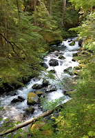
8/30, Monday. Drove to the day hike trailhead ~7am. 60°F at 8800', comfortable. Parked at a pullout nearby. Put 2 bags of food with labels in the only bear box at the TH. The trail starts in front of a few cabins, part of Glacier Lodge. It follows the creek for a bit, in the shade. After this bridge, the trail bifurcates to north fork and south fork.

I took the north fork, enters a valley. I followed the lower trail to stay in the valley which climbs up to join the high trail in ~3/4 mile. The trail here is sandy, and sand was filling in my new shoes. The trail then zigzags up cascades made by Big Pine Creek to an upper valley. Then you can see Temple Crag's jagged silouette.

About 4 miles and 2500' from TH, another fork. I took the left one for Big Pine Lakes (the right fork is for Black Lake). Soon, I saw a beautiful blue lake. It's the first of a chain. I like the 2nd lake the most. Bigger, and right below Temple Crag. Took a long break here, scrambled up to the boulders to see both lakes. Soon after, the 3rd blue gem is in front of you. This lake is a bit smaller and shallower.

I found a camp site near the next trail junction, in a cluster of trees, so my tent is mostly in the shade. ~10600'. I didn't bother with the rainfly: too hot. Washed my socks and shoes, and took a nap. Found many Mountain Coyote Mint nearby, which has a lavender smell.

I forgot to pack a book. Got bored waiting for the temperature to cool. Headed out south to Sam Mack Meadow in the same socks and shoes (already dried), packed microspikes. It's only 0.7 miles, really pretty even though the meadow was brown right now. ~11100'. Here you see why the lakes have glacial color. The milky creek runs cold. A lot of white alpine gentian (much smaller than the regular deep blue gentian). A lovely place to camp, but I didn't see any obvious established campsite. There's a Sam Mack Lake above these steep walls, which I didn't attempt.

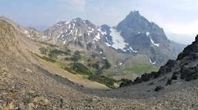
I retraced my track, crossed the creek and followed a trail zigzagging up towards Palisade Glacier -- the south most glacier in US. As I gained elevation, the view opens to the valley. The string of 3 bright blue lakes is so pretty. From here, I can see that only one other Lake is glacial blue, all other lakes are black (Lake 4, 6, 7, Black, Summit).

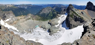
About half a mile up, the trail becomes faint. Follow the cairn(s), sometimes pointing to different directions. Traverse a boulder field east to directly above the 3rd Lake. Then, it's just going up on the morain field. I stopped from time to time to throw rocks out of my shoes. Eventually the trail ends ~1.5 mile from the junction, on the rock ridge, ~12400'. An icy lake below (already dark and I couldn't see any glacial color). A bit windy. I hid behind a rock and ate a bar. Headed down ~6pm.

By the time I got back to my camp, it was already dark. Sun sets ~7:30pm now. Brillant stars at night. Without the rainfly, I could see the sky lying down. My 20°F kept me warm.

8/31, Tuesday. Woke up as the sun rose. Cooked breakfast, headed out in a day pack with water and snacks to see lake 4-7. Instead of doing a loop and hike out via Black Lake, I decided to hike out the same way and revisit lake 1, 2, 3, because of their beautiful color.

Walked up the 5th Lake first. It has a bit of glacial color. This lake would be a nice place to camp, big, away from the main traffic. The 6th and 7th Lake are 1 mile farther uphill. Both are regular color. The setting is quite pretty. Very meadowy. In fact, almost swappy between these 2 lakes. It's very dry now, which makes my travel easy. Still my shoes got wet. In this heat, they dried up quickly. I took a long break for snacks at Lake 7, before return. It's not easy to find shade to rest here.

On my way down, met a group of 2 hikers -- first human I saw today. Took the 1/4 mile detour to see Summit Lake. Pretty setting. Normal color.

The 4th Lake has a meadowy shore. Quite pretty, but no glacial color. Met more hikers here.

Back at camp, cooked an early lunch, packed up and hiked out. Took another snack break at the 2nd lake. On the way out, I took the "high trail", which has no shade except for one tree. Quite hot. Met a girl hiking in with a dog questioning about the dog's safety due to heat. Don't remember seeing this sign on the way in, so took a photo now. Back to TH around 2:30pm. Retrieved my food from the bear box, very warm. Drove down to the hot valley floor, ~4000'.

Later I realized that I forgot 2 tent stakes at the camp!

Sunday, August 22, 2021

2021.8.22. Tolmie Peak in the clouds

8/22, forecast is mostly sunny. Chilly (high 50°F, windy 15-20mph, with gust of 25mph). I haven't been to Tolmie Peak for maybe 10 years. Happy to go again. About 14 of us met at Green Lake P&R. The hike leader was late, the last girl showed up 10 minutes late. I was in a Prius with 3 others, one is an librarian, so we talked about books, which is nice. Regrouped at a Starbucks in Auburn. Took awhile. Our Prius was the first to arrive at the trailhead, after the long washboard gravel road. After waiting for 40 minutes in the mist, we duct-taped a note on the sign, and headed on to the trail without the hike leader. Turns out that the driver thinks her car is not ready for "offroad" travel - as in her comment.

About 3 kids could keep up with me. We waited at the major junction, and at each steep hills, and then at Eunice Lake. It's a short hike, so no rush. We would continue if we got too cold to wait any longer. The sun never broke the clouds, and it even drizzled a bit. Right before the ridge, there's this nice meadow. Plenty gentium. Withered beargrass -- should come here in July.

The lookout was locked. Walked around the deck. Very cold due to wind. I went down and found a fancy toilet nearby. While waiting for the others, I continued further east. There's a track going further along the ridge. Due to the poor visibility and wind, I returned. Took this photo back from that angle.

Everyone hid behind the lookout to avoid most of the wind. Ate lunch while shivering. Once the group arrived, I took this photo. Then we hiked down. I picked huckleberry on the way, so was slow. At the lake, I nearly lost everyone. Too many side tracks by the lake. Almost at the last mile, we met this last car of 3 people with the hike leader. Not sure how they made it here. They continued up, we hiked out. Waited around at the TH for everyone again. When we drove out, the car said 43°F. No wonder we were all cold. Up on the ridge, it was probably in the mid-30s.

Despite of all the wait around and dreary weather, I didn't enjoyed myself. Maybe because of all the wait, I was forced to talk to my fellow hikers. One young dude did a 9 day backpacking off trail in Patagonia, as part of some leadership training program. Interesting to hear his experience. Also picked up some reading suggestions.

Saturday, August 21, 2021

2021.8.21. Seattle Design Festival

8/21-22, Seattle Design Fest held a Block Party in South Lake Union Park. I visited it around noon on Saturday. More than 2 dozens installations, COVID-19 themed. Like this one with face masks. Or this one, just offers color papers for you to write and fold into a boat and set sail in the pond. Many are similar, just offers different space for people to write wishes/anger/encouragement. Quite frankly, I'm quite sick of anything COVID-19. Can we just get on, please?

This one looks grand and pretty. But I could find out what it means. There're a couple of plant made structures, quite pretty, but not sure what they are trying to say. The only exhibit I liked is this by Craft Stick Crafts folks. They showcased a number of small wooden modals made by everyday objects + glue. They teach kids to build scaled-down buildings and furniture, so kids can learn to design, calculate, draw and build.

Overall a disappointment, because I learnt nothing. I spent about an hour. It's nice to walk around in the park.

Sunday, August 15, 2021

2021.8.15. Teneriffe - Dixie Peak

8/15, Sunday. According to weather.gov, the haze should be gone today. I hid indoor for most of last week due to bad air quality and stuffy hot weather. Very eager to go outdoors. Headed out in clouds (maybe haze?) early morning, and caught the 7:45am TrailheadDirect bus by the Central Library. 2 on board already, 3 of us waiting. No one else came up, so just 5 of us to the trail. I disembarked at Teneriffe TH. Parking lot was ~1/3 full.

Teneriffe FallsI was curious to see how much water is left, but didn't expect that the rock was bone dry. More surprising is that most hikers simply turned around here. To see the waterfall, checkout my first hike here. As usual, I continued up the Kamakazie Trail. It was getting warmer, and I made a stop to eat an apple. Didn't want to sweat too much, because I had only brought 1L of water + 2 small containers of milk (less than 0.5L total).

Arrived at the top before ~11:30. Just shy of 3 hours. Some fireweed on the open slope, but no flower on the rocky outcrop, just dry grass. I ate my sandwich under my silver umbrella. Pretty good view all around. Still a bit hazy.

Around noon, I headed down, and followed the regular Mount Teneriffe trail for about 0.9 miles, loosing ~800', to a road junction. The road is decommissioned. A pile of rocks, and behind that is a campsite. Further on (do not follow the road), almost along the ridge is a faint overgrown trail, which I followed. Once awhile there is a pink ribbon. Overall, fairly easy, about 3/4 mile and 500' to Dixie Peak. The top of the ridge is open (or rather alternative open and short section of trees). I saw Crater Lake (just an ugly pond now) to the west, but didn't see Rachor Lake to the east (maybe dried up?). A cairn marked the summit. Good view and some huckleberries. Not as good a view as from top of Teneriffe. The grassy slope to the east is quite nice. The west side is more treed. I didn't stay long here. I arrived ~1:10pm, it was getting too warm to be comfortable. It's very dry here.

Retraced my step. I initially thought of going to Blowdown Mountain. But it looks tree covered, also didn't see any track on the ridge south of Crater Lake. Didn't care for more bushwacking. So headed down Teneriffe Trail, and took Roaring Creek trail to come out at Mt. Si. parking lot. Surprised to see water along Roaring Creek trail, in fact, crossed maybe 3 small creeks, just not roaring. Was able to wash some sweat away.

Caught the bus shortly after 4pm. I waited more than 30 minutes this time (supposed to run every 20 minutes at this hour). 2 already in the bus (from Teneriffe TH), 5 boarded with me. A lot more people at Little Si TH. A lady decided to wait for the next bus with her toddler. Maybe 15 total on the bus. 2 got off and 2 got on at North Bend. Overall, very convenient for to get a good workout outdoors.

Monday, August 09, 2021

2021.8.8-9. End of bloom at Summerland

Last year, my favorite flower hike is the first weekend of August at Rainier from Summerland to Indian Bar. I gave up my permit at Boston Basin this weekend (the road was closed 2 miles before TH, and weather on Sunday was wetter at N. Cascades). Went to Rainier instead, hoping to see similar bloom. Alas, I was too late.

8/8, Sunday, cloudy. Left Seattle ~10am. A long queue at the White River entrance, because only 1 (out of 2) booth was open. Took ~45 minutes. I applied for an overnight permit, which took a bit of time. Reached Panhandle Creek TH ~1pm.

Nothing to note all the way to the big log bridge over Panhandle Creek. After this, the usual aster patch was now mingled with pink fireweed, looked very pretty. A group of backpackers hiked out, one girl stopped to take photos. She said this was the best patch of flowers of her trip. Hearing this, my heart almost sank.

Sadly, very true. Other than pink monkey flowers along the water, the meadows were dry. Lupine was all in seeds, bistort all dried out, a few heather were withering brown. At least the meadow was green, still pleasant to look at.

I headed higher to the same campsite we used last August. Still a tiny patch of snow left. A small creek for me to wash and filter. I didn't bother to bring a stove. After dinner, I headed up to Point 6945. But too cloudy, couldn't see anything to the east. I didn't wait for the sunset, because I was cold. Headed back to the tent, it was very wet already with condensation. My bear can is also wet. It was a cold night. I slid into my 20°F bag, read a few pages, retired early.

Clouds cleared overnight. Good stars.

8/9, Monday. Sunny. Up to shoot a few sunrise photos before breakfast. Packed for a full day, and hiked towards Indian Bar ~7am. Saw a runner, no one else, until ~11am. A large herd of sheep crossed the trail south of Panhandle Gap. Probably the same group of last year. Heather were dried out and brown, lupine in seed. Only on the slope near Indian Bar, I finally saw a carpet of aster, so dense, it made my heart sing. Like last summer, I stopped here for an early lunch. Then, I turned around.

Back along Wonderland trail. Saw probably the same flock of sheep. Met a group of ~5 on their 9th of 10 day trek of entire Wonderland. I asked them which is their favorite part. A girl said this section is pretty spectacular. Below Panhandle Gap, I left the trail and headed east towards Sarvant Mountains, Named after photographer Henry Mason Sarvant. Met 2 sheep here at a patch of blooming lupine. Further up, a large patch of harebells among white buckwheat on dryer soil. Saw 2 hikers coming my way from Panhandle Gap.

There is a track but it soon disappeared. The slope is gentle, easy going. I Stopped here for my "second" lunch, aired my boots, so to leave a large distance between me and the other 2. Great view of the Savant Glacier. You can also see Mt. St Helens.

Banshee PeakContinued up until Banshee Peak, the highest point. Couldn't find any shade to hide. A bit windy for umbrella. Jagged Cowlitz Chimneys to the east look intimidating. The green tarn below Sarvant Glacier looks inviting. To the south, can see Wonderland trail all the way down to Indian Bar. Took a long break here. Headed out shortly after 1pm.

On the way back, started to see day hikers at Panhandle Gap. The connection to the gap is narrow and goes up. Better weather today, so better color of the pond. Met 2 young guys doing Wonderland on their 5th of 6 day trek. I asked one what's his favorite section. Same answer.

By the time I was back at my camp, the tent had dried, the bear can was wet inside. I cleaned the can and the tent bottom as I was packing up. Filtered some water. It was warm. Hiking out under my umbrella. Below Summerland, met 2 rangers with large packs hiking up. The young lady checked my permit. I was back at car ~5:40pm. Stopped at Enumclaw for gas, very warm 78°F.

Have to come back next year at least a week earlier.

Saturday, August 07, 2021

2021.8.7. Tacoma

8/7, Saturday, cloudy. There was a native art event in Tacoma downtown, just outside of the history museum. I took bus 594, and spent a leisure half day there.

My first stop is the history museum. Nice building. Not a lot of things to see. Some interactive displays. I did take notes of some sights in eastern WA to visit some day.

My next stop is the museum of glass. A homeless guy was passed out on the glass bridge. Not a large collection. Spacious hot shop.

My last stop is the art museum. It has a glass collection and historical items, like this insurance price list for slaves in the old days. Again, not a whole lot to see.

On my way back, I admired the new sandle castle at Westlake Park. Talked to one of the guys who made it today. He said a lot of water and pounding down.

Monday, August 02, 2021

2021.7.31-8.2 Upper Royal Basin overnight

7/31, Saturday. Headed out early, caught the 8am ferry at Edmonds. After docking, it's still a 2 hour drive to Upper Dungeness TH, because of the long gravel road on NF-2870. The parking lot after the bridge was full, and the pullout next the TH was also full. We parked near the exit of the parking lot. Maybe ~50 cars. Walked back across the bridge, and hiked along Dungeness River. Quite a few backpackers heading out. Inquired about the bugs: not good:(

Royal CreekAbout a mile in is the junction of Royal Creek. Left (south) over a big bridge is a large camping area with a picnic table. Here, the Upper Dungeness Trail continues to Marmott Pass and Constance Pass, or Heather Creek. We continued forward, and in a few minutes, another junction. Right and up to Tyler Peak + Mt. Baldy. We continued forward, soon entered the national park boundary. Up and down, nothing steep, often not by the creek, but there are occasional smaller creeks if you want to filter water, as well as view of Royal Creek (the photo to the right was taken on Monday, on the way out, when it was sunny). There are 3 camping spots by the creek (require permit).

My permit for tonight is Lower Royal Meadow, to make this an easy day with a heavy-ish pack (a bear canister is required). The weather was cloudy, which made the hike-in more comfortable. At Lower Royal Meadow, the only good site was taken. The next one is too dusty. Searched around for a bit. Settled at a small spot on the east side of the creek. Almost pitched the tent right on an ant mound. It was only 3pm. It drizzled a bit, kept the mosquitoes down.

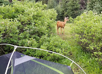
8/1, Sunday. A deer visited our camp when we were eating breakfast. It lingered for awhile. We packed up the wet tent, heading up.

Royal Lake is less than a mile away. It was quiet. However, the air was increasingly hazy. We could smell the smoke. Took the trail to the left (east) side of the lake (better view), and lost it at the south end of the lake. Need to circle back. The trail continues south from the right side.

Up to a nice valley, traverse the left (east) slope of a green meadow. A waterfall. At the south end of the meadow, the trail continues up the braided creek. Then, over some hump, Imperial Tarn shines in its beautiful glacial blue.

When I walked by a tent, the guy ruhsed out and carried his backpack up to another site, a nice one. Another site was taken by a group. There're flat grounds, but speckled with rocks, not suitable for tent. There's a gravel area near the trail, but too open, no shade, nor view. We left the packs behind a tree, and searched around for a suitable site. I first took to the right (west) ridge. It's a nice walk, great view of the basin below. Could see 2 more green tarns. Lots of paintbrush at the end. There was snow at its higher reach, but no water.

Back to the packs, ater lunch hiding under some short trees. Then, I went to check out the left (east) ridge along the climbing route. There's a small creek formed by melting snow at the base of the ridge. We settled on this side, overlooking the upper basin. Not too flat, somewhat open but with a few trees to sit under. We could see many day hikers coming to the blue tarn, but no one came up to where we were. A piece of solitude at this popular destination.

After pitching the tent, we headed down to the bigger green tarn. A bit steep and loose going down first -- I was wearing sandals -- then it was easier. A very pretty pale glacial color. Refreshing to wash up. It was quite muggy today. On the way back, we took an easier route. There, on baren rocks, I found this rare blue flower, only grown in the Olympics: Olympic Harebell. Not more than a dozen of them. That made my day.

At ~5pm, I took my ice axe, and headed up towards the ridge. The snow was not as soft as I thought. Needed to kick in. It was getting rather steep. At some point, I opted to go on rocks. But the surface is loose, the rocks are shards, brittle and hard to hold on to. I slipped once, only a few feet, but got me scared. I moved down, and back on snow. Took the rest of the snow up until no more snow. It was quite steep, but I had ice axe. The last bit is also loose dirt, but short and not as steep. I hugged to the rocks, and managed to get to the ridge, so I could see Deception Basin below, and more faint peaks beyond. Too bad, it was very hazy. On the way down, I put on micro-spikes. Saw only one Olympic Harebell.

Back to the camp, washed, and cooked dinner. Many mosquitoes. We had to walk around while eating. Afterwards, just hid inside the tent -- too warm in the sun.

8/2, Monday. Clear sky today. Sunny. I ventured higher on a slightly different route, without carrying anything but a hiking pole (not even water). Saw another tarn (no glacier color), no wonder all the bugs. I got to some loose ground, too steep that I turned around. Better view than yesterday.

My partner already packed up the tent. We headed out. We encountered 43 hikers on Royal Creek. It was quite warm. In the last mile, we saw a family of 7, and a young couple with a dog (pets are not allowed inside of park boundary). The parking lot was still almost full. It was ~1pm. We made a quick lunch stop, and caught the 4pm ferry (waited about 50 min). Thus concludes a relaxing 3 day outing.

Other endemic flowers I noted are: Olympic Mountain Grounsel (quite a few on the climbing route), Silky Phacelia, Rockslide Larkspur. Not as rare, but not common. You can find a list of flowers at Royal Basin here.