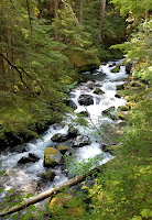
 About a mile in is the junction of Royal Creek. Left (south) over a big bridge is a large camping area with a picnic table. Here, the Upper Dungeness Trail continues to Marmott Pass and Constance Pass, or Heather Creek. We continued forward, and in a few minutes, another junction. Right and up to Tyler Peak + Mt. Baldy. We continued forward, soon entered the national park boundary. Up and down, nothing steep, often not by the creek, but there are occasional smaller creeks if you want to filter water, as well as view of Royal Creek (the photo to the right was taken on Monday, on the way out, when it was sunny). There are 3 camping spots by the creek (require permit).
 My permit for tonight is Lower Royal Meadow, to make this an easy day with a heavy-ish pack (a bear canister is required). The weather was cloudy, which made the hike-in more comfortable. At Lower Royal Meadow, the only good site was taken. The next one is too dusty. Searched around for a bit. Settled at a small spot on the east side of the creek. Almost pitched the tent right on an ant mound. It was only 3pm. It drizzled a bit, kept the mosquitoes down.
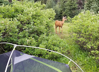
 8/1, Sunday. A deer visited our camp when we were eating breakfast. It lingered for awhile. We packed up the wet tent, heading up.
 Royal Lake is less than a mile away. It was quiet. However, the air was increasingly hazy. We could smell the smoke. Took the trail to the left (east) side of the lake (better view), and lost it at the south end of the lake. Need to circle back. The trail continues south from the right side.
 Up to a nice valley, traverse the left (east) slope of a green meadow. A waterfall. At the south end of the meadow, the trail continues up the braided creek. Then, over some hump, Imperial Tarn shines in its beautiful glacial blue.
 When I walked by a tent, the guy ruhsed out and carried his backpack up to another site, a nice one. Another site was taken by a group. There're flat grounds, but speckled with rocks, not suitable for tent. There's a gravel area near the trail, but too open, no shade, nor view. We left the packs behind a tree, and searched around for a suitable site. I first took to the right (west) ridge. It's a nice walk, great view of the basin below. Could see 2 more green tarns. Lots of paintbrush at the end. There was snow at its higher reach, but no water.
 Back to the packs, ater lunch hiding under some short trees. Then, I went to check out the left (east) ridge along the climbing route. There's a small creek formed by melting snow at the base of the ridge.
 We settled on this side, overlooking the upper basin. Not too flat, somewhat open but with a few trees to sit under. We could see many day hikers coming to the blue tarn, but no one came up to where we were. A piece of solitude at this popular destination.
 After pitching the tent, we headed down to the bigger green tarn. A bit steep and loose going down first -- I was wearing sandals -- then it was easier. A very pretty pale glacial color. Refreshing to wash up. It was quite muggy today.
  On the way back, we took an easier route. There, on baren rocks, I found this rare blue flower, only grown in the Olympics: Olympic Harebell. Not more than a dozen of them. That made my day.
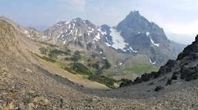
 At ~5pm, I took my ice axe, and headed up towards the ridge. The snow was not as soft as I thought. Needed to kick in. It was getting rather steep. At some point, I opted to go on rocks. But the surface is loose, the rocks are shards, brittle and hard to hold on to. I slipped once, only a few feet, but got me scared. I moved down, and back on snow. Took the rest of the snow up until no more snow. It was quite steep, but I had ice axe. The last bit is also loose dirt, but short and not as steep. I hugged to the rocks, and managed to get to the ridge, so I could see Deception Basin below, and more faint peaks beyond. Too bad, it was very hazy. On the way down, I put on micro-spikes. Saw only one Olympic Harebell.
 Back to the camp, washed, and cooked dinner. Many mosquitoes. We had to walk around while eating. Afterwards, just hid inside the tent -- too warm in the sun.
 8/2, Monday. Clear sky today. Sunny. I ventured higher on a slightly different route, without carrying anything but a hiking pole (not even water). Saw another tarn (no glacier color), no wonder all the bugs. I got to some loose ground, too steep that I turned around. Better view than yesterday.
My partner already packed up the tent. We headed out. We encountered 43 hikers on Royal Creek. It was quite warm. In the last mile, we saw a family of 7, and a young couple with a dog (pets are not allowed inside of park boundary). The parking lot was still almost full. It was ~1pm. We made a quick lunch stop, and caught the 4pm ferry (waited about 50 min). Thus concludes a relaxing 3 day outing.
Other endemic flowers I noted are: Olympic Mountain Grounsel (quite a few on the climbing route), Silky Phacelia, Rockslide Larkspur. Not as rare, but not common. You can find a list of flowers at Royal Basin here.