3/28, Tuesday
. Worked from home, so we could go to the airport together at 2pm. Our plane had some unwanted light on, and needed to switch a part. Hence close to an hour delay. We landed at SLC ~8:30pm (1 hour ahead of PDT). Called
Plaza Hotel for airport pickup. After checking into our room, we walked to Christopher's Prime Steak House for dinner, armed with a Groupon. It was late (~9:15pm), and there was only one other table occupied. Both food and service were very good. It turned out my Groupon couldn't be used for what I ordered. So I made a reservation for the date of our return. A day later, this reservation was canceled by the restaurant. I guess they don't want your business if they know you are to use a coupon.

 3/29, Wednesday
. Sunny. Walked east for a block to
Temple Square. A beautiful spring day. Cherry trees were in full bloom. Flowers everywhere. I saw about half a dozen gardeners working here. At the south entrance, I was talked into getting a Mandarin guide. All the "sisters" (volunteers from abroad) work in pairs, so we had a girl from Hong Kong, and one from Korea. In order not to make the Korean feel left out, everything is repeated in twice: English and Mandarin. A waste of time for all of us. This tour emphasizes the belief of
family better together in LDS. Once relieved of our guides, we checked out all buildings, except that the main temple (as in the picture) is out of reach to non-believers.


I really like the LDS Conference Building, especially the roof top, where a fountain is piped through its souther facade, which you can see from Temple Square. There're a lot of water features in and around Temple Square. Not sure how it is in summer in this dry state. The view is excellent here, of the temple square and downtown. We had one local lady as a tour guide here, and I like her a lot better than the girls. She's more knowledgable and less zealous. At noon, we sat in the organ recital for 30 minutes, where dad promptly fell asleep despite of the loud sound. We were handed a well printed program (this week's) at the door. You don't really need it, as the organist talked about what he was to play before every piece. The background of the stage rotates some very loud colors, fortunately slowly.

Lunch at
Garden restaurant at the top floor of Joseph Smith Memorial building, the original Hotel Utah. Now an office building of LDS. I like the ground floor lobby, still feels like a hotel. Beautiful glass ceiling. A lady was there playing piano when we walked in. Couches to sit.


Even if you don't eat here, you can still come up and look out of the window outside of the restaurant entrance. In fact, we had to wait here for some time before a table is ready.


Bright and airy. Food and service are both ok, price is reasonable. View is superb. Restroom is in the hallway outside of the restaurant.

After lunch, we walked up N. State St to
Utah State Capitol, passing many handsome houses.

Ringed by two rows of blooming cherry trees, very pretty at this time of the year.


Sitting on a hill, the Capitol building area offers great view of
Oquirrh Mountains to the west and
Wasatch Range (where the ski areas are) to the east, which define the Salt Lake Valley. Still a lot snow on both mountain ranges.

Behind the capitol building are plain looking administrative buildings. A fountain and many blooming pear trees.

Not a lot of people here. A couple was taking wedding photos. Doors to House and Senate were open to look around. The most ornate is the Reception Room, dubbed the Gold Room due to the high cost.

French chandeliers and gold leaves everywhere. Here, I stumbled upon a tour guide talking to some Spanish speaking tourists. So I listened. You can arranged a tour on this
official site. I didn't know at the time.

Back in town, visited Brigham Young's home and office: the
Beehive House. Again we were offered a Mandarin tour. Unable to say no, we had to wait for a long time for the next pair of sisters to arrive, before the current working sisters can take us on the tour. This time, a Chinese and a Portuguese. The Chinese is only 18. She shares a dorm with another girl in the downtown area during her mission. She was led to the Church of LDS by her aunt, who was influenced by some missionary. Now there are about 80 followers in her home town - a midsize city.


Not much to look at in the house. Old commodes, steep and narrow staircase, his room and the room of one wife, a family room where other wives and children gather together each day, and the later addition of one of Young's sons. When asked that this house couldn't possibly hold all 55 wives, the subject turned to polygamy. Our guide quickly pointed out that the next church leader after Young abolished polygamy. This is not true at all. The 4th president Wilford Woodruff, in an attempt to gain Utah statehood published a
declaration which advised "refrain from contracting any marriage forbidden by the law of the land".

Now we walked east into residential area. Saw some very nice looking churches of earlier day saint:
Cathedral of Madeleine and
First Prebysterian Church. Then the
governor's house, and finally some shopping area, where this curious garden sits.
Gilgal Garden is too small to worth the effort.


Dinner at
Copper Onion, one of the highest rated restaurants in SLC. Bustling. Even though I have a reservation, and we arrived on time, we still had to wait, and later seated with other people by a large table. I asked the lady next to me what she recommends, and took her suggestion, a pasta, which is what she ordered that night. Apart from that, we had bone marrow and duck confit for appetizer, and burger and trout for entree. All excellent, except I didn't care for the duck preparation. A bit pricy (hot tea is $4), and portion is a bit small. Good service, and tasty food. Walked back to hotel.
 3/30, Thursday
. Overcast.

Picked up a car. As we headed out of the city, light rain started. We stopped at
Brigham Young University in Provo. A blond girl came up to us and talked in fairly good Chinese. A modern looking campus with square buildings.

Next stop is Helper, a mining town. Even though
downtown Helper is listed in National Register of Historic Places, there's not much to look at.
We stopped at Price to visit the Castle
County Tourism Office. It's just a room in the county admin building, together with sheriff office. The girl there was quite helpful. She gave me a map, which I used to get to the following few spots. With looming dark clouds, I inquired road condition. You don't want to drive on these dirt roads when wet.


In stead of going straight on 191, we detour on hwy-10 and I-70, plus some dirt roads, into San Rafael Swell area. First stop is Cleveland-Lloyd Dinosaur Quarry, which I don't recommend. The road going in is a bit rocky + dirt. We just saw 2 other cars. A guy by himself, and a family with bunch of small children. A display house has a nice model skeleton and some rocks. A covered digging site, wheelchair accessible. Outside, there's a 2 mile trail, going through numbered viewpoints. The landscape is boring. Point 1 is a bone. if not for the white arrows painted there, I wouldn't have sees it. At point 2, we looked around and couldn't figure out where and what we were supposed to see. Didn't walk to the 3rd point and turned back.

2nd stop is
Buckhorn Wash Pictography Panel, well worth the drive. The drawings are refined, large, and there are quite a few of them. Unfathomable to be 2000 year-old. There's a shelter with benches at the site. The road around here is prettier. Saw a camper or two. Not sure what they do with water.

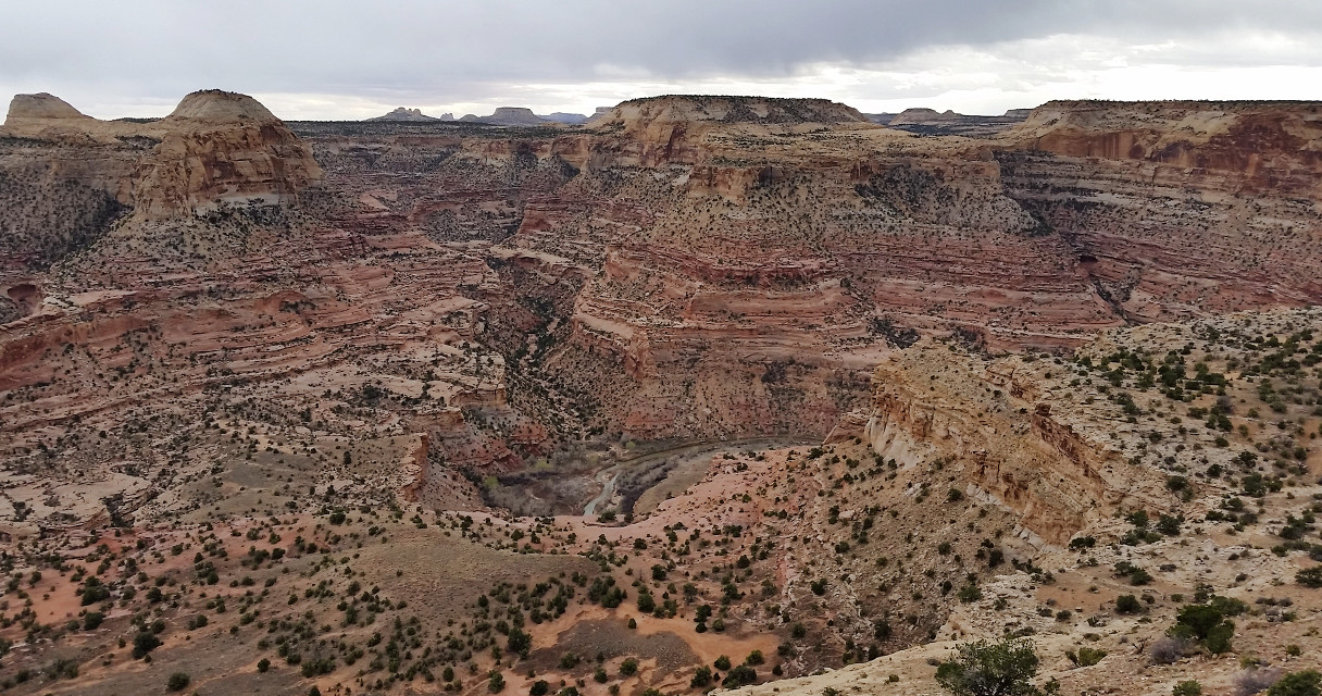
Not far is another worthwhile stop, Wedge Overlook of Little Grand Canyon. It's grand, not little at all. Twist and turn of San Rafael River below. Many layers of rocks. Not as red as the real Grand Canyon. There's a
camping area here close to the rim. However, very very windy. So be careful when you step close to the edge. Carry in water.

The 3rd stop is
Rochester Rock Art. There's a campground right at the rail head. It's a hike, so not a good idea at this late hour, with elderly parents. The landscape is not as pretty as Buckhorn Wash.

Last stop as the light was fading,

is the westbound rest area of I-70 just east of
San Rafael Swell. There's a view point on the eastbound west of the Swell. There are very few exits near yet. Your potential turn around could be 20 miles away. The uplifted earth is impressive just from the car going at 80mph. Dramatic color and lines. There're a few hiking opportunities south of here at
Goblin Valley State Park and
Little Wild Horse + Bell Canyon.
Dinner at Ray's Tavern in Green River (recommended by Moon Handbook) before continuing on to Moab for the night.
 3/31, Friday
. Cloudy, rain at times. First hike of the day:
Corona and Bowtie Arch.

The drive on state route 279 is quite scenic, follows Colorado River. A big campground on the river side of the road, across from the TH. The 1.5 mile hike goes up first, cross a rail track, eventually levels out.

A little over a mile later, you reach this ladder. Next to it are hundreds of cairns. From here, you can see both Bowtie Arch and Corona Arch. This is a good turn-around point, if you are not sure on your feet. Over the ladder, continue on, you can walk under both arches. View over the valley is very good.

Return as you came.
Back on SR 279, we stopped where some other cars stopped. Turns out, there're pictographs on the wall. Round and triangular shaped bodies.

Today is devoted to
Arches National Park. First short walk is
Park Avenue, where I deposited my parents at the trailhead, and parked the car at Courthouse viewpoint, and walked back up the trail to meet them. It's probably the best half mile walk anywhere.

Next, the Windows Section. We hiked to
North and South Windows, loop back from
Turret Arch. Short and sweet. In the same area, Double Arch is also short and pretty.
 Delicate Arch
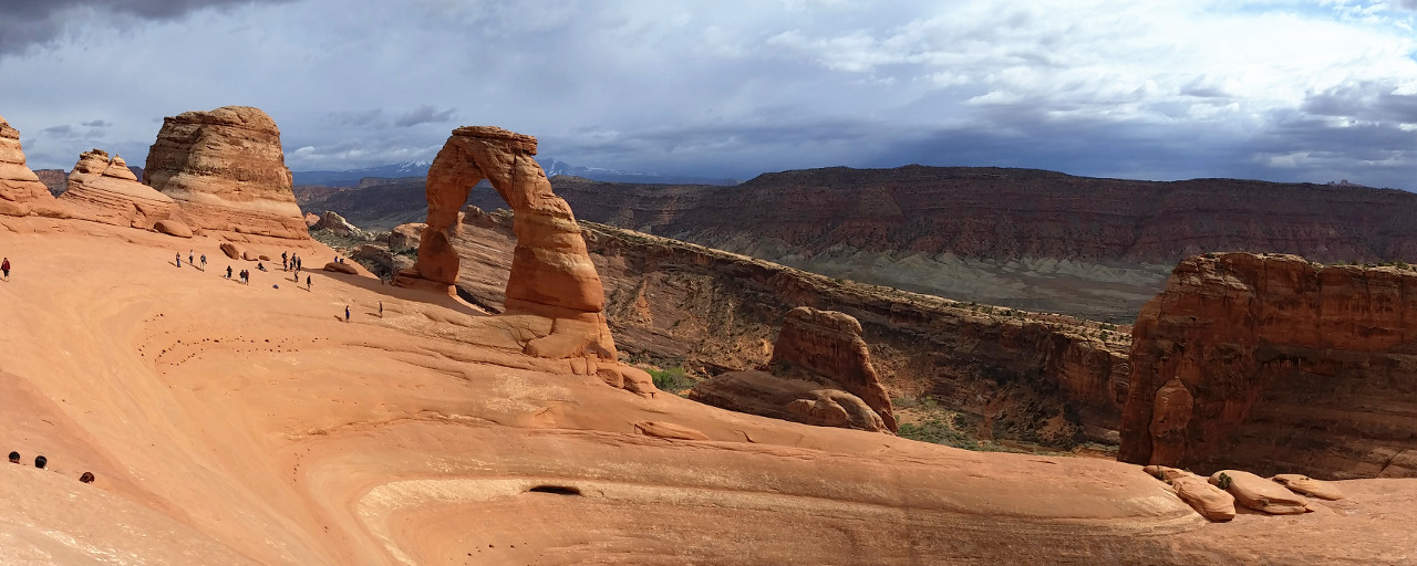
 is a must-see. We hiked slowly over to the arch. I also walked down the arch (not a good idea) to go the the other side, and loop back (easier). The view from the other side is not as good. On the way back, a gentleman stopped dad and asked how old he was. He had his wife taking a photo of them together. Thick clouds are looming above. There're people coming in as we left, hoping to photograph sunset. This spring, due to the construction, only Friday and Saturday, you can stay in the park late. Otherwise, everyone needs to be out of the gate by 7pm.

Drove to
Devil's Garden area, walked about only for a few minutes, as it was getting late. See my last year's hike
here (had sunnier). On the way out, it rained on us. Saw rainbow off and on.

Dinner at El Charro Loco south of downtown Moab, another suggestion of Yelp. Our second choice. Our first, a Thai restaurant was ~1 hour wait. This one was about 30 minutes. The food was hot and quite flavorful. Raining all night long.
 4/1, Saturday
. Cloudy. Driving to
Island In the Sky section of Canyonlands National Park.


There was a bike race going on. Stopped at all road side view points: Merrimac and Monitor, Shafer Canyon, Green River Overlook, Holeman Spring Canyon, Buck Canyon, and Orange Cliff Overlook. The last is Grand View point at the end of the road, where had a picnic lunch. Everyone of these view point is grand.

The only hike we did is half mile to
Mesa Arch.

On the way out, we visited
Dead Horse Point State Park ($15/10). Stopped by visitor center and the road end. Colorado River twists and turns in a different world down the cliff. Bright turquoise tailing ponds of a potash mining complex to the south. Beautiful and vast. Weather was getting better. We could see La Sal Mountain in the distance, topped with snow.

Now taking SR 128 from Moab east and north. The road is very scenic, dotted with trailheads and camp sites by Colorado river. This is just one of those. Only 5 legal sites at this place. There's also a hiking/biking trail between the road and the river.

A lot of people on that trail, including babies in strollers.

The prettiest stretch is around Red Cliff Lodge, especially 5 minutes east of the lodge. Afternoon sun is creating an intense color to everything.

We turned on the dirt road to Fisher Tower. It's pretty, but not grand. I may like it better if we hiked here. There's a campground right at the road's end. Quite a lot of people. No water.
SR 128 eventually leaves Colorado River and turns north, connects I-70. We had dinner again at Green River. Overnight in Price (should have stayed in Wellington).
 4/2, Sunday
. Cloudy, rain, hail, sun.

.
Nine Mile Canyon. It's a bit out of the way. Canyons walls are not as dramatic as in Moab area, nor as colorful. So I don't recommend this detour. Saw quite a few Deers on the way to Nine Mile Canyon, and a few on the way out. There're a couple of working ranches and mining operation.


The attraction here are the rock arts. However, I found those small and not as elaborate. There're many of them. At Fremont Village stop, I hiked up the hill, but unable to find any sign of human existence. I couldn't locate the grain storage at mile 39. Daddy's Canyon has the main parking lot on this drive. Some rock arts here. But the best one is called Great Hunt. To see the Big Buffalo,

Driving the north part of Nine Mile Canyon road, the first 10 minutes is very rough. Then condition of the road got a lot better, and later paved. Not as pretty. Saw many dispersed oil drills.

The road eventually hit highway 191. At Duchesne, took 40 towards Salt Lake City. It goes through few mountain passes, reaching ~7600' at
Strawberry Reservoir. The brown landscape turned to snowy white. Saw some anglers at this point. Light snow. We took I-80 instead of mountain roads for speed (less scenic, but good road condition), by pass ski resorts like Park City.

Our last destination of the day is
Bonneville Speedway, 100 miles west of Salt Lake City, just 4 miles shy of Nevada border. Speed limit on I-80 is 80mph, and many drive a lot faster. A little too windy to drive my little rental car this fast. Very pretty at the south side of Great Salt Lake. Not sure what's in this big pipe. Gasoline? Saw some salt cones of mining operation. A storm was brooding somewhere close by.

Further west, no more water. Flat and straight. Looks muddy. This strange sculpture sits north of I-80.

We stopped at the rest area off exit-10. Good place to walk in the shallow water, because there's a foot wash here to clean the mud. In spring, there's an inch or so water on the flat, making it a giant mirror. Super pretty, expansive.

We, of course, continued to the start of the speedway, where the access road ends. Same scenery, just no place to clean your feet. I ended driving with bare feet, and stopped at the east bound rest area to clean my feet. The view here isn't as good, because it's on the wrong side of the highway, even though there's a lookout built up a staircase. If you want to see the speed race, you have to come in August when it's dry. But that'll be too hot for me.
Back to SLC very late. So ate at the salad bar in Wholefoods, just before that was closed.
 4/3, Monday
. Partly sunny. Visited
Antelope Island State Park ($10). Beautiful now, because of the snowy mountains beyond the water on both sides. No trees here. Would be hot in summer. We hiked from Buffalo Point (highest where the car can go) to top for a rewarding 360°s view of the lake and mountains. Only 1 mile RT, 300' gain. Lomatium are blooming, big rocks to hop about. Absolutely beautiful.

Back down the hill, we drove to
Fielding Garr Ranch. Some rusting machines, a big barn, a couple of houses, otherwise, not interesting. They sure had a good view.

Saw a few roaming buffalos on the hills and on beach here and there.
This concludes the 6 day trip, and we headed to SLC airport for a ~3pm flight.

 New Year's Day. Flood warning and heavy rain storm was in the forecast for the whole day the entire region. However, we could ignore the sun. Finally headed out after lunch. A lot of people at Discovery Park. I was wearing the 2020 ping paper glasses from last night.
  Down South Bluff on a steep sandy boot track, walked along the beach, and back up at North Bluff on muddy staircase.A few brave soles swam briefly in the water. A good way to start the new year.