
 4/13 Saturday. Up at 6am, left home ~6:35. Arrived at the FR-6028 at ~8am. The gate was locked.
Took us some time debatting what to do.
Meanwhile a truck pulled behind us, and a guy in camouflage outfit and an orange hat rode in on a bike.
Should have brought my bike!
Walking the 3.78 mile (according Gaia)! Only cut one short zigzag.
Less than a mile in, we saw the blue bike of the hunter on the hill to the right.
Lots of logs. Good gravel road, clear to drive if you could open the gate. There's a second gate, but wide open.
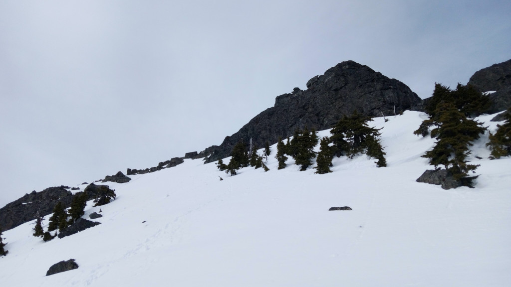
View of Mount Index.
4/13 Saturday. Up at 6am, left home ~6:35. Arrived at the FR-6028 at ~8am. The gate was locked.
Took us some time debatting what to do.
Meanwhile a truck pulled behind us, and a guy in camouflage outfit and an orange hat rode in on a bike.
Should have brought my bike!
Walking the 3.78 mile (according Gaia)! Only cut one short zigzag.
Less than a mile in, we saw the blue bike of the hunter on the hill to the right.
Lots of logs. Good gravel road, clear to drive if you could open the gate. There's a second gate, but wide open.
View of Mount Index.
 A little before 10am, ~2400', we turned left up scrambling the forested slope. Mostly burned.
It was easy first, but soon it got steep, and steeper. Loose ground, loose charred branches.
Crossed 2 creeks in deep gully which involved some down climb.
Put on my helmet.
A little before 10am, ~2400', we turned left up scrambling the forested slope. Mostly burned.
It was easy first, but soon it got steep, and steeper. Loose ground, loose charred branches.
Crossed 2 creeks in deep gully which involved some down climb.
Put on my helmet.

 At ~4200', we hit snow. At ~4500', we put on snowshows. I reached the ridge at ~1:30pm, ~4800'.
(The beginning of the red line on the left photo.)
That's 3.5 hours for just 1.5 miles!
Here, the view opens. I saw that O.K. was already on her ascent in the gully (see the circle on the right photo).
Go down ~2-300' to the basin below, and then up the gully.
It's very steep, typical avalanche terrain.
The snow now is quite sticky, fairly stable.
But once awhile, snow crashed down from the jaggard South Peak, which is scary.
Not much snow still clang on the straight wall of the South Peak.
At ~4200', we hit snow. At ~4500', we put on snowshows. I reached the ridge at ~1:30pm, ~4800'.
(The beginning of the red line on the left photo.)
That's 3.5 hours for just 1.5 miles!
Here, the view opens. I saw that O.K. was already on her ascent in the gully (see the circle on the right photo).
Go down ~2-300' to the basin below, and then up the gully.
It's very steep, typical avalanche terrain.
The snow now is quite sticky, fairly stable.
But once awhile, snow crashed down from the jaggard South Peak, which is scary.
Not much snow still clang on the straight wall of the South Peak.
 Arrived near the col between the two Baring Peaks a bit before 3pm. ~5550'
Just below the col, turn left (north) to the main peak.
It starts steep, I was debating taking off the snowshoes.
At the next steep section, I packed them up. Postholing a lot.
Here, plenty trees. Grab a branch here and there to pull myself up, but my snowshoes hindered my progress, got entangled in the branches sometimes.
Arrived near the col between the two Baring Peaks a bit before 3pm. ~5550'
Just below the col, turn left (north) to the main peak.
It starts steep, I was debating taking off the snowshoes.
At the next steep section, I packed them up. Postholing a lot.
Here, plenty trees. Grab a branch here and there to pull myself up, but my snowshoes hindered my progress, got entangled in the branches sometimes.
 Only at ~15 minutes before I reached the summit, I could see my destination.
Here, detoured to the left (west) and attained the summit all on snow. ~6100'
4pm. 6 hours for ~3 miles!
Only at ~15 minutes before I reached the summit, I could see my destination.
Here, detoured to the left (west) and attained the summit all on snow. ~6100'
4pm. 6 hours for ~3 miles!
The view of the summit is spectacular. Yes, you can see that you are higher than the South Peak (see the left photo).

 I was worried about running out of daylight.
Took a few photos. In less than a minute, I turned around.
For some reason, I didn't see O.K. during the last 2 hours.
I followed her footsteps down.
Glissade at the gully. But the snow was too sticky, only slid down ~400', had to walk the rest.
Put on snowshoes, took out my sandwich, finally ate my lunch at 5pm.
O.K. was waiting for me at the bottom of the basin. By now, my shoes and pants were very wet from the snow.
We stayed together for the rest of the scramble.
I was worried about running out of daylight.
Took a few photos. In less than a minute, I turned around.
For some reason, I didn't see O.K. during the last 2 hours.
I followed her footsteps down.
Glissade at the gully. But the snow was too sticky, only slid down ~400', had to walk the rest.
Put on snowshoes, took out my sandwich, finally ate my lunch at 5pm.
O.K. was waiting for me at the bottom of the basin. By now, my shoes and pants were very wet from the snow.
We stayed together for the rest of the scramble.
Going down the slippery forest slope is worse than coming up. I kept my helmet on, but wouldn't help if I'd fall on any dead branches poking skywards. We routed higher than the creeks to avoid the traverse. But the terrain is a bit worse. At one point, we down climbed one bad section one at a time, kicking rocks and dirt down. Reached the road just before 8pm. Black, dirty, wet boots.
 Very orange sunset.
Had to turn on headlamp for half of the road walk. Cressant moon.
Very orange sunset.
Had to turn on headlamp for half of the road walk. Cressant moon.
I drove back, sitting on my fleece shirt (so to keep the seat clean). Stopped for gas in Monroe. Got home ~11pm. A very long day. ~7.5 mile road walk + ~6 mile scramble. Maybe 4000' real hike, 1000' road.