4/28, Sunday. Joined the WA Native Plant Society's South Sound Chapter at Glacier Heritage Preserve.
The event is at 10am, and we arrived ahead of time.
Cynthia Dillon is the organizer for this event.
She asked for advanced liability waiver from each attendant.
She was there already waiting for the cars, standing in the cold.
She checked you in, and handed out a plant list in plastic folder (nice touch, as it rained later).
Right at the parking area, before we even started, saw a perigan falcon flew onto a lamppost.
In fact we saw 2 eagles, it's their nest.
That's a highlight.
Before we arrived at the preserve, even the I-5 medium, we already saw plenty small camas.
Near the preserve, the ground also look like in Mima Mound, has grassy bumps, many with camas blooming.
This preserve is much larger than I had thought, seems larger than Mima Mound.
Also full of mounds.
Some oak trees, willows, service berry (in bloom), and other shrubs. But mostly grass.
It's quite lovely. This preserve opens only one day per year on Prairie Appreciation Day, so today is a rare opportunity for public to see the preserve.
The highlights today, other than the eagles are: the golden painbrush (endangered, started planting 25 years ago),
white colored camas quamash (a mutation), a few chocolate lily, 2 blooming balsomroot plants.
Many blue-eyed Mary, violet, spring gold lomatium, little buttercup, a few lupine already blooming.
I also learned that rush has seed pods, while grass doesn't.
As with all flower outings, we don't move fast.
It was quite chilly. It also rained a few times. I was the only one who bothered with an umbrella.
Cynthia is so sweet, she brought mandarines and cookies at the end in the parking area.
Sunday, April 28, 2024
Saturday, April 27, 2024
2024.4.27. Where the Water Starts with King Conservation District
4/27, Saturday. Where the Water Starts, a public education program by King Conservation District, hosted at Discovery Park, aimed for property owners along the marine shorelines of King County.
It starts with a free class with 3 speakers:
I also picked up some brochures on native plants. You are eligible for a free site visit to your shoreline property. Request a visit.
After lunch (bring your own), we had a short walk right next to the building to identify the native plants here. Then, I hopped in the car with Cloe and Zoe to go down for a beach walk with all the speakers and organizers, to see the topics we just covered in situ. It's very educational. Highly recommend anyone interested in invest in beach property to attend. My take-away is: do not buy beach property.
Only about 7-8 in the morning class (2 were late, so only heard two speakers). 3 of us did the plant walk between the parking lot and the building, in the light rain. Only me, 1 public, went down to the beach.
It starts with a free class with 3 speakers:
- Geologic History of Puget Sound Shorelines, by John Bethel
- Puget Sound is post glacial landscape
- wind and wave action influence Puget Sound shoreline and bluffs, and the coastal retreat will continue (current average of bluff retreat is 0.3'/year)
- Coastal bluff processes, beach formation and longshore drift
- landslide is usually not covered by insurnace
- Sea level rise and shoreline man-made armor further limits already scarce habitat, Kollin Higgins, salmon and shoreline ecology
- Sea level rising is accelerating some coastal process, more flood events
- Puget Sound has strong salinity gradiant, steep hills, deeper trough
- bulkheads and armoring interrupt coastal process and lead to loss of habitat
- Marine Shoreline Ecology, by Steve Richmond, restoration practioner.
- many fish and wildlife species depend on beach in and out of water by coastal process
- resident Orca rely on Chinook Salmon, which depend on marine shoreline for habitat
- utilizing plants to manage water, stabilize slopes, and create wildlife habitat on your property
- landscaping practices that improve or weaken slope stability
- Invasive weed control and native plant selection (need ISA certified arborist)
- Human impacts and best practices:
- set back developement from bluff faces and shorelines
- consider armor removal where erosion risk is low
- consider working with your neighbors to increase the impact of shore friendly practices
- safely outlet intercepted water and use discretion with infiltration
- native trees, shrubs and ground covers are more effective in erosion control and water management.
- selectively prune for "windowed" views instead of cut the tree
- Remove invasives: knotweed, Egnlish ivy, Himalayian blackberry, morning glory
- Weeding is better done May, June, and Fall
I also picked up some brochures on native plants. You are eligible for a free site visit to your shoreline property. Request a visit.
After lunch (bring your own), we had a short walk right next to the building to identify the native plants here. Then, I hopped in the car with Cloe and Zoe to go down for a beach walk with all the speakers and organizers, to see the topics we just covered in situ. It's very educational. Highly recommend anyone interested in invest in beach property to attend. My take-away is: do not buy beach property.
Only about 7-8 in the morning class (2 were late, so only heard two speakers). 3 of us did the plant walk between the parking lot and the building, in the light rain. Only me, 1 public, went down to the beach.
Tuesday, April 23, 2024
2024.4.23. Tiger 2+3, a talk by Arctic Bird Research
4/23, Tuesday. The weather forecast for the rest of the week (including weekend) is a bit wet.
Headed to Tiger in the morning.
It's good to come early. No one at the foot of Jakob today ~9am.
The highlight today is the woodpecker. I think I startled him. He flew out of somewhere and landed on this tree close by. He has no red crest. Saw some trillium. Quite some yellow violet, lots of bleeding heart.
The clouds were forming. Despite of clouds, the view was very clear. Olympics, highrises of downtown Seattle and Bellevue. Stopped at Tiger3 to air my boots.
Continued on to Tiger2, better view. View of Rainier and Baker on the way. Not sure why most hikers turn around at Tiger3.
I took the same way down this time, so I could fill water at the Issaquah Community Center. I ran out of water. It was warm. It seems they open at 7am, so I could have stopped by earlier. They close on Sundays.
In the evening, went to Town Hall for a lecture on Black Guillemot on Cooper Island by George Divoky. Cooper Island is a flat strip of sandbar off north Alaska. What's amazing is Dr. Divoky continued his study there every summer for 50 years, regardless whether he had funding or not. Other than the obvious climate change witnessed by the island, many data might be interetsing to biologists.
Monday, April 22, 2024
2024.4.22. Earth Day
4/22, Monday. Sunny. Many events today and throughout the week in the theme of earth.
I had this new temporary addition to my small home.
Seattle University hosted (seems like annually) Earth Talks at Pigott Auditorium. Many short talks by both students and teachers. I especially like the bioswale projects by Mark Grey (property manager and investor) and Jeremy Febus (civil engineer), to clean highway storm water in Fremont. The last talk is by Jessyn Farrell (head of Office of Environment and Sustainability of Seattle). She talked about the planning for electrifying Seattle.
At 4pm, I went to a tour and 54th birthday party of Environmental Works, a community landscape/architecture design firm (that I'd never heard of) founded on the first Earth Day. 54 balloons, 54 candles on the big birthday cake. Nice friendly people.
Sunday, April 21, 2024
2024.4.21. UW Arboretum
Saturday, April 20, 2024
2024.4.20. Snow Lake winter scramble via Source Lake
4/20, Saturday. A beautiful day with impending rain. Windy.
Headed to Snow Lake, a very popular summit destination. This will be my first try in winter.
Downloaded Brad Wagenaar's GPS track to Wright Mountain on 4/24/2022, assuming similar condition.
I was picked up ~9:20am. Parked at Alpental - the last weekend of operation this year. We took the winter route, above Source Lake - which is always quite pretty. The route is via skier's exit track, which is officially only for lift users.
Above Source Lake, it gets quite steep. I followed some skier. The snow was slushy, still sinking at times even with snowshoes on. My partner didn't bring ice axe, plus unfamiliar with the new snowshoes, he turned around. My track turns out to be higher than Wagenaar's. Here is avalanche terrain. I could see some old avalanche debris, which is nice to walk on now, because it's more clumpy, so better traction and no sinking. A few skiers flying down from high gullies.
This steep section is only about 15 minutes. Then it's a skiers highway, wider tracks, and then a plateau with such typical winter beauty. Flat, a bit more windy. Once over the ridge to Snow Lake side, it got more windy. I found a good overlook to take a photo, and then turned around.
Took off snowshoes to glissade the steep section. Then put them back on, because I was sinking too much. Followed the regular track on the the north side of the creek. Once into the woods, I took off snowshoes and put on micro-spikes. The track is well trodden. At the junction to Snow Lake summer trail, saw well trodden boot track up. Not sure how many made it up this side: more avalanche prone.
When I realized that the track would lead me to a farther parking lot, I scouted for a place to cross the creek. This is, maybe the worst scrambling today. Both banks of the creek are quite steep. Made to the car at 2pm. Ate my lunch then.
On the drive back, more clouds were forming. By the time we were in Seattle, it was gloomy. It did rain later, but not much.
Friday, April 19, 2024
2024.4.19. Potlatch Symphony with Seattle Symphony and regional first nation artists
4/19 Friday. 7:30pm. A free community concert at Benaroya Hall.
A good turn out: ~80% full. Program:
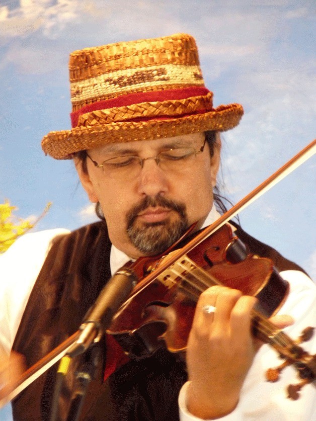
The violin of Kanim is a solo. I like his vest.
Then drumming noise came in from the lobby. Soon 2 lines of indigenous people, some in straw hats (I like those) and few in traditional attire filed in onto the isle and then to the stage, while drumming. One in wheelchair. For some unknown reason, some audience member decided to stand up and watch them, blocking the view of those behind them.
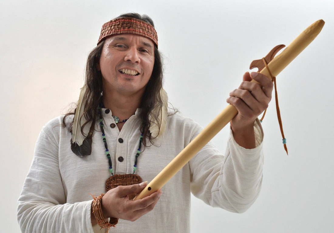
Then, Chiyokten played a flute solo. It's an interesting flute with a distinct sound. However, his breathing is too loud.
Last, the world premier of Potlatch, simulating a gift giving ceremory, where Chiyokten narated a story of two sisters, acompanied by the orchestra. I didn't care of Chiyokten's voice. The story is okay, fairly simple with a good message, but could be better told, or written. The melody is not more or less classical.
Sunny Xia is the conductor tonight. I like her.
The whole thing with some speeches lasted ~an hour. Overall, I enjoyed the concert. I appreciate the effort to foster new works, and the promotion of traditional teachings.
Max Dawes - Creation Swil Kanim - Father Distant Daughter Sergei Prokofiev - Troika from Lieutenant Kijé, Op. 60 Astor Piazzolla - Libertango Paul Chiyokten Wagner - Kwaanuk Janice Giteck - Potlatch Symphony 2020Dawes is a 21 year old senior student at Cornish College of the Arts. He conducted his own composition. The structure is violin with a background orchestra with increasingly loud harmony. The violin is a bit weak, not as pretty as the background. Overall, quite nice.
The violin of Kanim is a solo. I like his vest.
Then drumming noise came in from the lobby. Soon 2 lines of indigenous people, some in straw hats (I like those) and few in traditional attire filed in onto the isle and then to the stage, while drumming. One in wheelchair. For some unknown reason, some audience member decided to stand up and watch them, blocking the view of those behind them.
Then, Chiyokten played a flute solo. It's an interesting flute with a distinct sound. However, his breathing is too loud.
Last, the world premier of Potlatch, simulating a gift giving ceremory, where Chiyokten narated a story of two sisters, acompanied by the orchestra. I didn't care of Chiyokten's voice. The story is okay, fairly simple with a good message, but could be better told, or written. The melody is not more or less classical.
Sunny Xia is the conductor tonight. I like her.
The whole thing with some speeches lasted ~an hour. Overall, I enjoyed the concert. I appreciate the effort to foster new works, and the promotion of traditional teachings.
2024.4.19. Invisible Beauty - a documentary movie
4/19, Friday. Pigott Auditorium at Seattle University. Screening of Invisible Beauty with writer and director pair of Bethann Hardison and Frédéric Tcheng, featuring Bethann and her fight for diversity in the fashion industry.
It's a treat today, because both Bethann and Frédéric were in attendance to answer questions.
I enjoyed the movie, even though I couldn't care less of the fashion industry. It's a little too long. Good message. Bethann is very nice, looks young for her age (81). I even chatted a little with her after the Q&A. When asked to whom would she hand over the baton, she said there isn't a baton, rather everyone in the community.
Sunday, April 14, 2024
2024.4.14. Jazz in the City at Frye Art Museum
4/14, Sunday, 2-4pm. O.K. went with me to Frye to attend another jazz concert.
This time, Duende Libre.
The trio features pianist Alex Chadsey, percussionist Jeff Busch, and electric bass guitarist Farko Dosumov.
Every piece today was composed by Alex (he talked a bit about each piece). Quite nice.
However, I'd prefer to hear at least one familiar tune.
The auditorium was about 60% full today.
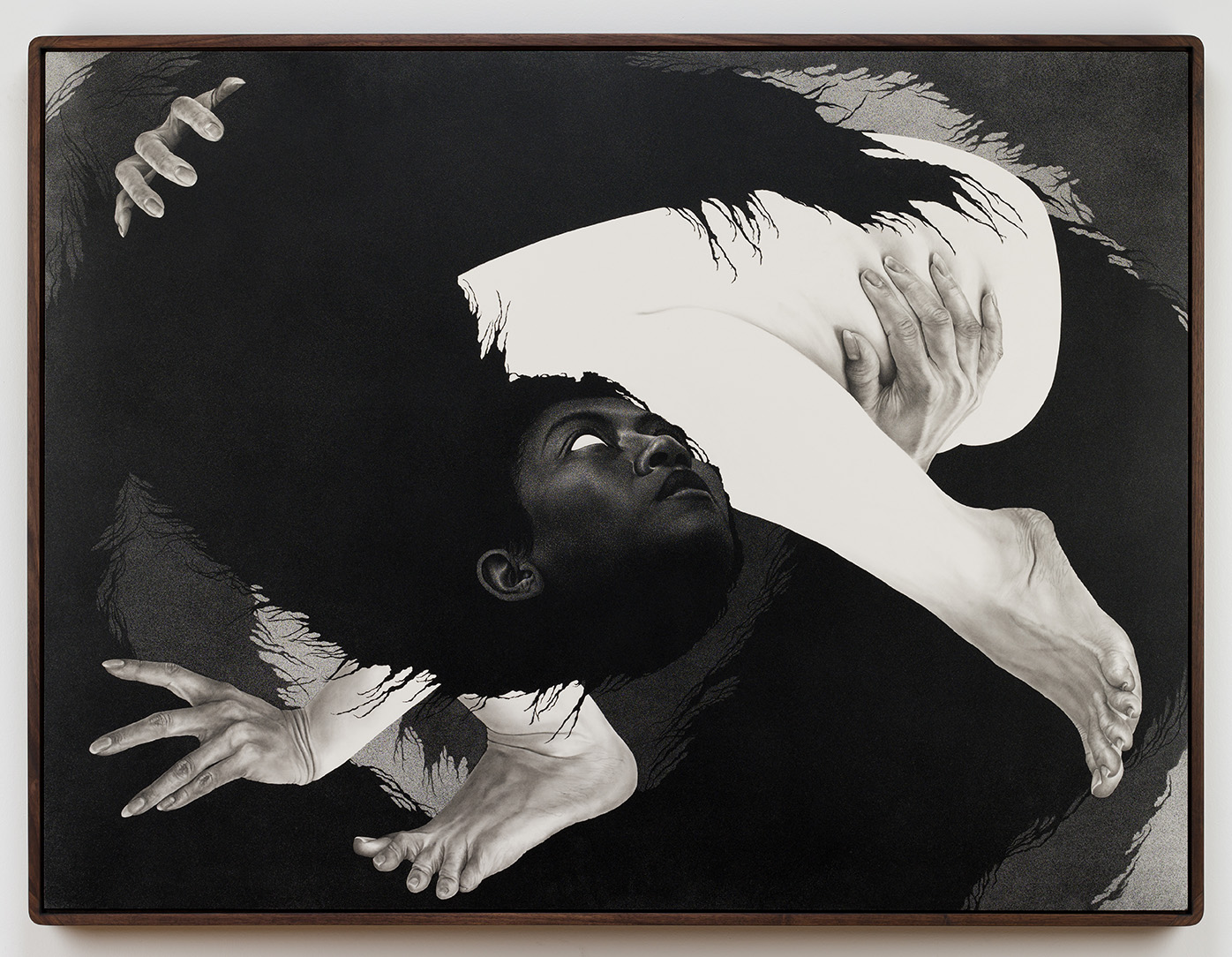
During the intermission, we went through the new exhibitions. Didn't like most of them (as usual) except for Semantha Wall's drawings. This one is called "the space to grow".
Walking back to downtown is not good for my legs: so sore.
Before the concert, we checked out briefly the Japanese Festival in Seattle Center (Fri-Sun). I liked the Ikebana display and a short demo of setting up 4 flower arrangements. One booth shows paper-dolls in intricate detailed clothing. The paper she uses is very soft and clothe like. I even sat down and folded some color paper. There were some quite complicated examples of animals, people, made by folding paper. The Judo (?) performance of mostly teeagers is fairly basic. They kicked or broke a square wooden plank by hand. There were a group doing drumming and dancing. Again, very simple.
Saturday, April 13, 2024
2024.4.13. Baring Mountain
4/12 Friday, O.K. arrived ~9:30pm. We had agreed to climb Baring Mountain a day earlier.
It was badly burned 2022, which made the standard access (via west ridge using Barclay Lake TH) difficult.
According to a trip report on April 2nd, someone approached it from the south side, and we planned to give this a try.
4/13 Saturday. Up at 6am, left home ~6:35. Arrived at the FR-6028 at ~8am. The gate was locked. Took us some time debatting what to do. Meanwhile a truck pulled behind us, and a guy in camouflage outfit and an orange hat rode in on a bike. Should have brought my bike! Walking the 3.78 mile (according Gaia)! Only cut one short zigzag. Less than a mile in, we saw the blue bike of the hunter on the hill to the right. Lots of logs. Good gravel road, clear to drive if you could open the gate. There's a second gate, but wide open. View of Mount Index.
A little before 10am, ~2400', we turned left up scrambling the forested slope. Mostly burned. It was easy first, but soon it got steep, and steeper. Loose ground, loose charred branches. Crossed 2 creeks in deep gully which involved some down climb. Put on my helmet.
At ~4200', we hit snow. At ~4500', we put on snowshows. I reached the ridge at ~1:30pm, ~4800'. (The beginning of the red line on the left photo.) That's 3.5 hours for just 1.5 miles! Here, the view opens. I saw that O.K. was already on her ascent in the gully (see the circle on the right photo). Go down ~2-300' to the basin below, and then up the gully. It's very steep, typical avalanche terrain. The snow now is quite sticky, fairly stable. But once awhile, snow crashed down from the jaggard South Peak, which is scary. Not much snow still clang on the straight wall of the South Peak.
Arrived near the col between the two Baring Peaks a bit before 3pm. ~5550' Just below the col, turn left (north) to the main peak. It starts steep, I was debating taking off the snowshoes. At the next steep section, I packed them up. Postholing a lot. Here, plenty trees. Grab a branch here and there to pull myself up, but my snowshoes hindered my progress, got entangled in the branches sometimes.
Only at ~15 minutes before I reached the summit, I could see my destination. Here, detoured to the left (west) and attained the summit all on snow. ~6100' 4pm. 6 hours for ~3 miles!
The view of the summit is spectacular. Yes, you can see that you are higher than the South Peak (see the left photo). I was worried about running out of daylight. Took a few photos. In less than a minute, I turned around. For some reason, I didn't see O.K. during the last 2 hours. I followed her footsteps down. Glissade at the gully. But the snow was too sticky, only slid down ~400', had to walk the rest. Put on snowshoes, took out my sandwich, finally ate my lunch at 5pm. O.K. was waiting for me at the bottom of the basin. By now, my shoes and pants were very wet from the snow. We stayed together for the rest of the scramble.
Going down the slippery forest slope is worse than coming up. I kept my helmet on, but wouldn't help if I'd fall on any dead branches poking skywards. We routed higher than the creeks to avoid the traverse. But the terrain is a bit worse. At one point, we down climbed one bad section one at a time, kicking rocks and dirt down. Reached the road just before 8pm. Black, dirty, wet boots. Very orange sunset. Had to turn on headlamp for half of the road walk. Cressant moon.
I drove back, sitting on my fleece shirt (so to keep the seat clean). Stopped for gas in Monroe. Got home ~11pm. A very long day. ~7.5 mile road walk + ~6 mile scramble. Maybe 4000' real hike, 1000' road.
Friday, April 12, 2024
2014.4.12. Fat Ham at Seattle Rep
4/12, Friday. The first preview performance of Fat Ham.
Advertised as "2022 Pulitzer Prize Winner, 2023 Tony Award Nominee". I don't understand how, or the world is becoming too politically correct.
It's labeled as "for family" 16+. Aabsolutely not for children.
Explicit sexual reference: blowjob by a gingerbread man? It's acted out. Funny, yes, but I don't see the point.
Plot:
Juicy, a young queer Black man, is taking online classes for a college degree in HR. His mother just married his uncle after the untimely death of his father, whose ghost appears demanded that Juicy avenge his murder. Plus, the uncle and mom used his tuition saving for remodling the house and the wedding.
The scene is a BBQ at the yard. The family (only 1) who arrived happens to have a Lesbian daughter and a gay son who's pretend to be straight. They ate, played games, sang karaoke, and the uncle died. Not very coherent and a bit contrite.
The last drag parade is fun. I like the costumes and some dialogs. I like the actress who played the mother. I don't like the story, nor the structure. Seems badly mushed together.
Single act. I arrived late, sat in the balcony which is fine.
Monday, April 08, 2024
2024.4.4-8. Chasing Totality in Texas
I booked everything 6 months ahead, anticipating the crowd. The air fare was already inching up.
The 2 tickets, each leg is different.
I chose Texas, hoping for a sunny April day.
A month before my trip, Hertz called me to cancel my car reservation. I scrambled to find another car. Took some effort, found one in the outskirt of north Austin for $535 w/o insurance (instead of $220 with Hertz including insurance).
4/4, Thursday. 0:00. I boarded United with a stopover in Houston, arrival ~8:30am. Ate my breakfast while topping the battery on my phone. Took bus 20 into the town. Bus fare is only $1.25. I got a day pass for $2.5. Got off after the bus crossed Congress Ave bridge.
Walked along Colorado River. Very nice walk paths. Many joggers, kayaks on water, Geese on the lawn. This nice building is 2 toilets. Huge.
I left the river walk onto Lamar Blvd. First, visited the Treaty Oak. A Texas live oak tree, the last surviving Council Oak, one of the grove of 14 trees that served as a sacred meeting place for Comanche and Tonkawa tribes before European colonization of the area. Estimated 500 years old. It doesn't look impressive, but definitely alive.
Walked on 5th and 6th st to the town center. 6th is very lively, live with many bars and some small museum. One is called Museum of the Weird. The best looking hotel is here: Driskil (now owned by Hyatt).
I walked to the park south of O'Henry Museum for a picnic lunch, while waiting for its openning at noon. The small house has 2 volunteers eager to talk. The left is the mug shot of O'Henry when he was imprizsoned. O'Henry and his wife + daughter lived here for a few years. The piano in this photo was actually played by the wife. The museum staff encouranges you to play too.
Next door is Susanna Dickenson's residence with her 3rd husband, years after she came back from Alamo. Here, the main exhibition is the description of the 12 survivors of Alamo. Susanna is the only white woman.
Checked out Jones Center (The Contemporary Austin's downtown branch), hoping to leave my luggage here while walking around the town. But the museum has very little to see. 2 exhibitions, 5 minutes each is plentiful. So I'm obliged to take my bags when I left. One is large paintings, all are people surround a table, lack of perspective, simple bright palete. 2nd floor is all long planks with misc decorations, not sure how they are grouped. It has a covered roof, not very high, but good view.
Walking north to the capitol. On the way, visited Saint Mary Cathedral, because the nice looking facade. A small side door was open with a sign which I followed inside. The stainless glass windows are new, but nice and colorful.
Visitor Center of the state capitol is in the capitol square, but in a separate building. It has more to see than I had time for. There is a documentary movie about the capitol ranch that I found interesting. I had a reservation of a 2:30pm tour at the governor's mansion, where no backpacks or purses were allowed. The front desk let me leave my luggage here (thank you). I walked through the south border of the large green space surrounded the capitol building. Not a lot of shade. Getting quite hot.
I was the last person of my group who arrived at the gate of the governor's mansion, ~2:25pm. The state government website publishes tour dates 1~2 month ahead. I filled up a form, picked a date. On 3/19, I was notified via email of an availability (the time slot of that day), and a request to submit my driver's license number (or passport number if you are a foreigner). A week before the tour, I received a confirmation email (passed the background check) and a warning "no storage available". Everyone heeded to the warning. No one brought any bags. Security check (a lot of security guards) and X-ray first.
This house predated the capitol building by ~50 years. Maybe the longest occupied governor's house. We were shown the rooms downstairs. These are for public functions. Once, a governor once hosted 3000 guests here for his daugter's wedding. Not sure how it would fit. Nicely decorated with views to the garden. Other than the history and anecadotes, we were told about the paintings, the memorabilias. Towards the end of our 30 minutes, the wife of the current governor came out with "pancake" the dog to say hi to everyone. She's gracious and amicable.
I walked back to the visitor center to fetch my luggage, and looked around the exhibit more, still rushed past many items. Then onto the capitol building itself. A lot of visitors here. Many docents talking about this and that. My guide is an old blond lady with a Taxas droll. Senate and House were not in session. We were allowed to wander around up to the 3rd floor. The dome looks quite nice. Portraits of governer line the wall. Whenever a new governer swears into the office, all the portraits have to be shifted by one spot.
~3:40pm I headed to the bus stop. It's a 45 minute ride + 20 minute walk to the Enterprise rental car office, where a car was waiting for me. I called this morning just to reconfirm. It's $120 + tax, comes to about $530 for 4 days. Pricy! I bought some salted duck eggs at a Chinese grocery store, visited a Mexican store. Didn't like either.
Did a 5 minute hike to the Pennybacker Bridge Overlook. A pullover with capacity of ~10 cars right before the bridge, southbound only. Almost no mergeL 60mph squeech to 0. Need to be careful. Highly recommended. A lot of folks come and go. The path is a bit scrambly. Good view of Colorado River and the bridge.
I had reserved a free ticket for the afternoon entry (it turns out unnecessary) to The Contemporary Austion's sculpture park at Laguna Gloria. This location opens until 9pm! It took me awhile to find a parking spot. I didn't expect it to be busy ~7pm. All the streets were lined with cars. I ended parking at Mayfield Park and Nature Preserve next door, but didn't visit it. It turns out that today is the unveiling reception of this giant tin bus called Mariposa Relampago. I was given a brochure and 2 drink tickets. After walking around the property, I found the bus at the end of a walk. You are free to board the bus, sit on it, touch the giant utensils. At some point, there was a long sound ceremony where 3 artists climbed on board played the drums. Right next to it is a table handing out drinks and a pop-up takeout food canopy. I had a taquila cocktail called sunshine. I like the color. Too bad, they don't have beer. Thankfully, now the sun was gone, it's not so hot any more. I had a cidar next. At least it's chilled.
Before driving to San Antonio for the night, I bought some food and beer from Trader Joe's. Eating as I drove, to keep myself awake. San Antonio is only 70 min south. Checked into the hotel ~9:30pm, unloaded food into the fridge. Washed. Headed to the airport ~midnight to pick up my partner.
4/5, Friday. Sunny, very warm. Breakfast at hotel.
Walked out to downtown along San Antonio River, north bound. A couple of cute southern houses with large verandars. Very pleasant. Along the Passeo de Rio (a loop), many restaurants decked out in flowers and tables taking over half of the walkway. Bridges crossing the river often, colorful barges filled with people with guide yelling into speakers. Quite pretty. We made a snack stop by the river, and another lunch stop at a random restaurant. It was getting warm.
Alamo is a must-see in San Antonio, a crucial relic in the Texas history. Now the large Alamo Plaza is under reconstruction, making some new "experience" for future visitors. There's actually not much left to see. The facade of mission Valero church is almost intact. The long barack. All the rest is fabrication. A lot of tourists. A queue to get into the church. Another queue to get the (free) ticket to go into the church. All under the sun, no shade. They try to sell you package of different combo of virtual experience. Not sure why anyone would bother. Very crowded.
The church was never completed, the mission was abandonned ~1800. Military occupancy later. The claim to fame is the Battle of Alamo of 1836 during the Texas Revolution. When Mexican troop killed nearly everyone, it ignited the revenge, which led to the victory of Battle of San Jacinto a little over a month later. Thus the Republic of Texas was born.
Before escaping the heat to the AC-controled hotel room, we checked out the cathedral (looks a bit new, nice facade) and the county court house (a striking red building). It has a decent exhibition of the local history on the ground floor.
Took a short siesta. ~4:20pm, we headed out again in the heat, driving to the Hill Country for bluebonnet - Texas' state flower. Slightly cooler too. As we left the city, started to see patches of flowers along the highway (in the median, on the banks, but nothing in the rest areas).
First stop, the Stonehenge II. I guess there are many Stonehenge #2s. I didn't like this one. All stones look the same. I like the 2 giant heads. Next door is the Hill Country Visual Arts Center. It was closed, with many signage and posters for parking (preparing for Monday).
Stopped by Kerrville. Nice cute downtown. Some old handsome buildings like this Schreiner Mansion (of course closed at this late hour). I especially like this large overlook of Guadalupe River. Again, saw parking signage and posters for Monday.
Willow City Loop off Hwy 16 north of Fredericksburg is what my research said as a destination for Texas Bluenette. Already saw plenty along Hwy 16. Road 1323 towards Willow City (no city really). Private ranches. Curvy road. The Willow City Loop actually climbs up some elevation, offers view of the neighboring field at times. A couple of small creeks. Very pastrol. At the end of the loop, due north of Hwy 16, saw this patch of white poppies. A lot of them. Beautiful against the setting sun. Did see a few other flower chasers (less than 10), taking selfies while trampling the flowers!
Back to hotel quite late.
4/6, Saturday. Breakfast in the hotel. Going to the ocean today, hoping to see some birds.
First stop is Choke Canyon State Park ($5/pp). Saw maybe an ibis. Two different entrances to two corners of the large reservoir. Quite a few people fishing. Picnic tables all have roofs. Many fish cleaning stations.
Next, Lake Corpus Christi State Park (same ticket works). Another reservoir. Again, quite a few people fishing here. More campers. Being a Saturday, it was busier. The lady at the entrance mentioned one trail for bird watching. We went, saw a group of school kids, no birds. However I found this CCC built pavilion, named Castle, interesting.
Made a mistake of visiting Pollywog Pond Bird & Wildlife Sanctuary. Very buggy. Swampy. Looks like waste-water treatment ponds. Lots of small birds chirping, but couldn't see any!
Driving over the water to Padre Island is scenic. 2 very long bridge, or causeway. We stopped briefly at Red Dot Pier right by the highway, in the middle of the water. Many fishermen. Windy.
Drove south towards Padre Island National Seashore. It's a very long stretch of sand bar (endless sand dunes). So wide that you cannot see water when driving on the road. Picked a side road, and drove to the beach. The water isn't cold, but still, I didn't dare to swim. Not many people, they drive their car onto the beach.
After checking into a hotel at Port Aransas, we went for dinner at the Fins, recommended by the hotel front desk. It's overpriced. Had their snapper, a bit over cooked. The seating area is covered with net. Laughing gulls are flying about and watching you (or rather your food).
After dinner, walked to Roberts Point Park next door. A lot of folks were fishing. This guy caught a big Black Drum, proudly posing for photos.
People here drive golf carts around instead of cars. Not a bad sunset. Wet weather was coming.
4/7, Sunday. A few drops of rain in the morning. Still warm. Breakfast in the hotel. Took the short ferry (free) back to the mainland. They run continuously. Each boat can carry ~10 regular cars.
Drove back to San Antonio to checkout the missions that I forgot yesterday. First one is Mission Espada. First mission in Texas, transferred here in 1731. The building was finished in 1756. We missed the aquaduct north of the mission, dated to 1745. Lots of potted plants in the corridor. Very pleasant.
Next is Mission San Juan. Mid 1700s. I didn't like the white plastered wall.
3rd is Mission San Jose, the most crowded and the largest of the 5 along San Antonio River. Large parking lot(s). A separate museum and gift shop. ~mid 1700s. More elaborate church, surrounded by walls on all 4 sides. A granery. As with all other churches in these missions, the inside is plain.
Last (most closer to San Antonio) is Mission Concepcion. Also moved here from eastern Texas. Thick wall, unrestored, yet stil standing. There's a remnant of the quarry, where the stones for the church came from. The walls are gone. All 5 missions, including Alamo, are worth visiting while you are in the area. But none of these churches can compare with those I saw in Mexico. Maybe not enough population to sustain all these churches in such close proximity.
Now, going back to Austin (where we'll be watching the solar eclipse).
Drove to UT Austin to see the Ransom Center. It's Sunday. Free parking = no parking. Took me awhile to find a spot. The lady at the reception asked "Are you one of those eclipse people who's wandering around"? The main reason to come here to see the 500 year old Gutenberg bible, one of the only 20 in the world. I'm surprised to see it in such good condition. Nicely displayed. They'll turn the page a few times a year.
Another prized posession here, which I wasn't awared of is this Niépce Heliograph (1827), earliest know photograph. However, it's almost impossible to see what's on it. So vague. Vague title too: viewpoint.
There's a Self-Portrait with Thorn Necklace and Hummingbird by Frida Kahlo. Not very big.
A temporary exhibition of Elizabeth Olds: paintings, silkscreen, lithography. The brushstrokes are coarse. Some are satiric, like this one titled Picasso Study Club and this Sister's Union Demands Shorter Hours for Prayer.
Another temporary exhibition that we spent most of our time is The Clarkson Stanfield Album: many early photographs by the partnership of David Octavius Hill and Robert Adamson. The subjects are often everyday life. There is a long poster on Calotype, an early exposure method. However, it doesn't make me understand it and its advantage over daguerreotype.
Next, checked out a public art installation called The Color Inside in the student activity center. Need to reserve tickets if visit during sunset time.
The campus is very pretty along the flower parterre (University Ave) and the Littlefield Fountain. Quite a few students in graduation gowns. I asked one, was told that they were just taking photos, not graduation yet.
Drove out of the school to visit the troll Malin in Pease Park. Parked on Park Way, and walk down to Shoal Creek. It's just some green space, without the troll, it's not interesting.
Now it's time to settle down for a spot for the evening bat show near Congress Ave Bridge. The trick is finding a parking spot. Maybe because it's a Sunday free parking, every street near Congress Ave was full of cars. Parked on Lee Barton Dr between a condo called "Bridges On the Park" and a small golf course called "Butler Pitch and Putt".
Walked along Colorado River. Very pleasant with good view of Austin downtown on the other side of the water. There are also these root stumps, like alone San Antonia River. We walked up a small hill SE of the bridge, marked as Bat Viewing Site on Google Map. A lot of people, and more and more were arriving. Sunset around 8pm, but no sign of bats until almost 8:30. They came out in waves. Those boat tours shine red lights under the bridge from time to time. The best time to see them is supposed to be August when baby bats were emerging (so double the population). All what roosting here are female. Don't know why.
Checked into the hotel quite late.
4/8, Monday. Total solar eclipse.
There are many "viewing parties" all around the town. Not sure which one to go to, where to park, plus not running into traffic jam when we leave for the airport (which is just right outside of the totality zone). I decided to go to Zilker Botanic Garden. After yesterday's difficulty to finding parking spot, we arrived at the garden right after they openned (10am). Very happy to snatch a parking spot. It turns out that throughout the morning, there were parking available. The eclipse was supposed to be around 1:37pm. That's a lot of time to wait.
The park is very small. Didn't take long to walk all around. There's a small Japanese garden with Koi fish. A so-called prehistoric garden with concrete dinosaur and a butterfly garden with giant plastic butterfly chairs. The rose garden and the main lawn is very nice. Quite a few different kinds of flowers blooming, but not all have tags, so I had to ask the employees in the visitor center with my bad photos. My favorite is this this Asiatic Day Lily, which is everywhere in this garden.
We eventually settled at the flat lawn next to the visitor center. They gave out "eclipse glasses" which is so dark, that you can use it to see full sun at noon. They also sell better eclipse glasses, which is more usable. Clouds moved in, covered the sun from time to time. Everytime the sun shone out of the clouds, people cheered. Slowly the moon moved in, and the sun was like a new moon. Too bad, at 1:37pm, the sun was covered by the clouds. So, couldn't see the corona, or the solar wind, or the 360° sunset. Definately, it cooled down (not as obvious as if it were no cloud cover), and all the birds shut up. Soon, birds started chirping again, and we got up to leave.
It started to drizzle as we drove to the airport. I filled the gas right outside of the airport. But Enterprise charged me 5.5 gallons of gas. They said that the Bluetooth in the gas tank showed only 4.5 gallon, even though I just put 6 gallon into the car! Oh, well. A sour note of an otherwise good trip.
Back in Seattle in rain, of course.
A month before my trip, Hertz called me to cancel my car reservation. I scrambled to find another car. Took some effort, found one in the outskirt of north Austin for $535 w/o insurance (instead of $220 with Hertz including insurance).
4/4, Thursday. 0:00. I boarded United with a stopover in Houston, arrival ~8:30am. Ate my breakfast while topping the battery on my phone. Took bus 20 into the town. Bus fare is only $1.25. I got a day pass for $2.5. Got off after the bus crossed Congress Ave bridge.
Walked along Colorado River. Very nice walk paths. Many joggers, kayaks on water, Geese on the lawn. This nice building is 2 toilets. Huge.
I left the river walk onto Lamar Blvd. First, visited the Treaty Oak. A Texas live oak tree, the last surviving Council Oak, one of the grove of 14 trees that served as a sacred meeting place for Comanche and Tonkawa tribes before European colonization of the area. Estimated 500 years old. It doesn't look impressive, but definitely alive.
Walked on 5th and 6th st to the town center. 6th is very lively, live with many bars and some small museum. One is called Museum of the Weird. The best looking hotel is here: Driskil (now owned by Hyatt).
I walked to the park south of O'Henry Museum for a picnic lunch, while waiting for its openning at noon. The small house has 2 volunteers eager to talk. The left is the mug shot of O'Henry when he was imprizsoned. O'Henry and his wife + daughter lived here for a few years. The piano in this photo was actually played by the wife. The museum staff encouranges you to play too.
Next door is Susanna Dickenson's residence with her 3rd husband, years after she came back from Alamo. Here, the main exhibition is the description of the 12 survivors of Alamo. Susanna is the only white woman.
Checked out Jones Center (The Contemporary Austin's downtown branch), hoping to leave my luggage here while walking around the town. But the museum has very little to see. 2 exhibitions, 5 minutes each is plentiful. So I'm obliged to take my bags when I left. One is large paintings, all are people surround a table, lack of perspective, simple bright palete. 2nd floor is all long planks with misc decorations, not sure how they are grouped. It has a covered roof, not very high, but good view.
Walking north to the capitol. On the way, visited Saint Mary Cathedral, because the nice looking facade. A small side door was open with a sign which I followed inside. The stainless glass windows are new, but nice and colorful.
Visitor Center of the state capitol is in the capitol square, but in a separate building. It has more to see than I had time for. There is a documentary movie about the capitol ranch that I found interesting. I had a reservation of a 2:30pm tour at the governor's mansion, where no backpacks or purses were allowed. The front desk let me leave my luggage here (thank you). I walked through the south border of the large green space surrounded the capitol building. Not a lot of shade. Getting quite hot.
I was the last person of my group who arrived at the gate of the governor's mansion, ~2:25pm. The state government website publishes tour dates 1~2 month ahead. I filled up a form, picked a date. On 3/19, I was notified via email of an availability (the time slot of that day), and a request to submit my driver's license number (or passport number if you are a foreigner). A week before the tour, I received a confirmation email (passed the background check) and a warning "no storage available". Everyone heeded to the warning. No one brought any bags. Security check (a lot of security guards) and X-ray first.
This house predated the capitol building by ~50 years. Maybe the longest occupied governor's house. We were shown the rooms downstairs. These are for public functions. Once, a governor once hosted 3000 guests here for his daugter's wedding. Not sure how it would fit. Nicely decorated with views to the garden. Other than the history and anecadotes, we were told about the paintings, the memorabilias. Towards the end of our 30 minutes, the wife of the current governor came out with "pancake" the dog to say hi to everyone. She's gracious and amicable.
I walked back to the visitor center to fetch my luggage, and looked around the exhibit more, still rushed past many items. Then onto the capitol building itself. A lot of visitors here. Many docents talking about this and that. My guide is an old blond lady with a Taxas droll. Senate and House were not in session. We were allowed to wander around up to the 3rd floor. The dome looks quite nice. Portraits of governer line the wall. Whenever a new governer swears into the office, all the portraits have to be shifted by one spot.
~3:40pm I headed to the bus stop. It's a 45 minute ride + 20 minute walk to the Enterprise rental car office, where a car was waiting for me. I called this morning just to reconfirm. It's $120 + tax, comes to about $530 for 4 days. Pricy! I bought some salted duck eggs at a Chinese grocery store, visited a Mexican store. Didn't like either.
Did a 5 minute hike to the Pennybacker Bridge Overlook. A pullover with capacity of ~10 cars right before the bridge, southbound only. Almost no mergeL 60mph squeech to 0. Need to be careful. Highly recommended. A lot of folks come and go. The path is a bit scrambly. Good view of Colorado River and the bridge.
I had reserved a free ticket for the afternoon entry (it turns out unnecessary) to The Contemporary Austion's sculpture park at Laguna Gloria. This location opens until 9pm! It took me awhile to find a parking spot. I didn't expect it to be busy ~7pm. All the streets were lined with cars. I ended parking at Mayfield Park and Nature Preserve next door, but didn't visit it. It turns out that today is the unveiling reception of this giant tin bus called Mariposa Relampago. I was given a brochure and 2 drink tickets. After walking around the property, I found the bus at the end of a walk. You are free to board the bus, sit on it, touch the giant utensils. At some point, there was a long sound ceremony where 3 artists climbed on board played the drums. Right next to it is a table handing out drinks and a pop-up takeout food canopy. I had a taquila cocktail called sunshine. I like the color. Too bad, they don't have beer. Thankfully, now the sun was gone, it's not so hot any more. I had a cidar next. At least it's chilled.
Before driving to San Antonio for the night, I bought some food and beer from Trader Joe's. Eating as I drove, to keep myself awake. San Antonio is only 70 min south. Checked into the hotel ~9:30pm, unloaded food into the fridge. Washed. Headed to the airport ~midnight to pick up my partner.
4/5, Friday. Sunny, very warm. Breakfast at hotel.
Walked out to downtown along San Antonio River, north bound. A couple of cute southern houses with large verandars. Very pleasant. Along the Passeo de Rio (a loop), many restaurants decked out in flowers and tables taking over half of the walkway. Bridges crossing the river often, colorful barges filled with people with guide yelling into speakers. Quite pretty. We made a snack stop by the river, and another lunch stop at a random restaurant. It was getting warm.
Alamo is a must-see in San Antonio, a crucial relic in the Texas history. Now the large Alamo Plaza is under reconstruction, making some new "experience" for future visitors. There's actually not much left to see. The facade of mission Valero church is almost intact. The long barack. All the rest is fabrication. A lot of tourists. A queue to get into the church. Another queue to get the (free) ticket to go into the church. All under the sun, no shade. They try to sell you package of different combo of virtual experience. Not sure why anyone would bother. Very crowded.
The church was never completed, the mission was abandonned ~1800. Military occupancy later. The claim to fame is the Battle of Alamo of 1836 during the Texas Revolution. When Mexican troop killed nearly everyone, it ignited the revenge, which led to the victory of Battle of San Jacinto a little over a month later. Thus the Republic of Texas was born.
Before escaping the heat to the AC-controled hotel room, we checked out the cathedral (looks a bit new, nice facade) and the county court house (a striking red building). It has a decent exhibition of the local history on the ground floor.
Took a short siesta. ~4:20pm, we headed out again in the heat, driving to the Hill Country for bluebonnet - Texas' state flower. Slightly cooler too. As we left the city, started to see patches of flowers along the highway (in the median, on the banks, but nothing in the rest areas).
First stop, the Stonehenge II. I guess there are many Stonehenge #2s. I didn't like this one. All stones look the same. I like the 2 giant heads. Next door is the Hill Country Visual Arts Center. It was closed, with many signage and posters for parking (preparing for Monday).
Stopped by Kerrville. Nice cute downtown. Some old handsome buildings like this Schreiner Mansion (of course closed at this late hour). I especially like this large overlook of Guadalupe River. Again, saw parking signage and posters for Monday.
Willow City Loop off Hwy 16 north of Fredericksburg is what my research said as a destination for Texas Bluenette. Already saw plenty along Hwy 16. Road 1323 towards Willow City (no city really). Private ranches. Curvy road. The Willow City Loop actually climbs up some elevation, offers view of the neighboring field at times. A couple of small creeks. Very pastrol. At the end of the loop, due north of Hwy 16, saw this patch of white poppies. A lot of them. Beautiful against the setting sun. Did see a few other flower chasers (less than 10), taking selfies while trampling the flowers!
Back to hotel quite late.
4/6, Saturday. Breakfast in the hotel. Going to the ocean today, hoping to see some birds.
First stop is Choke Canyon State Park ($5/pp). Saw maybe an ibis. Two different entrances to two corners of the large reservoir. Quite a few people fishing. Picnic tables all have roofs. Many fish cleaning stations.
Next, Lake Corpus Christi State Park (same ticket works). Another reservoir. Again, quite a few people fishing here. More campers. Being a Saturday, it was busier. The lady at the entrance mentioned one trail for bird watching. We went, saw a group of school kids, no birds. However I found this CCC built pavilion, named Castle, interesting.
Made a mistake of visiting Pollywog Pond Bird & Wildlife Sanctuary. Very buggy. Swampy. Looks like waste-water treatment ponds. Lots of small birds chirping, but couldn't see any!
Driving over the water to Padre Island is scenic. 2 very long bridge, or causeway. We stopped briefly at Red Dot Pier right by the highway, in the middle of the water. Many fishermen. Windy.
Drove south towards Padre Island National Seashore. It's a very long stretch of sand bar (endless sand dunes). So wide that you cannot see water when driving on the road. Picked a side road, and drove to the beach. The water isn't cold, but still, I didn't dare to swim. Not many people, they drive their car onto the beach.
After checking into a hotel at Port Aransas, we went for dinner at the Fins, recommended by the hotel front desk. It's overpriced. Had their snapper, a bit over cooked. The seating area is covered with net. Laughing gulls are flying about and watching you (or rather your food).
After dinner, walked to Roberts Point Park next door. A lot of folks were fishing. This guy caught a big Black Drum, proudly posing for photos.
People here drive golf carts around instead of cars. Not a bad sunset. Wet weather was coming.
4/7, Sunday. A few drops of rain in the morning. Still warm. Breakfast in the hotel. Took the short ferry (free) back to the mainland. They run continuously. Each boat can carry ~10 regular cars.
Drove back to San Antonio to checkout the missions that I forgot yesterday. First one is Mission Espada. First mission in Texas, transferred here in 1731. The building was finished in 1756. We missed the aquaduct north of the mission, dated to 1745. Lots of potted plants in the corridor. Very pleasant.
Next is Mission San Juan. Mid 1700s. I didn't like the white plastered wall.
3rd is Mission San Jose, the most crowded and the largest of the 5 along San Antonio River. Large parking lot(s). A separate museum and gift shop. ~mid 1700s. More elaborate church, surrounded by walls on all 4 sides. A granery. As with all other churches in these missions, the inside is plain.
Last (most closer to San Antonio) is Mission Concepcion. Also moved here from eastern Texas. Thick wall, unrestored, yet stil standing. There's a remnant of the quarry, where the stones for the church came from. The walls are gone. All 5 missions, including Alamo, are worth visiting while you are in the area. But none of these churches can compare with those I saw in Mexico. Maybe not enough population to sustain all these churches in such close proximity.
Now, going back to Austin (where we'll be watching the solar eclipse).
Drove to UT Austin to see the Ransom Center. It's Sunday. Free parking = no parking. Took me awhile to find a spot. The lady at the reception asked "Are you one of those eclipse people who's wandering around"? The main reason to come here to see the 500 year old Gutenberg bible, one of the only 20 in the world. I'm surprised to see it in such good condition. Nicely displayed. They'll turn the page a few times a year.
Another prized posession here, which I wasn't awared of is this Niépce Heliograph (1827), earliest know photograph. However, it's almost impossible to see what's on it. So vague. Vague title too: viewpoint.
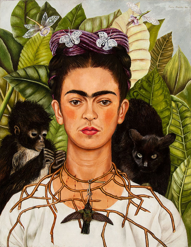
There's a Self-Portrait with Thorn Necklace and Hummingbird by Frida Kahlo. Not very big.
A temporary exhibition of Elizabeth Olds: paintings, silkscreen, lithography. The brushstrokes are coarse. Some are satiric, like this one titled Picasso Study Club and this Sister's Union Demands Shorter Hours for Prayer.
Another temporary exhibition that we spent most of our time is The Clarkson Stanfield Album: many early photographs by the partnership of David Octavius Hill and Robert Adamson. The subjects are often everyday life. There is a long poster on Calotype, an early exposure method. However, it doesn't make me understand it and its advantage over daguerreotype.
Next, checked out a public art installation called The Color Inside in the student activity center. Need to reserve tickets if visit during sunset time.
The campus is very pretty along the flower parterre (University Ave) and the Littlefield Fountain. Quite a few students in graduation gowns. I asked one, was told that they were just taking photos, not graduation yet.
Drove out of the school to visit the troll Malin in Pease Park. Parked on Park Way, and walk down to Shoal Creek. It's just some green space, without the troll, it's not interesting.
Now it's time to settle down for a spot for the evening bat show near Congress Ave Bridge. The trick is finding a parking spot. Maybe because it's a Sunday free parking, every street near Congress Ave was full of cars. Parked on Lee Barton Dr between a condo called "Bridges On the Park" and a small golf course called "Butler Pitch and Putt".
Walked along Colorado River. Very pleasant with good view of Austin downtown on the other side of the water. There are also these root stumps, like alone San Antonia River. We walked up a small hill SE of the bridge, marked as Bat Viewing Site on Google Map. A lot of people, and more and more were arriving. Sunset around 8pm, but no sign of bats until almost 8:30. They came out in waves. Those boat tours shine red lights under the bridge from time to time. The best time to see them is supposed to be August when baby bats were emerging (so double the population). All what roosting here are female. Don't know why.
Checked into the hotel quite late.
4/8, Monday. Total solar eclipse.
There are many "viewing parties" all around the town. Not sure which one to go to, where to park, plus not running into traffic jam when we leave for the airport (which is just right outside of the totality zone). I decided to go to Zilker Botanic Garden. After yesterday's difficulty to finding parking spot, we arrived at the garden right after they openned (10am). Very happy to snatch a parking spot. It turns out that throughout the morning, there were parking available. The eclipse was supposed to be around 1:37pm. That's a lot of time to wait.
The park is very small. Didn't take long to walk all around. There's a small Japanese garden with Koi fish. A so-called prehistoric garden with concrete dinosaur and a butterfly garden with giant plastic butterfly chairs. The rose garden and the main lawn is very nice. Quite a few different kinds of flowers blooming, but not all have tags, so I had to ask the employees in the visitor center with my bad photos. My favorite is this this Asiatic Day Lily, which is everywhere in this garden.
We eventually settled at the flat lawn next to the visitor center. They gave out "eclipse glasses" which is so dark, that you can use it to see full sun at noon. They also sell better eclipse glasses, which is more usable. Clouds moved in, covered the sun from time to time. Everytime the sun shone out of the clouds, people cheered. Slowly the moon moved in, and the sun was like a new moon. Too bad, at 1:37pm, the sun was covered by the clouds. So, couldn't see the corona, or the solar wind, or the 360° sunset. Definately, it cooled down (not as obvious as if it were no cloud cover), and all the birds shut up. Soon, birds started chirping again, and we got up to leave.
It started to drizzle as we drove to the airport. I filled the gas right outside of the airport. But Enterprise charged me 5.5 gallons of gas. They said that the Bluetooth in the gas tank showed only 4.5 gallon, even though I just put 6 gallon into the car! Oh, well. A sour note of an otherwise good trip.
Back in Seattle in rain, of course.
Subscribe to:
Posts (Atom)