3/19. Thursday. Sunny with clouds. Left work at 2:30pm, to meet my friend downtown. Fought traffic for a bit. East of The Dalles, Columbia is calm. Reflection of rolling dry hills covered with new grass. Around the turn of I-84 and hwy-97, there are hundreds of wind mills. At the setting sun, they look somewhat majestic.
 Arrived at Cottonwood state park shortly after 7pm. Set up tents in daylight. Only one other tent here and an RV a bit further. Later, a noisy family (or rather 2) arrived, with their car headlights on all the time, ruined a bit of the shining stars. It's good to introduce young kids to the outdoors, but not sure about taking a baby along, who cried multiple times.
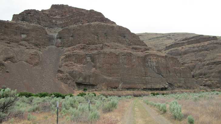
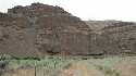
 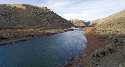 The tent sites are nice, each with a fire ring, a picnic table. Some has a raised platform filled with wood chips. The sites are small here: most of them can fit just one tent. No shade. No trees to separate you from your neighbors. Multiple vault toilets, clean, with antibacterial foam inside the stall and a water spigot outside. In the day use area, the bathroom is much nicer: hot water and paper towel. But some park employee came and locked it up before I had a chance to use it. The area is very pleasant, right by John Day river, however, not viewable from the campsites.
3/20. Friday. Cloudy.  A ranger arrived in early morning, put a trail closure notice on the sign of a trailhead close to our sites. He then carried an herbicide spray on his back and hiked up the trail.
More windmills on hwy 206.

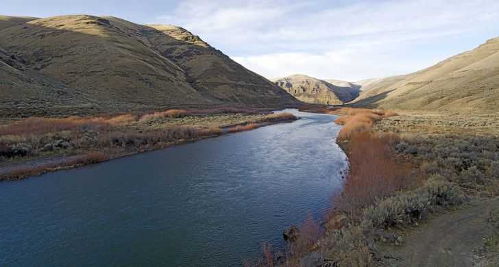
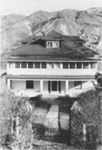 Sheep Rock unit of John Day national monument is 2 hours away. Pretty scenery along the drive following John Day River, tall colorful rocky hills on both sides. Lunch at the historical Cant Ranch. Restored white house (1917), old farming tools, fruit trees (some in flower), and flat lawn.
  Found an old timer pulley for transport across the river. Now it's hanging on a steel cable, with a thick white rope to pull. Thomas Condon Paleontology Museum is quite nice, housing fossils found in neighboring hills. I learned that the blue in some of the rocks is celadonite.
 Prairie City and Strawberry Mountain area looks nice with plenty snow on top. East of Austin, scenery gets boring. First all trees (5000'), then no trees at all, but rock and sage grass. Vale is decent size. Cheap gas. Lots of agricultural land well irrigated. We crossed the timezone at some point.
 Headed to Lake Owyhee state park. 10 miles south of Vale, the scenery gets better and better. We spent some lazy hours at Snively Hot Spring, with 2 more groups of 2 and 3. They live nearby (~20 miles away). They all smoke. But nice. They told stories of inconsiderate bathers in this overused pool. The hot spring mixes with cold river water, so you can adjust where and how warm you want. Scenery is unbeatable. Saw fish jumping in the river! Yes, lots of anglers along this river.
 Continued on Owyhee Lake Rd all the way to the dam and further to the state park along the coast of the lake.
  The large campground seems closed. We camped there anyway. Nice to have no neighbors. All toilets are locked and water spigots have no water. The ground is nice, one blooming cherry tree, young green grass with little pink flowers. Some trees, will provide welcoming shade in summer. A boat launch ramp that stops abruptly high above water. Two tipi sites. Handicap campsites. A picnic table and fire ring for each site. However, the sites are close to each other, with space for at most 2 tents. All on a gentle slope by the water, after a bit of walk. To keep the ground clean, we packed all waste out, instead of using the garbage cans onsite (maybe locked too), and had to walk quite a bit for bio break. Stars were nice, but no reflection in the water. A warm night. The only noise is the boats coming and going once a seldom while.
3/21. Saturday. Woke up in overcast sky. Drove down to the end of the road. Another boat launch (at least reaches water), a fish cleaning station (no water), pit toilet (open). Another campground that seems closed. Still part of the state park. Drove back out and made a brief stop at the hot spring before another car showed up.
 Turned to Hwy-201 (Succor Creek Hwy) which branches a wide gravel Succor Creek Rd towards Succor Creek state park (signed for the state park). On my map (by Travel Oregon), it's marked as secondary highway, which caused me some confusion and a detour to Idaho on Hwy 19.
 It's absolutely beautiful, starts with rolling hills (with some shooters) under open sky, then deeper and deeper canyons.
 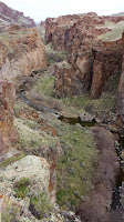 My favorite is a couple of miles near the treed campground. Quite big, under towering red walls, by the creek (with a bridge). Now occupied by a few boy scout groups. A couple of smaller sites north of it. Had an early lunch south of the camp, on a small high plateau with exhilarating views. Now spring is here, everything has a green hue. As you drive south, canyon gets shallower, and eventually you're back on a plateau. Still pretty, especially now with spring grass.

 We turned west towards Leslie Gulch. Similar road condition. Wide enough. Flat open space, until you enter Leslie Gulch recreation area. Hiked the short Juniper Gulch. Kind of fun. This apparently is the most popular hike in 13 miles. About 10 cars parked at the trailhead. Another trailhead that has any use is the upper Leslie Gulch: 2 cars. I read somewhere this is more for climbing. At the end of the 13 mile gravel road (not any worse than the ill-labeled hwy) is Owyhee River/Lake. A boat launch. Water is rather shallow, but wide, some birds. Birds chirping. Leslie Gulch is designated camping only. One campground (Slocum Creek CG) close to the road end. Looks alright. Small. Each site has a picnic table with its own roof. No trees.
 Continued south on Succer Creek rd, not as pretty as before. Farm land. Got on hwy 95, skirting Snake River for a short while. At Jordan Valley, filled gas at the only station. Price is surprisingly normal, even a bit cheaper than where I live. The clouds have gone by now. Temperature rose to mid 60s. On the way west to Rome, saw a sign for the burial site of Jean Baptiste Charbonneau, Sacagawea's son. Visited the signed Pillar of Rome, 3 miles north of Rome. Nothing special. Rome is the launch spot for commercial rafting in Owyhee Canyon. But here, no hint of a canyon. Very flat.
 Continued west to Malheur wildlife refuge. Back to Pacific timezone. Boring drive. The refuge is closed on weekends! Thankfully, the restroom is open, running water and fat toilet seats (still the same size paper seat, now ill fit). 3 brochures of trail, hunting, and fishing each, outside of the visitor center. A few nice brick houses. No sign of residents, I only saw warnings of "residents only, no public" everywhere. Lake is far (this year water level is low all across the west coast).
  Not many birds even around 6pm (sun is to set in an hour). Saw 2 other cars with bird lovers. Drove the gravel "auto route" loop, boring. Road is a bit rough. Passed the Field Station, where you can rent a cabin, or as a group, take the hostel. It looks like a dump station. Lots of cheap looking structures. West of the refuge is paved. Drove north to the narrow. The bridge now sits on clay-like bottom. No water, no bird. Quite a disappointment, as this was my main destination for this trip: Malheur is the biggest birding area in western US, now in spring migration season. We did see a flock of probably 50 sandhill cranes flying SOUTH on the way here. They were too high for me to see clearly what they are.


 Now headed to Harney Lake hot spring promised by my old book. Access is an 8.5 miles deeply rutted clay-like road. But we found the spot. However the owner has gated the access road. You can see steam off the few little channels outside of the fence. We parked by the gate. Carried our gears inside. A pool dug to thigh high. Very muddy though, with slippery algae covered all sides. Nice and warm to sit in. A remnant of a recent campfire nearby. Be careful where you lay your tent: pick out broken twigs, as they are very prickly, can easily puncture your air pad. By now, the sky is clear, waxing moon on the horizon. As the moon sets, stars become more brilliant. Had beer and snacks under the diamond studded sky. Cannot be better. The main channel is too hot to stand in for long. Slightly cleaner, as the water moves somewhat faster, we used that to rince off. Still very muddy bottom. A cold night: my water bottle had icicles the next morning.
3/22 Sunday. More clouds. Worried about the access road if it rains, we packed up and left without making breakfast.
 Drove south towards Frenchglen. Buena Vista is an aptly named viewpoint in Malheur refuge: marshy ponds, extended views. Again, not many birds.

 Diamond Crater is just east of here. Lots of "bumps" in the earth with broken crusts. Pete French, one of, or the very first cattle rancher in the region, had an operation here, just north of the crater zone.
 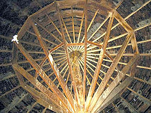 His round barn is all log and wood plank, national registered. Quite nice and solid. The visitor center is in a separate side road. At our request of where's the next gas station, the lone gentlemen kindly called Frenchglen's hotel inquiring its cafe owner, twice. The answer is it's not yet open. So we drove 20 miles north to Crane to fill gas. That wasted at least 1 gallon and 45 min. Frenchglen seems bigger, nicer looking. Most is closed. But seems that the hotel, its restaurant and the gas station are all open!
 A wide and well graded gravel road leads to Hart Mountain Antelope Refuge. Open sagebrush prairie. Saw 1 pronghorn on the way in the 40 mile drive to the refuge headquarter. It's a random collection of stone houses and shabby looking timber construction. Lots of building equipment and vehicles everywhere. The visitor center is one room of a stone house, which is, unbelievably open 24/7. A washroom, brochures of neighboring parks, pictures of animals frequent here, practical information of next services/town and how far they are.
  4 miles scenic drive south of the HQ is the Hot Springs campground. Stone wall for privacy, bench, a small rectangular pool. One van was parked there when we arrived, but no one was in the pool. She left after being woken up by our conversation. We didn't stay long. Packed to leave when a dog showed up. His owners kindly waited till we left. The setting is picturesque. However you don't see it from inside the stone wall. The water temperature is a tad too low for me. I got cold as soon as I'm out of the water. We then checked out some campsites. Quite spacious, in an aspen grove. There are about 25 sites. Not sure if it ever is full. We missed an undeveloped pool. Well, have to come again, maybe in the fall, when aspen turns yellow.
 As you drive down from the Hart Mountain, you can see the 5-6 large seasonal lakes in the Warner Valley, now without water, just mud and grass. We drove across Flagstaff Lake, yes, on a bridge, over flat clay bottom. Hours of driving in never changing landscape, makes you appreciate how vast this country/state is.

 Hwy 395 passes below Abert Rim, skirting the immense Lake Albert. This largest (and one of the highest) fault scalp in US is quite impressive. I stared at the rim wall for any moving dot, hoping to see big horn sheep, which frequent there.
Now heading home. Around Summer Lake, saw a flock of about 50 Sandhill Cranes. Filled gas in Silver Lake.
Soon after, the rain started in earnest: announcing the farewell of the desert. We settled for the night in a cabin at La Pine state park, as I dislike tenting in the rain. A hot shower is also much appreciated. The facilities here are clean, but you need to bring everything yourself. I forgot my towel there :(
 3/23. Monday. Snowed overnight. Makes everything prettier. A late start + a big accident as we approached Bend made today very long. Due to winter closures of various roads, I opted to see McKenzie River and continue our theme of hot springs. Sun in Bend, rain in the Cascades. Sahalie Falls is rushing in the rain. 10 minutes later at Koosah Falls, a rainbow shone across the water.
  Hiked the 4 mile RT to Tamolitch Pool from Trail Bridge in drizzle. The pool is as blue as I hoped. Quite lovely. The trail is very muddy. Often you have to hop on lava rocks to avoid puddles. Quite a few hikers on this rainy Monday. A father of one group was very friendly. He told me of a warm Scout Lake, which I shall check out in the future.
 Bigelow Hot Spring is right off hwy-126, off Deer Creek road. A girl was its only user. Didn't want to barge in, I only tested the water temperature. A bit low. Maybe where she sat it was warmer. Nice riverside setting, with rocks and ferns as decoration.
 Terwilliger Hot Spring west of Cougar Reservoir, on the other hand, is crowded, especially now in spring break. It's only 1 hour from Eugene, lists on regular maps. The very top pool is closed (for awhile). The top most available pool is piled with people, half nude. I managed to get into the 2nd pool. I had to immerse myself in the water, otherwise I'd be cold. Don't know how someone can stay in the lower pools. More people tried to squeeze into the 2nd pool, so we left. Beautiful hillside setting. 2 openwall huts to change clothes (not a restroom). This is on a short hike, 1/4 mile? The trailhead has a big parking lot, 2 vault toilets, a tall waterfall and a guy charging you $6. Day use only.
Summary: 4.5 days is too short, 2 days are just to and from, as the space is immense. We drove about 1400 miles. In the future, I'd like to try
- Owyhee
- Steens
- hike Steens mountain in fall for aspen color
- check out Alvord Desert area east of Steens, and check out Mickey hot spring and the two in Borax Lake