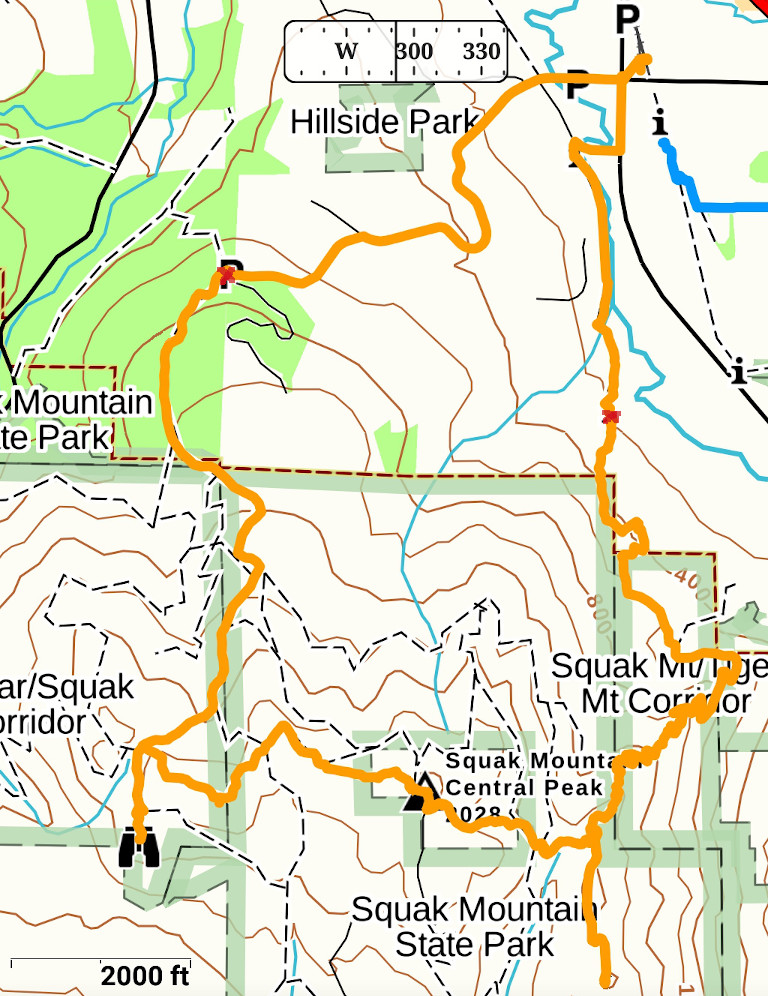
 4/18, Saturday, a bit rainy in the morning. I headed out after lunch to Issaquach again. This time, trying Squak Mt, which is crossing the street from West Tiger (where I went last weekend). More road walk. I did this loop from the town center, about 9.7 miles, 2800' EG according to Gaia (1/3 is walking on road, 1/3 is old logging road -- so very gentle grade). Very boring. No wonder I never came here before.
  Well placed trail signs of different ages. However, so many little trails, it's good to have a trail map in hand. Met total 17 people (including 4 toddlers), maybe due to the weather. The trails are open, with signs reminding you of practicing social distancing.
 I started from the west parking lot on Mountainside Dr. SW, about 7-8 cars. Went to Debbie's View first. It's a small opening, one bench, with limited view to the west.
 Next, West Peak. A wooden frame on ground suggesting an older house. A small sign on a tree says "West Peak". It's flat here, and without this sign, I would not know where exactly the peak was. No view at all.
 On the way to Central Peak, the steepest terrain of this loop, but not very steep. There's this nice looking stone structure, looks like an old fireplace. A picnic table, some flat cleared ground.
 Central Peak is fenced with 4 cell towers. A dilapidated hut on the other side of the parking lot. No view at all.
 SE Peak is not marked. A boot track, a bit overgrown. My pant legs got quite wet going through the plants. My legs got a bit of rash. This is even more boring. The trees are thinner here. Even though there's no view, there's some promise of view beyond trees.
I came down to Sunrise Place SW. No trail sign here. The south half of the Squak Mountain Access Trail was closed. The northern half is open, and quite nice, going along Issaquach Creek.
I waited ~20 minutes for my bus back to Seattle.