 Dad is in town. We headed to southern Oregon for a sightseeing road trip during the Memorial Day long weekend.
5/25, Friday. After dinner, we drove out to Prineville for the night. No traffic getting out of Portland, but some slow semi on the road. Arrived around 10:40pm.
 5/26, Saturday. I signed up a wild flower hike at Chimney Rock with Friends and Neighbors of Deschutes Canyon at 10am. Before getting to the trailhead, we first stopped at Ochoco Overlook outside of Prineville.
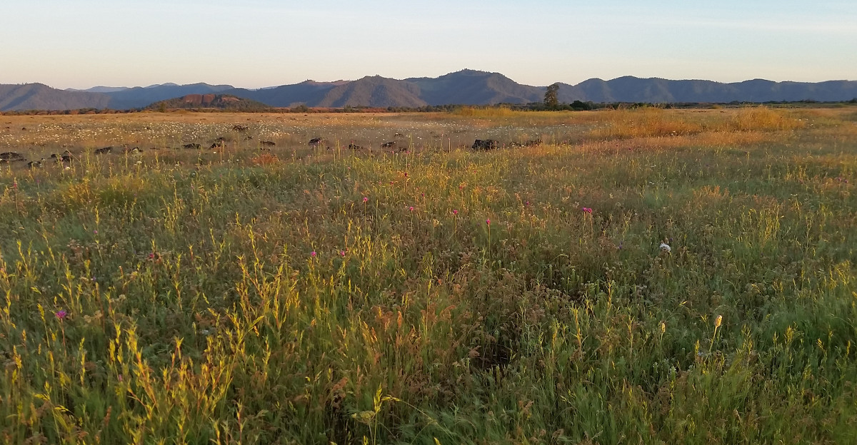
 Crooked River highway is quite scenic, along the winding river with steep canyon walls, until the Prineville Reservoir. Saw quite a few anglers in the river and by the dam. Many campgrounds.
Today's guide is Marilynne Keyser (mtkeyser@gmail.com). She's very knowledgeable and enthusiastic. Super fit. I couldn't guess that she's in her 70s. About 10 of us, all women, except dad. Flowers that are unfamiliar to me but common in the desert region: Showy Townsendia, Threadleaf Fleabane, Threadleaf Phacilia, Rock Buckwheat, Wooly Groundsel, Desert Gooseberry, Wax Currant, Purple Sage, Mountain Death Camas, Cutleave Penstemon, Hopsage, Brittle Fern, Needle and Thread grass.


 A mile or so and 500' later, the trail reaches a plateau, with many Lewisia Rediviva blooming on unlikely rocks. Here's a sample of different shade and shape. This is my new favorite flower ever since I saw them last May. A bench overlooking Crooked River and 3 Sisters in the far distance. We had lunch. Dad stayed here. The rest of us walked over to the Chimney Rock.


 Heading south now, towards Bend, saw many cyclist. Here's one taking a drink looking at the 3 Sisters. Later, we drove by a group of vultures feasting on a recently killed deer. The birds flew up to the trees when we stopped. I waited, but they wouldn't come down until I leave.
  Hole in the Ground is in the middle of nowhere. A volcanic crater. Do NOT follow Google's navigation! Repeat after me: do NOT follow Google! It routed me to some really sandy jeep tracks. Wasted time and serious risk of being stuck there. Follow the signs, on a wide decent gravel road. Saw a group of bikers camping at the rim. No water anywhere. Plenty shade.
 Fort Rock is a volcanic tuff ring with portion collapsed long ago. Quite spectacular. You can see it miles away, but have to drive around private lands to get here. No shade. Scramble or walk in the basin.
Stayed in Eagle Point for the night. We arrived around 9:30pm.

 5/27, Sunday. Dad refused to go hiking with any elevation gain. So I decided to do a sunrise hike before having breakfast together. I headed to Lower Table Rock. At 5:09am, I was already on the "table" at the short boardwalk. Walking leisurely to the end of the "table", and taking photos. It's too late for flowers. I found this pnwflowers website an excellent resource for id-ing flowers. Now, mostly white (White Navarretia) and yellow (Fitch's Tarweed. Some Clackia, and Crown Brodiaea.


 Breakfast at 8. All homemade by the Airbnb host, who used to be an extreme skier, now a carpenter. The wife trains dogs.
 Drove south to Mt Ashland - Siskiyou Peak Botanical Special Interest Area -- almost at California border. Too early for flowers. A nice campground behind the ski area, with picnic tables and volt toilet. Saw 3 groups camping here. Superb view of Shasta and Siskiyou Peak. The gravel road gets a bit rough and very narrow past the campground.
 City of Ashland looks lively and pretty. A good tourist destination. Ashland is know for its Oregon Shakespeare Festival every year from Feb to end of Oct, often running 3 performances everyday. The 2 ladies (probably in their 80's) at the visitor center were very friendly.
  The best of the city is Lithia Park, which is in the middle of the city. Its narrow and long shape allowed many access points by the citizens. Ashland Creek runs along. A nice pond with ducks, a climbing wall in front of a big bathroom, kids playgrounds, lots of shade and flowers. Trails connect to outside of the city.
 Lunch at Hearsay Restaurant's outdoor patio. No one dines inside today. Good flavor and service, but on the salty and pricy side. Southern flavors.
Had to drive back to last night's Airbnb, because I forgot a shirt there. On the way back, saw some wild turkeys in a grape field.

 Stopped at Central Point for Lillie Bell chocolatier, Rogue Creamery and Ledger David Cellar. Bought some pistachio chocolate, a slice of stout cheese, and sat down for wine tasting ($5/pp) on the porch of Ledger David under umbrellas. Very hot, and no shade.
Took the Applegate Valley wine route to Grants Pass for the night. A nice and scenic drive. We didn't stop at any winery. Dad wouldn't let me drink any more alcohol. This makes an easy day. Sat on the balcony of our Airbnb for dinner, watching the sun go down.
 5/28, Sunday. I was unable to find Limpy Botanical Trail. At wherever marked on Google Map as this trail, it was just woods, no parking, and before and after are people's driveways with "no trespassing" signs. Went to a trail in the area, called Waters Creek trail.
 Not interesting. First 1/4 miles along a little scream, then, cross the road into a nice meadow, then again into the woods next to a clogged scream. We didn't walk very far. Dad found the only Siskiyou Iris we encountered this weekend.
 Driving towards home. Stopped at the little town of Mrytle Creek for a bathroom break. The bridge over South Umpqua River looks quite nice. A large parking lot, and a boot track going down to the river. Saw some guy camping there (homeless?). Didn't see any myrtle.
 From Roseburg we detoured along South Umpqua River, and back to I-5 via North Umpqua River.
  Lunch at the Colliding Rivers viewpoint, next to hwy 138, in Glide. Benches above the colliding waters. Had lunch here. A visitor center and ranger station. I talked to the elderly gentleman in the visitor center and he suggested Susan Creek Falls for an easy hike. So there we went.
 North Umpqua River is very scenic.
 Stopped by the beautiful Tioga Bridge, new as in 2012, replacing Youngs Bay bridge that was washed away in 1964. The other side of the bridge connects to North Umpqua trail.
 Susan Creek Falls trailhead is only half a mile farther. I parked across the road on the south side next to the campground, because the parking at the TH was full. That turned out to be great, because my car stayed in the shade. I pointed out to dad a wheelchair person who was rolling out. This has to be easy enough! Quite a lot of people on the trail, and we were not the slowest!
 Coming back to I-5 along North Umpqua River, through pasture land. My goat is Marys Peak, where I visited 3 years ago at about the same time. However, no iris at all this time. At the large parking lot, there's a green slope you can hike up, or take the road (gate closed) for less than 0.5 miles. The slope has many yellow and purple violets, fawn lily (maybe the Coastal Range Fawnlily, I saw both cream and pink flowers).
  Dad got tired walking up the slope, so he missed the main flowers show south of the towers.
  If you walk the road up past the fenced towers and a lone picnic table, you'll see flowers lying beneath. View is excellent here. 360° A bit hazy to identify distant mountains or the ocean. There's a campground here (probably no water).
2.5 hours later, we got home. Total driven about 1100 miles.