10/1, Saturday. Met with both NP and her climbing friend BR at Green Lake at 7am. BR drove.
We decided to head to Mt. Baker area, hoping that the massive mountain would block some smoke.
 Yellow Aster Butte
 TH. It was so busy, we almost gave up on finding a parking spot and leave altogether.
None of us is a fan of crowd. Luckily, on the way down, we found a large enough pull-out to park the car.
It was busy for a good reason. The fall color is always amazing here, and it didn't disappoint today, and we could see it from the road.

There's no trailhead parking. From the shaded trailhead, you get on a sun-drenched slope very soon, zig-zagging through fall leaves.
~1.4 miles in, reach a short boardwalk, where a nice patch with plump (rare treat this year) huckleberries.
I waited here for NP and BR. BR is very slow going up hill.
No one seems to go right at the junction to Tomyhoi Lake (at ~1.7 mile).
At the next junction, ~3.6 miles, I waited here again for long enough to take off my boots and socks.
My waterproof boots are too hot for this weekend.
Going down is to the basin with quite a number of tents. Not as bad as Gothic Basin, but getting there.
We filled water here, and took a lunch break. Elevation ~5600'.

Crossed the basin, continued on almost due north, following a trail.
First up a fairly steep hill to reach a plateau.
A small tarn at the end of a small snow patch, at just shy of 6400'.
I put some snow in my water bottle. Saw a dog pee-ing in the water, while the owners stoodby chatting. Unbelievable!
There was a tent in the area already, so we continued up, and settling not far up on this plateau.
Better view here. Copper Lake fire was spewing in distance. (This photo is BR's.)
Quickly I set up my tents, and headed out to Tomyhoi Peak alone, shortly after 3:30.
I was afrait if we tried tomorrow together, based on the progress today, they may not make it.
I left my ice-axe at the tent, because on the way up here, from talking to those coming down, we learned that the glacier can be entirely avoided. Just in case, I took micro-spikes along.

It took me ~1 hour to get to the snow/ice.
It was straightforward with clear trail to follow, up to this point.
Quite some ups and downs though. This ridge is after a somewhat steep drop of 200', and then up.

On the way, one Indian guy was very kind showing me his photos on the route he found.
He said it took him 45 minutes to find a good route.
First stetch of snow, I squeeze between the moat and rocks, then on to some snow, both very short. See the bottom left of this photo to the right in portrait.


Then I saw a blacked foot track on snow further, recognized what the Indian guy told me. So I went down towards it.
See this photo I took the next morning, and our track.
However, I couldn't figure out which "flat slab" he mentioned, let alone how to get there.
I tried 2 gullies (the left 2 red track on the left photo).
The first I tried (the middle red line) had a little bit overhang. I didn't try harder, and went to the 2nd gully (the left red line).
I made it up, but it felt sketchy to me to come down there.
In the end, I return along the right red line I drew on the photo.
This matches the description of the Indian guy's "flat slab".

Once I reached the ridge, a little to the right, I saw a cairn, and a trail!
It's more or less flat for a while skirting to the left side of the rocky spine.
Met 2 climbers on their way back, and inquired the condition.
They told me that the cairn is where I need to go down, and going further, more up and downs, but mostly with good hand-holds.
From then on, I was the only person on the mountain.
I reached the summit shortly before 5:40pm.
The view is fabulous, but unfortunately hazy to the north.
Took a few photos, and headed down just before 5:50pm, because I need to be back to safety before sunset.

On the way down, I took a sharp turn at the cairn. There is a gentle ramp, more fitting for the Indian guy's description.
From there, it was a bit slippery to get down to the blackened snow.
I put on spikes, as I was afraid of that it may become icy as temperature dropped.
Also, this short stretch is a little steeper, even though I walked in (slowly) just in boots.
The sun set on my way out. All was very pretty in the glowing low light.
Saw a group of folks admiring the sun and they asked if I made to the summit. "yes!"
There is a small shallow pond at the bottom of a snow patch. I cleaned up a bit there before continued to the camp.
I reached ~7:15pm, already pretty dark.
My teammates had fetched more water for me to cook dinner.
We discussed the route, and I promised to be the "guide" if the condition is good tomorrow.
~11pm, I was up for a bio-break. It was very smokey. I was glad that I climbed today.

 10/2, Sunday
. The smoke was gone. No wind at all. NP asked us to be ready at 6:30. BR was slow, and we left shortly before 7a.
Sun rose as we went higher. Very beautiful. We were the only people on the mountain.
Today, it was hazy to the east, more clear to the north.
Huckleberry leaves were shining.

We took my return route up and down. They stowed their packs and hiking poles at the end of the black snow.
NP had a bit trouble with the loose slab (difficult) and the short knife edge on the rocky spine, which didn't occur to me to be difficult. Exposure, yes, but solid.

We made to the summit just before 9:30am. Lingered here for half an hour, no rush.
On the way back, met one guy solo on the top ridge.
He came up from a different gully.
I took this photo, circle the guy on the climb.
Yes, from this ridge, you drop down equally steeply, and then climb up steeply.
Looks scary, but feels okay. Good hand holds.
When we were back to the safety, saw a couple trying to scramble up.
Then a large group of ~20, none had helmet.
Someone recognized my voice, it turns out to be ZY from my last Enchantment scramble.
I chatted with her and detailed the route we took.
Back at camp, BR was again very slow in packing.
We hiked down a little after 1pm.
Waited at the trail junction long enough so I can air my boots and socks.
We stashed our packs here, and headed to Yellow Ester Butte.

I cannot believe that I never walked along this ridge before.
Yes, need to drop down from Peak 6178 (which I usually turned around, as many others).
The trail continued all the way to the rocky peak at the end of this ridge, a little bit of scramble at the end.
View of Tomyhoi to the left, and Larabee and American Border Peak to the right.
Took this photo on my way back.

Good color on the slope to Peak 6178.
Stopped for ~10 minutes to pick huckleberries at the patch by the boardwalk.
Smooth sailing driving back.
 The trail starts narrow and overgrown. Soon, it goes up on steep forested slope. Faint, at times.
We overtook one couple.
~1 mile later, at ~4600', a large cairn (we didn't understand its existance until our way down).
Here, snow started in earnest, as the grade eases.
Met one guy coming down. Inquired about snow conditions, as his pant legs were wet at the bottom.
Reached Lake Lillian ~10:50.
 It wasn't clear how to get around the cliff to the right (east) of the lake.
The trail on my GPS map is by the shore.
We followed some snowshoe track up the hill, getting to a bit too steep for the powdery slope.
Bushwacked down through trees and snow (knee deep sometimes) to find the trail by the shore.
I had to stop to shake off snow from my boots. Forgot to bring gaiters.
On the way back, we were able to more of less get over the rock more easily.
Looking back, great view of Rainier beyond the blue pool.
Put on micro-spikes, just in case.
 Getting out of the lake basin is also steep.
But more rocks below the snow on this stretch.
Digging my hands into the fluffy snow doesn't offer more traction, except for some stability.
My gloves were so wet, that I had to sqeeze water out of them multiple times.
Once over the ridge, it's a winter wonderland.
Many small, frosen tarns. Still blue Rampart Lakes, Rachel Lake.
Met one young guy in snowshoe going out. Better prepared than us.
 Decided not to go to Rampart Ridge itself, as I don't see tracks going there.
I don't want to sink more into the snow than necessary. My boots were already squishy wet.
We followed some snowshoe track (we sank more, but not too bad) to a butte in the middle at about 5600'.
Great 360° view here.
Not cold, not much wind. It was getting more cloudy.


 10/14, Friday. 8pm.
Seattle Symphony's first pop concert this season.
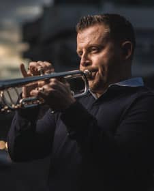
 Costa Rican trumpeter
  I highly recommend


