 I was picked up by I-5 exit ~7:10am. After a coffee stop in Arlington. We arrived at the end of FSR 1890 (further than the road end on Google map or CalTopo) before this bridge. There were 5 other cars, and they were just gearing up. What prompted me to hike this today is T's group would be ahead of us.
We started shortly before 9am, ~2000'. The car showed 22°F, but it didn't feel very cold, maybe because there was no wind at all. V left his crampons and helmet in the car. Walked over the slippery bridge (wood surface with frosty leaves), followed the road to a pink ribbon. There, we headed uphill to the right. The slope was easy at first (more fallen logs), but got progressively steeper. At one resting spot behind a tree, V shortened his poles, and promptly lost the bottom section of one pole. We spent some time looking for it, but gave up. The slope eased around 2900', but got very steep ~3000-3200. I had to use hands to pull myself up a few times. All along, no trail. In the forest, we couldn't see the tracks of people ahead of us.

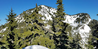
 Finally at around 3400', on the (not well defined) eastern ridge towards Higgins, we hit snow. Crusty, patchy, soon it was solid. We put on micro-spikes. The slope isn't steep here. All the while in the woods, with glimpse of broken views through the trees. ~4300', we reached a "top", a flat ridge out of the trees. Here you can see the Round Mountain ahead (north), and Higgins to your left (west). Also, we caught up T's group as they were going down, one at a time, slowly.
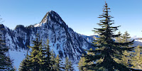
 Here, a very steep but short section of down climb. We took a long snack break here waiting for T's group to finish. Then, used ice-axe to down climb, also one at a time. The snow is good for holding my feet. Now, in the woods again. Losing a bit of elevation before slowly going up again. All along, an obvious and narrow ridge. Before the slope gets steep, I stashed snowshoes and one pole by a tree, stashed the other pole in my pack. I changed into crampons. The rest looks too steep for me to use snowshoes. Besides, we were not post-holing much. On snow, we could easily follow the footprints of T's group. The climb is quite steep, but the snow wasn't too hard. At ~1/3 way up, in front of a steep rock (right below where this photo was taken), we met a lady sitting by some trees. She quit and was waiting for her group. V decided to wait with her. He wasn't comfortable going up in micro-spikes. The view here to the south is already great.
 I followed the footprints, detoured around the rock. Yes, a bit tricky, because both sides were steep drops, but not too bad. I didn't feel any real danger, because the snow was solid enough to hold my feet. Of course, ice-axe helps. The slope gets easier the top 1/3. The very top (~5320') is befitting the name: round. ~1:20pm. I was surprised to see about 10 people there. Another group took a different route, not sure from where. I walked around the flat summit, didn't see any footprints going down anywhere expect for where I walked up. The 360°view is splendid. I can see Rainier to the south, Olympic mountains to the west. Baker to the north, North Cascades to the east. However, all the peaks are a bit far. I chatted with T for a bit. The lady down below is his wife. He is against carpool due to Covid-19, emphasizing double mask and keeping distance. Most of his group didnt use crampons. The other group, seems all on crampons. After everyone left, I had the summit to myself. It was lovely. Very little wind.
Didn't stay long. ~1:50pm, retraced my steps down to where V was waiting. Poor guy was bundled up. Despite of the sun, it was still below freezing. I retrieved my snowshoes, packed up crampons and ice-axe, put on micro-pikes and both poles. V kept his ice axe. Going down, every slope looks steeper! In the upper forest section belong the ridge (moss and lichen on the ground), V slipped, was slowed down by his ice-axe! It was difficult, slow going. You don't want to fall here. Many trigs can punch a hole in your body. This, I consider to be the most difficult of today's climb. From time to time, we consulted the GPS map to adjust our direction. Finally we were back by the pink ribbon. It was 5pm, getting dark. Right on the bridge, V slipped again and "thomp" fell hard on his butt. Thankfully, nothing was broken.
I was dropped off at an I-5 exit. Got home shortly after 7pm. This, might be my first end-to-end off-trail hike. Total maybe 6 miles, 3400' EG. Took 8 hours!