
 Soon after entering Alaska, it started to rain, lightly. A few abandoned cabins along the road. Stopped at Tetlin NWR's visitor center - already closed. Nice building with a very large deck outfitted with two scopes. I took the binocular out, didn't see anything interesting. It was getting dark. Camped at Deadman Lake, one of the two campgrounds in Tetlin NWR.
 Day 10, 9/21, Saturday. 8°C at 8am. Rain had stopped. Overcast. Cooked coffee, breakfast on my picnic table. There's a shelter with screen doors and windows (probably very buggy in summer), and tables for games (not for food). Picnic tables outside. Ranger led tours usually starts here. But not today. 5 cars/RV. There was a camp host. Campsites are spaced by trees. Quite nice. The lake is unimpressive. There's a boat launch (with safety vests), and a couple of viewing deck, and a short boardwalk with interpretive displays.
I stopped by Lake View Campground just to check it out. Also about 4-5 campers. It's very small, campsites are crowded around the day-use / boat launch area. No privacy. The lake is similar, non-descriptive. Closer to the main road.
 No more big mountains. Lots of black spruces and ponds. A bald eagle flew over my car west of Tanana River bridge. After crossing the river, maybe one hour from Lake View, there's this LORAN towel by a lumber yard.
 Filled gas at Tok $3.2/G. Visitor center and the library were closed when I was there. Used the washroom at a large gift store across the street. It has fantastic heads and pelts. A stuffed moose stands in front of the store in its own glass house.
 Hitting the same construction crew 9 days earlier: pilot car east of Chistachina River bridge. Now that I wasn't in a hurry in this drizzle, I stopped at Matanuska Glacier State Recreation Site to stretch my legs.
Checked into a motel at Palmer ~4pm. Stayed indoor for the rest of the night. Rain didn't stop until dark. I spent quite some time researching which hikes to go tomorrow morning before the airport. Checked in my return flight.
Day 11, 9/22, Sunday. Sunny.
The drive to Hatcher Pass is very scenic. I stopped at the large parking lot of Independence Mine, and bought a parking permit. There's a machine that takes credit card. Excellent view here. Saw a couple walking with their dog in this freezing temperature. They probably stayed in the cabin next to the parking lot.

 I drove to the actual pass, now in the shade, freezing. The road after the mine is gravel, but in good shape, wide enough to allow two way traffic.
 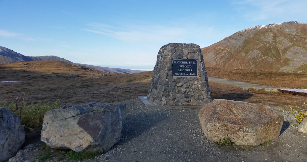 This photo of the pass was taken after the hike, when there was more light.
 Hike the short (2.4 mile RT, 856' EG) April Bowl trail to the summit. Didn't even see the small Summit Lake until I was half way up the ridge. The first half mile goes up on towards the ridge, then it's a glorious walk with views extends to all side. Can see 4 tarns. Frosty ground.
  Close to the top of the mountain, the view is incredible. Countless peaks. Everywhere I looked, there is a glaciated mountain. I lingered here for a long time, waiting for the sun to reach the tarns. But gave up due to my timing constraint.
 I was debating whether to spend the next hour or two checking out Independence Mine or another hike. Opted for a hike given such good weather. Took Fishhook Trail (2.7 mile RT, 1955' EG), which is about 1000' lower than the pass. This means that I have to gain an extra 1000', and I did. Being lower in elevation, better fall color, and still some huckleberry left.
  Frost on ground in the shade. I didn't finish hiking up Marmot Mt, just went along the ridge for ~10-15 minutes, and turned around ~noon (11am Alaska time), since I have a 3pm plane to catch.
 Driving back to Anchorage didn't need to go through Palmer, which avoided the construction traffic. Only took an hour, faster than I thought. The scenery on the highway is outstanding, especially around Knik Arm, now in full autumn glory. Filled gas in town. $2.71/G. I arrived at ANC 2 hours ahead of departure, earlier than I'm used to. My flight was fully booked, otherwise, all smooth. I was able to take the tent as carry-on luggage.