
 Day 1, Thursday. Warm, hazy. It would be 91°F in Banff (a record in Alberta). After a leisured morning and a pharmacy stop for some blister kit in town, we arrived at Sunshine Village ski area. Bought a bus + lift ticket (T-Th only, CA$35 RT day-only). Hopped on the yellow school bus at 11am (every half an hour starting at 9). At Sunshine Lodge, took Standish Chairlift. At the terminus, a big sign says "WiFi". No, I didn't try that. I sat and ate a peanut butter + honey sandwich I made last night, it was already noon. Threw the sandwich bag in a trash can. After this, I'll have to pack all garbage out.
 An employee was at the viewing deck answering questions. She showed us what we'd see on a clear day. You can compare the photo I took and the photo I downloaded from Sunshine Village's website. A pity!
Download a trail map, or ask for one at the lodge.

 I didn't ask for a map, since I didn't want to carry it for 5 days. Trails are well signed. We walked down the stairs to the this sign (Rock Isle Junction). Left continues a loop to Sunshine Lodge along Rock Isle Lake, as well as into the core of Assiniboine. Right goes to the 3 lakes. Vinit headed left.


 I turned right to see the lakes, since it's too early to go to the camp, despite of the weather. I should've left my pack here. Instead I carried it with me, hoping there'd be a shortcut somewhere. All 3 lakes are quite nice, flowers lined some paths, lots of larch, bench here and there. Quite a few people doing this lollipop loop. However the enjoyment was diminished by the heat and smoke.
 The trail to the core area starts at this totally faded sign: 29Km. I had to turn up contrast of the sign in the photo so you can see. 2:15pm now.It goes through 2 very big meadows, full of strawberry plants, but I only found 1 berry. Then up some hills before dropping down to Howard Douglas Lake in about 5Km.
 The Lake is prettier than I thought. Shallow, little fish jumping, lots of bugs (common problem throughout the trail). 5 camp sites are in the trees next to the lake. Some has more privacy than others. The creek doesn't have enough flow to fetch water. A bear wire, table for eating and an outhouse. All taken today. I have reserved for 2 tent pads. A Dutch couple hiked in from Sunshine parking, a family of 3 who hiked in from the south, an elderly gentleman staying here for 2 nights. He and the mother of the family both highly recommended Skyline Trail. Everyone is more fit than the 2 of us. Not much of a sunset. I fell asleep before it got dark. Some stars at night. I could see from my tent, as I didn't bother to put up the rain fly. A warm night. I'm glad that I brought my thinner sleeping bag (Phantom 45).
My phone registered 22797 steps today.
 Day 2, Friday. 10 miles today to Og Lake. I woke up around 6:25, already light out. The lake is quite lovely at this hour. Had to wake up Vinit. Started out later than I should at 8am. Today would be hotter (94°F in Banff, another record high). Citadel Pass is next. Quite gentle, much easier than I thought. There's a lake just north of the pass. We reached Citadel Pass (2360m) around 9:09. There's a side trail to Fatigue Pass (2.7Km). There's a map posted here (but only from here to the north). We are now 9Km from Sunshine, 12.5Km still to Og.
 Then the trail goes down, first mile is gentle and scenic, the it got a bit steep until the junction to Porcupine Meadow camp (1Km further down) at ~10:20am. We took the high route (9.5Km to Og Lake). Quite scenic the first mile. Then in the woods, up and more downs until rejoining the low trail from Porcupine. It was now 12:00, still 5.5Km to Og. Had lunch near the junction, sitting on logs. A 30 min break. It was getting hotter, and we were low on water. The worst is still ahead: Valley of the rocks. Hot, dry, no shade. The rocks were radiating heat. My umbrella really helped. We walked through it 1:30 to 3:30pm, very slow. I had to wait for Vinit to catch up many times. It's the toughest hike he has done, with the weight and heat. The smokey air was also a killer. I was carrying more than I need: 2 sets of cooking gear, since he planned to hike out 1 day ahead of me. It was taxing. I didn't bother to take any photos here. We met the Dutch couple twice. They set up camp at Porcupine (free, reservation not required), and day hiked to Og.
 Finally we saw the big shiny lake. By then, we had run out of water. Before pitching the tent, we headed down the rocky slope to the lake. Filtered water, snacked. The water is cold. Again I wasn't able to fully immense in the water. Vinit swam to the little island. There's a food storage bin here, and a gray water disposal hole. There was only one tent when we arrived. They were here last night. More people arrived later, all coming directly from Sunshine Meadow. Some continued on after refill. I'm only able to book one tent pad here and in Magog. The tent pads are made of gravel. Only short bushes.
  Open, with view of the lake and Mt Assiniboine ahead. Not much space to pitch a tent other than in the pads. Had dinner with Wilma from Victoria. She and her group of friends (5 women in their 60s) do a week long hike every year. She suggested the Island of Nootka, West Coast Trail (in May before the permit season). After dinner, I waited until 8pm, there were still 3 pads unclaimed (out of 10). So I took one. Again I didn't put up my rain fly, because it was too warm. Again I fell asleep before it got dark, maybe 10pm. Around 3:30am, my bladder woke me up. No stars tonight. I laid there debating if I should get up, felt a drop on my face, then another. Put on my rain fly quickly. Now the tent became too warm. Minor gust of wind. The toilet door was blown open. Temperature didn't drop :(
My phone registered 32549 steps today.
Day 3, Saturday. Tent was dry, but covered with ash. The little rain last night didn't help clearing the sky. We hiked out around 9am in a warm haze. Met a group of camper going out to Sunshine all the away. I guess we'll have no problem finding a site early.
 The trail from Og to Assiniboine Lodge is flat and pleasant, with faint views of mountains ahead. Very pretty. Only 5Km. A bit of woods once past Og Meadow.
 Assiniboine Lodge is sitting right in front (above) Magog Lake, facing Mt Assiniboine. Pink fireweed adorn the front meadow, wooden benches. Really a lovely place.

 We inquired about helicopter out tomorrow (only Fri-Sun) to Mt Shark. Maybe CA$183, including a pack upto 40lb. Met a hiker from Mitchell Meadows Camp, named Adam. He flew in yesterday. As he didn't secure a permit at Magog, he camped at Mitchell Meadows, about 6Km west. He said it's quite pretty there, and has a running creek. First come first serve, only 2 tent pads, but has places to pitch a tent. Adam didn't like Skyline Trail: mosquitoes galore, and camping area has no view, a long road walk at the north end.
 Magog Camp has no view of Lake Magog, about 1.5-2Km flat walk from the lodge, spread over a large bushy/meadow area. We picked one of the closest, pads #4. It has a bit of space next to the pad which I can pitch my tent. The tent pad is only big enough to pitch one tent with fly on. The forecast called for thunderstorm today, so... The closest bear wire we saw is next to 3 tent pads. Odd. We packed a day pack and food, headed to one of the lakes for a lazy lunch. Actually cooked lunch, and refilled water. I should've washed myself here, as it turned quite cold later.
 After lunch, Vinit headed to the lodge to chill, I continued the trail to the lakes. The trail goes by Lizzie Rummel's Cabin at Sunburst Lake. It has a porch, but is closed. This side of the lake is much grander, because the mountains is on the other end of the water. Cerulean lake provides similar view, slightly different angle. Both are good size and full of jumping fish. Saw a few anglers here.
  I was curious to check out Mitchell Meadows Camp, so headed west after the west end of Cerulean Lake. When the elevation starts to drop, I turned around, and took the trail to Elizabeth Lake.
 Elizabeth Lake isn't very pretty. You have to climb a bit to get here. My goal is Nub Peak. On my GPS map, it seems that I should be able to loop back via Nublet. However I never saw a sign for Nub Peak.
  At the lake, I met a father and daughter. I asked if they came from Nub Peak. They said no. They didn't find trail to go there, but they did it last year. They told me that Chuck's Ridge offers great view and was only 1Km away, so there I went. I saw the sign to Chuck's Ridge (and Mitchell Meadows) a couple of minutes after talking to them.
 The Ridge (end of the trail) is quite nice. Would be nicer if it was clearer. All in a hazy glow. On the way back, I cut across the north slope of the lake and found the boot track going straight up. So I followed. But 10 minutes later, thunder and lightening followed by rain. I sat on the trail among fireweed waiting for it to pass. 30 minutes later, I gave up and came down. Went to Lizzy's cabin by Sunburst Lake (closed, but its porch has a long bench looking out to the lake) to catch up this blog. Temperature dropped noticeably. Not enough rain to clear the smoke.
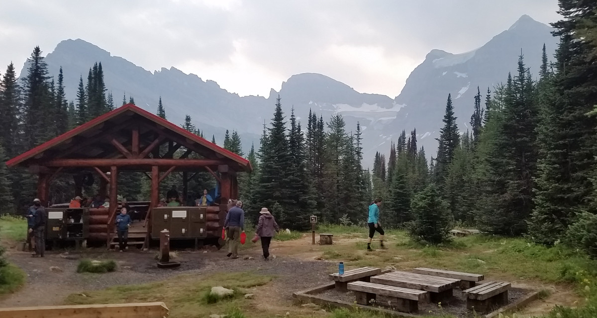 On the way back to camp, I saw the lively cooking shelter. Back at my campsite, Vinit said that the lady at the lodge came and checked the permit. She said we weren't allowed to set up a tent outside of the gravel pad.
  By now, It was already 7:30pm, and plenty pads unoccupied. I moved to site 5, closer to food. More exposed. I really don't like these gravel pads. Hard to stake in, and bad for the tent floor. Unlike Og, here it's all dirt, why not just leave it as dirt? Vinit finally found a ride from Mt Shark to Sunshine, with 2 girls. He'll hike out via Wonder Pass down to Marvel Lake tomorrow, and continue to the trailhead on Monday. Less elevation gain this way, and 2.5Km shorter.
 Met Wilma and her friend again from Og. They'd be here for 3 nights. They told me that more rain is expected tonight. Never in my life this sounded liked a piece of good news.
My phone registered 32344 steps today.
Day 4, Sunday. Woke up at 7. Still smoke in the air. On my way to the toilet, pad 1 & 2 were still vacant. Cooked breakfast in front of the lodge. Refilled water. Vinit finally decided to fly out. So he took the trash bag, and his own stove and the bigger fuel canister in his bag (luggage under 140 pound is included in the flight ticket CA$175+tax). Very busy here. Photos, packing, weighing. Many people flying their luggage out (CA$3/lb).
 I headed to Wonder Pass. First passed Naiset Huts, only ~300m from the lodge. Wooden individual cabins, bench at the porch. Quite nice. A large cooking cabin with pots and propane, solar panel.
 Continued on to Gog Lake. Very pretty. A boot track goes closer to the shore, and up a small cascade. However I lost the track after the waterfall, and had tramp the meadow in order to get back to the trail. Quite many people were hiking out this way. All very flat.
 The slope picks up in a larch forest. Young trees. Pasque flower seeds every where. A thin waterfall. Soon it levels out. Wonder Pass is a worthy destination.
  Further down 0.7Km, a boot track (on the map, but not labeled at the junction) goes up 0.5Km to a big cairn with a marker with no label. However, the sky darkened, so I waited at the bottom of the climb (where this photo was taken) under my umbrella. Didn't want to be caught in a storm half way up a steep slope. It rained. Not hard. Not much wind. I waited for 3 hours listening to my podcast! Cold. I cooked some water to drink. The rain didn't clear the sky, still smelled smoke, dark and low clouds. I got bored, so walked up to the "lookout". There's an obvious rocky path up. Very steep.
  Once reached the top, no more paths. It's a rolling plateau. Walking all the way (a bit downhill) to the edge is well worth the effort. You can see Gloria Lake, Marvel Lake, and a little lake in between. Big glaciers. Too foggy to see much else. I can imagine a glorious view on a clear day. Waited more, since there wasn't anything else I want to do here. Gave up eventually, and headed down. Took some time to locate the track on which I came up. All was more cloudy than in the morning. The zipper handle broke on my Ikea nylon bag. The zipper opened by itself with my gait, and things fell out. Now I had to hold it in my hand. I took a lower trail from Naiset Huts to Lake Magog. On the way, the bottom of my trekking pole fell out without me noticing it (I didn't have hand to use the pole: one hand holing the bag, one holding the umbrella). Not auspicious. At least I found the bottom section when retracing my steps.
Back in camp, saw a large group of Chinese (at least a dozen) following the ranger. They were talking about some overflow area. They carried a lot of stuff. One guy was holding a grocery shopping bag. They came from O'Brien Meadow from the west. Later, the ranger came to check my permit after I returned from dinner. She also replenished toilet paper and sprayed it with some freshener.
I went to bed early. Need to get up early tomorrow in order to hike out straight (29Km).
My phone registered 26539 steps today.
 Day 5, Monday, up at 6am. A cold night. My rainfly was full of frost. Surprising that I slept well in my 45°F bag. Took awhile to scrape some ice off, and pack up. My hands were freezing. Walked to Assiniboine Lodge to cook breakfast. A few hotel guests were up waiting here with their cameras/phones. Thick fog above the lake, but the mountains were clear.
 Unable to wait for the fog to dissipate, I hiked out. Arrived at Og Lake just before 9am, on schedule. The lake was also buried under a thick fog. The Ogg Creek Meadow was beautiful with a layer of thin flog. Just the better view is on my back.
 Going through Valley of Rocks is a piece of cake in the morning hours, on this cooler day. At 10:35, I arrived at the junction with Porcupine trail. Took me until 12:29 to hit the north junction. It's harder going back out, mostly uphill.
  From there, it was going up steadily for an hour, in the trees, until about a mile before Citadel Pass. The one mile on either side of Citadel Pass is very pleasant. Gentle slow, with a pond on each side, open views.
 Howard Douglas Lake is a welcome sight. It was not yet 3pm. I knew I would make it to the lift before it shuts off at 5pm. I actually used the outhouse here before heading uphill.
  After this hill, the rest is a piece of cake, and very nice, open meadows. Gradually I saw more and more tourists.
 At 4:30, I could see the ski lifts, and strolling tourists.
  Walked along Rock Isle Rd to the village to take the Gondola. I should have walked up to Standish Lift and take it down to the village. It closes at 5pm, and I should be able to get there just in the nick of time.
 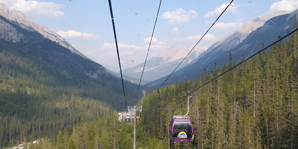 The Gondola took longer than I thought. I was able to use the same ticket to get on the downhill Gondola. I had the whole cart to myself. Drank, ate, took my boots off. A good way of ending my trip.
My phone registered 51417 steps today.
Vinit was already waiting at the visitor's lounge next to the ticket office. It has AC and WiFi. He was here since 4pm, apparently had more faith in my hiking ability. I washed and changed. Threw away my hiking pants and socks. Had a beer and V8.
We drove out just before 6pm. Hwy 93 was open, no stops allowed for a long section of the highwaay, while 12 helicopters were busy dumping water to the burning forest. We saw at least 4 helicopters in two different places. Smoke everywhere. The water bucket looked so small, seems a futile effort. Better than nothing. A sad scene.
Vinit drove straight to Oregon. He bought some booze at a duty free shop just as it was closing (9pm). Idaho was also burning. I passed out soon after we crossed the US border.
8/14, Tuesday. Arrived home at 5am! I went to work at 10.
Summary/lessons:
1. I packed way too much food. I can last 2 more days.
2. Should packed only 1 extra batteries while also taking a power-bank (Ankar 10000mAh).
3. Should packed an extra Sawyer water bag.
4. Umbrella was useful rain or shine.