The drive was smooth this early. Misty, but no rain. First hour on the trail was clear too. Then the rain started. Not heavy. Last time I hiked to Table Mountain was 5 years ago, with blue sky.

 You can no longer park at Bonneville Hotspring Resort. We started on a closed road (with trespassing sign) under power lines. Then it connects to PCT, which goes along Cedar Creek for awhile. Saw a big teepee, and later Sacagawea and Papoose Rock.
 Went ~100m off trail from PCT, to check out some big cracks (one looks like a cave) in the rocks. Jonathan, our host for today, went down to the cave bottom, and told us it was too silty and wet. So, no one else bothered to scramble down.
 About 3 miles in, you see a big sign for Table Mountain: difficult (1.7 miles) and more difficult (1.3 miles), and someone's angry note "Table Mt is much further than 1.7 or 1.3 miles. Good F...ing Luck". We went up 1.3 miles and came down 1.7 miles. True, both feels much longer. Fairly steep, signed by a wooden broken heart nailed on trees. We all concur that the shorter trail is easier. It has a big boulder field, but the rocks are bigger, so more stable.
 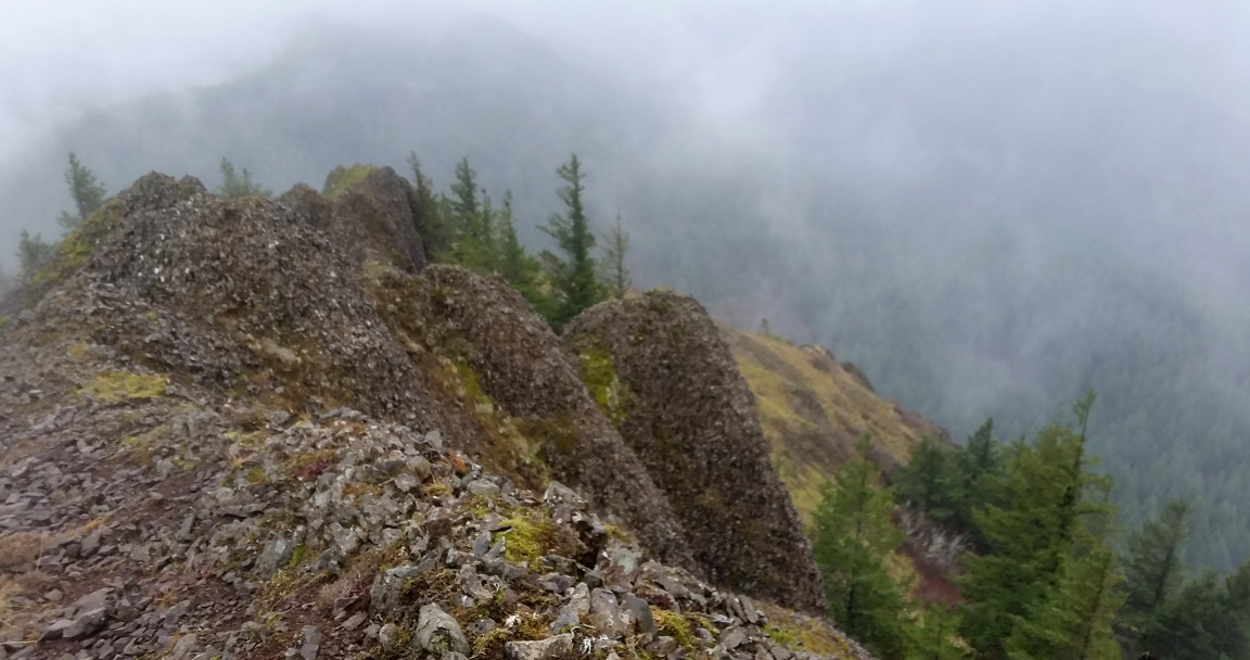 The longer route was probably dynamited out, lots of little rocks and they move under your feet. But it gets slightly better view: closer to the edge.
 Very windy close to the top, and it was raining. So my photos are fuzzy: the lens was wet. There's a sign and a little bench marking the top. You can walk ahead for a few hundred meters to get a better view, but not today. Some snow on trail closer to the top, but all passable in just hiking boots.
The rain stopped half way when we hiked out. Didn't go through the private land under power line, instead, hiked to the road and walked back to the car. A few cars parked at the road end where the trail comes out.
Back in town before 4pm. We did about 10 miles, maybe 3400' elevation gain.