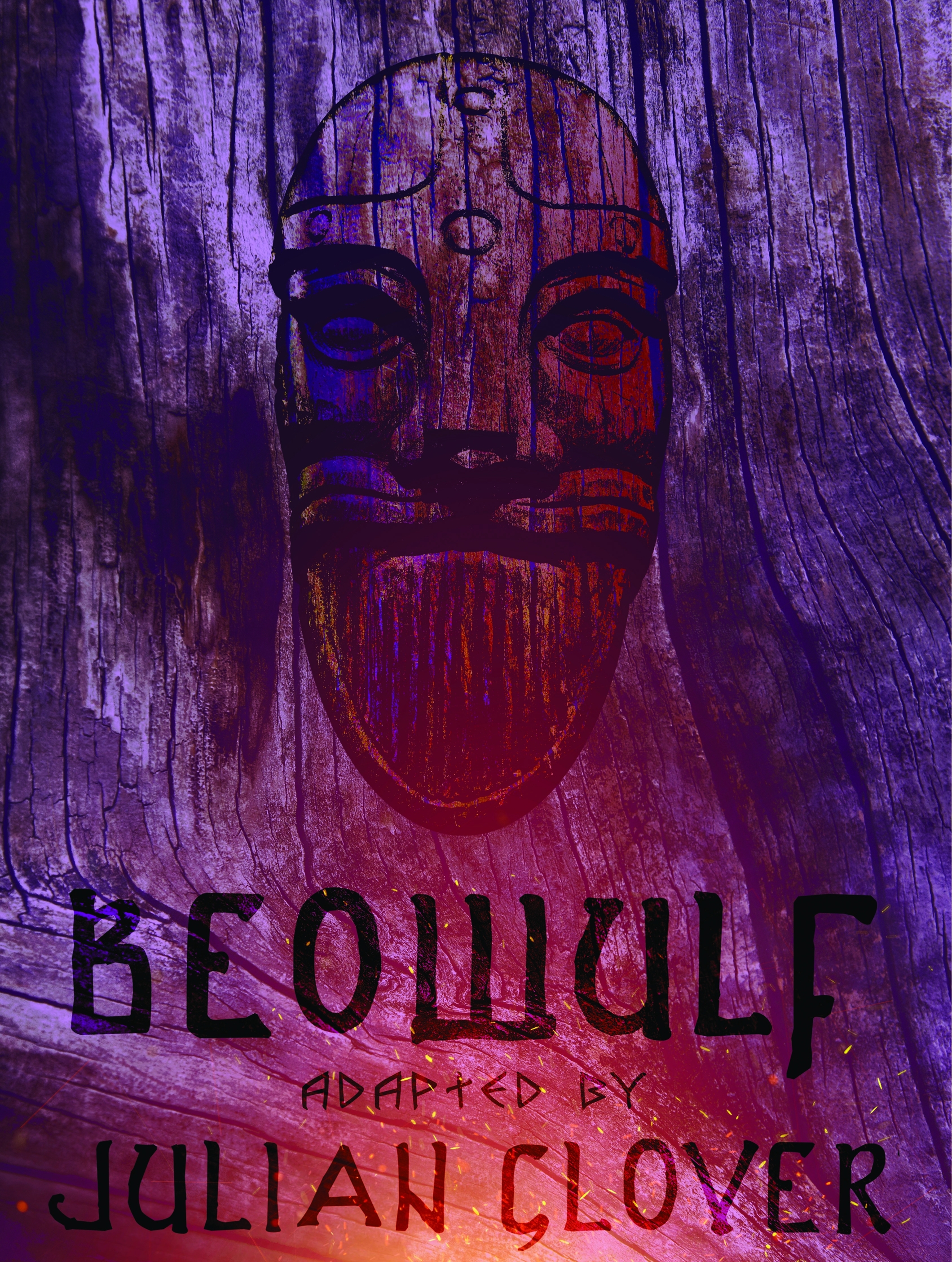
 7/28, Thursday. I was in Armory in the afternoon to enjoy the AC. Saw the ad for Beowulf, so bought a rush ticket. A single actor, the narrator is played by Brandon J. Simmons. He's quite amazing, acting out all parts, speaking tones, articulates very clearly. A program notes can be found at PlayBill.
Thursday, July 28, 2022
22.7.28. Beowulf at Book-it
7/28, Thursday. I was in Armory in the afternoon to enjoy the AC. Saw the ad for Beowulf, so bought a rush ticket. A single actor, the narrator is played by Brandon J. Simmons. He's quite amazing, acting out all parts, speaking tones, articulates very clearly. A program notes can be found at PlayBill.
Monday, July 25, 2022
2022.7.23-25 The Craggies + Rainy Pass
After missing each other last weekend due to our bad cell carrier which didn't deliver SMS in time, O and I planned to climb this weekend together.
Initially, we were set to Snowfield Peak for 3 days, camping under Neve Glacier for 2 nights.
O invited a couple of folks, I asked one person, none came along.
O insisted roping up. With just 2 of us, and I not knowing ropes, I decided not to take the risk at Snowfield.
We settled on West Craggy (85th) and Big Craggy (62nd), the 2 Bulger peaks next to each other in Okanogan Range.
We are both happy not to lug crampons and ice axe along. Helmet, yes!
Due to the long drive (4.5 hour from Seattle), we decided to keep this a 3 day outing, and add a few short hikes nearby.
Conclusion 7/23, Saturday, we left Seattle ~8am, in thick clouds. Drove to Blue Lake TH. ~11:30am, the parking lot was full. Sunny here. Had to park along Hwy-20. Being an easy hike (4.4 mile RT, 1000'EG), it's very popular, but I had never visited it. Oops, forgot my wool socks!
Half way up, enters a small meadow, view starts to pop up, across from Hwy-20, and the Liberty Bell group. There they were, 2 goats: a baby and an adult.
 A few muddy spots. Continue on. The lake is quite pretty. Yes, very blue and clear, but not glacier color. Some larches.
We walked to a small tarn nearby. Camping is not allowed near the lake.
A few muddy spots. Continue on. The lake is quite pretty. Yes, very blue and clear, but not glacier color. Some larches.
We walked to a small tarn nearby. Camping is not allowed near the lake.
 Back as we came. On the way out, people stopped on both ends of the trail because of this bear.
He was very close to the trail. I walked on, tapping my pole on rocks, so not to startle him. I turned around to take a photo, and he looked at me and O, but continued eating grass.
Back as we came. On the way out, people stopped on both ends of the trail because of this bear.
He was very close to the trail. I walked on, tapping my pole on rocks, so not to startle him. I turned around to take a photo, and he looked at me and O, but continued eating grass.
 Drove to Winthrope for some gas. Then onto Copper Glance TH. It was quite hot: the car indicated 91°F, ~3:30pm. One other car in the small pullout. O was debating whether to take her rainfly. Dark clouds ahead, so she stuffed it in.

 There is a gate and sign for "road closed". Totally unnecessary. It is narrow like a trail, not drivable at all (see photo to the right with O).

 Quite some flowers along the "road". Most notable is magenta paintbrush, silvercrown is at its end, yarrow, pearly everlasting, aster (more coming).
Saw 2 Collomia Grandiflora, some pink Iliamna Rivularis. Burnt trees all around. Saw a girl hiking out with a handfull of flowers.
Quite some flowers along the "road". Most notable is magenta paintbrush, silvercrown is at its end, yarrow, pearly everlasting, aster (more coming).
Saw 2 Collomia Grandiflora, some pink Iliamna Rivularis. Burnt trees all around. Saw a girl hiking out with a handfull of flowers.
There're two crossing over Copper Glance Creek, one very close to TH, one almost at the end. I filled water at the first.

 About an hour later, we reached the meadowy slope, charred trees, rugged rocky ridge.
Reached the pond, too mosquito-y to make a base camp. The trail becomes faint here. Supposedly if you continue for less than 1/2 mile, you'd reach an overlook over Copper Glance Lake. We continued along the creek in NW direction. All bushwhacking now. Lots of downed charred logs. Slow progress. But we didn't need to go far. ~6pm, we found a small site for 2 tents, close to the creek, next to the rocks, more or less at the treeline. As we were pitching the tents, the rain started, with thunder. I had to crawl into the semi-erect tent to wait out the rain, ~1 hour. It certain surpressed some mosquitoes. Filled water, ate, too cold now to wash my shirt.
 7/24, Sunday, climb day. We are using Ian Lauder's GPS track of 2020. Heading to West Craggy first. We started hiking ~6am with helmets on.
 Follow the creek's left bank, hopping over rocks. 2 cute ponds, good reflection. Probably breeds mosquitoes.
 Crossed to the right side, and up over steep (somewhat loose) rocks.
This part may be the most sketchy of the day.
Crossed to the right side, and up over steep (somewhat loose) rocks.
This part may be the most sketchy of the day.
 Once reached the ridge, it is fairly easy, more of less stayed on the west side of the ridge. Great view from then on.
 Here's O, who was way ahead of me.
 Here is her signing the summit registry. I reached the summit at 8:40. She took a few photos of me on the summit.
Next Big Craggy. We retraced the ridge half way, losing elevation.
Found the cutover (there's a cairn, and if not, it's kinda obvious where you'd need to turn).
Continued to lose about 1000' elevation.
Nice view of the small No Dice Lake.
We retraced the ridge half way, losing elevation.
Found the cutover (there's a cairn, and if not, it's kinda obvious where you'd need to turn).
Continued to lose about 1000' elevation.
Nice view of the small No Dice Lake.
 Mostly fun and pretty ridge walk. Exposure, yes, but danger, not so much.
Looking behind for the West Craggy.
I kept on thinking the next bluff is the summit, but no... At least 3 times.
Mostly fun and pretty ridge walk. Exposure, yes, but danger, not so much.
Looking behind for the West Craggy.
I kept on thinking the next bluff is the summit, but no... At least 3 times.
 Finally, I saw O up there waiting.
 This is the view on top of Big Craggy, looking west. I arrived ~11:10am.
 Going down directly to the Copper Glance Creek drainage.
Backtraced only a bit, then a long rock screefield to go.
I didn't like this part, even though not as bad as coming down Robinson last June.
Bacm at camp ~1pm.
Going down directly to the Copper Glance Creek drainage.
Backtraced only a bit, then a long rock screefield to go.
I didn't like this part, even though not as bad as coming down Robinson last June.
Bacm at camp ~1pm.
 Here's more of less our route.
Packed up, and hiked out. More sunny (hotter) today.
Here's more of less our route.
Packed up, and hiked out. More sunny (hotter) today.
 The nicest stretch is the flowering slope around 5500'. Not much elevation gain, but good view to the valley behind and the peaks ahead.

 On the way out, O stopped at the road's end, and we went in a bit to see the mine.
I didn't even see it on the way up.
For more info on the Copper Glance mine, checkout FS website.
On the way out, O stopped at the road's end, and we went in a bit to see the mine.
I didn't even see it on the way up.
For more info on the Copper Glance mine, checkout FS website.
Drove out on NF-5130, saw a small bear (brown fur) running away. We stopped, and he stopped too. A little too far for phone camera. O stopped at Winthrope for meal. I read my book, and ate my cold-soaked backpack meal. It was 95°F.
 Parked at Bridge Creek TH parking, and crossed the Hwy-20, and walked PCT for ~1 mile (mostly flat, lost some minor elevation) to its junction to Copper Pass / Stiletto Lookout trail.
We were planning to hike to Stiletto Peak tomorrow.
Found a campsite near State Creek. Washed, hung my shirt on a tree. My left nose started bleeding. Too hot.
Only then, we realized that the bridge is out. Looked for a crossing, found a possible log, but it ends in bushes on the other side. We discussed an alternative.
Parked at Bridge Creek TH parking, and crossed the Hwy-20, and walked PCT for ~1 mile (mostly flat, lost some minor elevation) to its junction to Copper Pass / Stiletto Lookout trail.
We were planning to hike to Stiletto Peak tomorrow.
Found a campsite near State Creek. Washed, hung my shirt on a tree. My left nose started bleeding. Too hot.
Only then, we realized that the bridge is out. Looked for a crossing, found a possible log, but it ends in bushes on the other side. We discussed an alternative.
When we chatted after dinner (not as buggy as last night), a young guy walked to our camp, and pitched his bivy close to O. He's from Germany, looks Asian, perfect English. He is going PCT south bound. Just hiked from Harts Pass all the way here (~33 miles), and was going to Stehekin tomorrow (~17 miles). He said it was very buggy all day today (the one factor he contributed to his 33 mile day). His backpack is about the size of my day pack (~20L). Definitely no stove. We didn't see him cook, nor eat. Only saw him filter water.
7/25, Monday, sunny, very warm. Maple Pass loop, a classic at Rainy Pass.
 Packed out ~6am, drove to Rainy Pass TH, repacked for the day hike. In fact, we could have walked there via PCT. Probably take the same amount of time. Monday morning, the giant parking are was rather empty, and we weren't sure where is the TH proper. We headed up to Maple Pass first, aiming for Frisco Mt.
As we approached the tree line, we saw this grouse cooing for mate. He stood there, right by the trail, called many times. It was ~8:10am. That alone made my day!
Packed out ~6am, drove to Rainy Pass TH, repacked for the day hike. In fact, we could have walked there via PCT. Probably take the same amount of time. Monday morning, the giant parking are was rather empty, and we weren't sure where is the TH proper. We headed up to Maple Pass first, aiming for Frisco Mt.
As we approached the tree line, we saw this grouse cooing for mate. He stood there, right by the trail, called many times. It was ~8:10am. That alone made my day!
 Once emerged to the glacier lily filled meadow, the view is spectacular, so were the mosquitoes.
 Most lily was still coming. Quite some pasqueflowers. Larches. Snow was melting everywhere, very pretty.
This marmot was sunning.
Most lily was still coming. Quite some pasqueflowers. Larches. Snow was melting everywhere, very pretty.
This marmot was sunning.
 At about 6950', there's a junction. We could see some snow on the way to Frisco Mountain. Since we didn't bring spikes, O decided to sit this one out, and I ventured up left, following a visible track.
Snow can be avoided, for at least 2 bumps that I went up to. Definitely exposed, sometimes very narrow.
I turned around before a steep drop, view is excellent. Some phlox on the rocks.
At about 6950', there's a junction. We could see some snow on the way to Frisco Mountain. Since we didn't bring spikes, O decided to sit this one out, and I ventured up left, following a visible track.
Snow can be avoided, for at least 2 bumps that I went up to. Definitely exposed, sometimes very narrow.
I turned around before a steep drop, view is excellent. Some phlox on the rocks.
 We continued on the loop, loosing elevation now, until about 6600 at Maple Pass.
Lots of snow along this stretch, views to all directions.
Seeing people coming from opposite direction. Lots of people. Tracks on snow was well defined.
Then we headed up to a gentle bump, marked as Heather Pass Peak on one version of Gaia Map, following a faint boot track.
This is an excellent choice. You can see Lewis Lake from here.
We encountered only one person here. I sat against a snowbank, half in the shade. Not too many mosquitoes.
We continued on the loop, loosing elevation now, until about 6600 at Maple Pass.
Lots of snow along this stretch, views to all directions.
Seeing people coming from opposite direction. Lots of people. Tracks on snow was well defined.
Then we headed up to a gentle bump, marked as Heather Pass Peak on one version of Gaia Map, following a faint boot track.
This is an excellent choice. You can see Lewis Lake from here.
We encountered only one person here. I sat against a snowbank, half in the shade. Not too many mosquitoes.
 Back to the main drag. Crowds. Snow lingered on the zigzag all the way to Heather Pass.
Some hikers even turned around. Some are better prepared than O and I, and they wore spikes.
Back to the main drag. Crowds. Snow lingered on the zigzag all the way to Heather Pass.
Some hikers even turned around. Some are better prepared than O and I, and they wore spikes.
 O plans to drive out at 3pm. So we walked to Rainy Lake from the same parking lot. It's only a flat mile, mostly in shade, all paved for wheelchair/stroller. There are also ~3 nice benches along the way. A large "deck" and another bench at the end of the pavement. The lake is quite lovely. Can climb down to the water, but it was too sunny. We hid in the shade and rested, before walking back to the car.
My left eye was getting quite bad. I threw away the contact lens, but the tears didn't manage to expel any foreign particle. I practically drove home with just one eye. We stopped at a Mexico restaurant for O at Arlington (91°F), and a gas stop. Cheap gas here by I-5. No traffic. Arrived back in Seattle shortly before 7pm. The car registered 88°F. Will be hotter the next few days.
Conclusion
- the Craggies are better done in larch season. It's short enough to climb with shorter day light in autumn. Total: shy of 10 miles, maybe 6000' EG. Right now, already no snow to help the climb, so a lot of scree. Tons of mosquitoes.
- the 3 extra hikes we did near Rainy Pass are excellent choices this time of the year (or during larch season), if you can put up with the crowds of pests and people: the remaining snow makes the scenary much prettier, quite some flowers, wild animals (despite of the crowds).
- thick socks are needed for hard boots.
 7/23, Saturday, we left Seattle ~8am, in thick clouds. Drove to Blue Lake TH. ~11:30am, the parking lot was full. Sunny here. Had to park along Hwy-20. Being an easy hike (4.4 mile RT, 1000'EG), it's very popular, but I had never visited it. Oops, forgot my wool socks!
Half way up, enters a small meadow, view starts to pop up, across from Hwy-20, and the Liberty Bell group. There they were, 2 goats: a baby and an adult.

 A few muddy spots. Continue on. The lake is quite pretty. Yes, very blue and clear, but not glacier color. Some larches.
We walked to a small tarn nearby. Camping is not allowed near the lake.
A few muddy spots. Continue on. The lake is quite pretty. Yes, very blue and clear, but not glacier color. Some larches.
We walked to a small tarn nearby. Camping is not allowed near the lake.
 Back as we came. On the way out, people stopped on both ends of the trail because of this bear.
He was very close to the trail. I walked on, tapping my pole on rocks, so not to startle him. I turned around to take a photo, and he looked at me and O, but continued eating grass.
Back as we came. On the way out, people stopped on both ends of the trail because of this bear.
He was very close to the trail. I walked on, tapping my pole on rocks, so not to startle him. I turned around to take a photo, and he looked at me and O, but continued eating grass.
 Drove to Winthrope for some gas. Then onto Copper Glance TH. It was quite hot: the car indicated 91°F, ~3:30pm. One other car in the small pullout. O was debating whether to take her rainfly. Dark clouds ahead, so she stuffed it in.

 There is a gate and sign for "road closed". Totally unnecessary. It is narrow like a trail, not drivable at all (see photo to the right with O).

 Quite some flowers along the "road". Most notable is magenta paintbrush, silvercrown is at its end, yarrow, pearly everlasting, aster (more coming).
Saw 2 Collomia Grandiflora, some pink Iliamna Rivularis. Burnt trees all around. Saw a girl hiking out with a handfull of flowers.
Quite some flowers along the "road". Most notable is magenta paintbrush, silvercrown is at its end, yarrow, pearly everlasting, aster (more coming).
Saw 2 Collomia Grandiflora, some pink Iliamna Rivularis. Burnt trees all around. Saw a girl hiking out with a handfull of flowers.
There're two crossing over Copper Glance Creek, one very close to TH, one almost at the end. I filled water at the first.

 About an hour later, we reached the meadowy slope, charred trees, rugged rocky ridge.
Reached the pond, too mosquito-y to make a base camp. The trail becomes faint here. Supposedly if you continue for less than 1/2 mile, you'd reach an overlook over Copper Glance Lake. We continued along the creek in NW direction. All bushwhacking now. Lots of downed charred logs. Slow progress. But we didn't need to go far. ~6pm, we found a small site for 2 tents, close to the creek, next to the rocks, more or less at the treeline. As we were pitching the tents, the rain started, with thunder. I had to crawl into the semi-erect tent to wait out the rain, ~1 hour. It certain surpressed some mosquitoes. Filled water, ate, too cold now to wash my shirt.
 7/24, Sunday, climb day. We are using Ian Lauder's GPS track of 2020. Heading to West Craggy first. We started hiking ~6am with helmets on.
 Follow the creek's left bank, hopping over rocks. 2 cute ponds, good reflection. Probably breeds mosquitoes.
 Crossed to the right side, and up over steep (somewhat loose) rocks.
This part may be the most sketchy of the day.
Crossed to the right side, and up over steep (somewhat loose) rocks.
This part may be the most sketchy of the day.
 Once reached the ridge, it is fairly easy, more of less stayed on the west side of the ridge. Great view from then on.
 Here's O, who was way ahead of me.
 Here is her signing the summit registry. I reached the summit at 8:40. She took a few photos of me on the summit.
Next Big Craggy.
 We retraced the ridge half way, losing elevation.
Found the cutover (there's a cairn, and if not, it's kinda obvious where you'd need to turn).
Continued to lose about 1000' elevation.
Nice view of the small No Dice Lake.
We retraced the ridge half way, losing elevation.
Found the cutover (there's a cairn, and if not, it's kinda obvious where you'd need to turn).
Continued to lose about 1000' elevation.
Nice view of the small No Dice Lake.
 Mostly fun and pretty ridge walk. Exposure, yes, but danger, not so much.
Looking behind for the West Craggy.
I kept on thinking the next bluff is the summit, but no... At least 3 times.
Mostly fun and pretty ridge walk. Exposure, yes, but danger, not so much.
Looking behind for the West Craggy.
I kept on thinking the next bluff is the summit, but no... At least 3 times.
 Finally, I saw O up there waiting.
 This is the view on top of Big Craggy, looking west. I arrived ~11:10am.
 Going down directly to the Copper Glance Creek drainage.
Backtraced only a bit, then a long rock screefield to go.
I didn't like this part, even though not as bad as coming down Robinson last June.
Bacm at camp ~1pm.
Going down directly to the Copper Glance Creek drainage.
Backtraced only a bit, then a long rock screefield to go.
I didn't like this part, even though not as bad as coming down Robinson last June.
Bacm at camp ~1pm.
 Here's more of less our route.
Packed up, and hiked out. More sunny (hotter) today.
Here's more of less our route.
Packed up, and hiked out. More sunny (hotter) today.
 The nicest stretch is the flowering slope around 5500'. Not much elevation gain, but good view to the valley behind and the peaks ahead.

 On the way out, O stopped at the road's end, and we went in a bit to see the mine.
I didn't even see it on the way up.
For more info on the Copper Glance mine, checkout FS website.
On the way out, O stopped at the road's end, and we went in a bit to see the mine.
I didn't even see it on the way up.
For more info on the Copper Glance mine, checkout FS website.
Drove out on NF-5130, saw a small bear (brown fur) running away. We stopped, and he stopped too. A little too far for phone camera. O stopped at Winthrope for meal. I read my book, and ate my cold-soaked backpack meal. It was 95°F.
 Parked at Bridge Creek TH parking, and crossed the Hwy-20, and walked PCT for ~1 mile (mostly flat, lost some minor elevation) to its junction to Copper Pass / Stiletto Lookout trail.
We were planning to hike to Stiletto Peak tomorrow.
Found a campsite near State Creek. Washed, hung my shirt on a tree. My left nose started bleeding. Too hot.
Only then, we realized that the bridge is out. Looked for a crossing, found a possible log, but it ends in bushes on the other side. We discussed an alternative.
Parked at Bridge Creek TH parking, and crossed the Hwy-20, and walked PCT for ~1 mile (mostly flat, lost some minor elevation) to its junction to Copper Pass / Stiletto Lookout trail.
We were planning to hike to Stiletto Peak tomorrow.
Found a campsite near State Creek. Washed, hung my shirt on a tree. My left nose started bleeding. Too hot.
Only then, we realized that the bridge is out. Looked for a crossing, found a possible log, but it ends in bushes on the other side. We discussed an alternative.
When we chatted after dinner (not as buggy as last night), a young guy walked to our camp, and pitched his bivy close to O. He's from Germany, looks Asian, perfect English. He is going PCT south bound. Just hiked from Harts Pass all the way here (~33 miles), and was going to Stehekin tomorrow (~17 miles). He said it was very buggy all day today (the one factor he contributed to his 33 mile day). His backpack is about the size of my day pack (~20L). Definitely no stove. We didn't see him cook, nor eat. Only saw him filter water.
7/25, Monday, sunny, very warm. Maple Pass loop, a classic at Rainy Pass.
 Packed out ~6am, drove to Rainy Pass TH, repacked for the day hike. In fact, we could have walked there via PCT. Probably take the same amount of time. Monday morning, the giant parking are was rather empty, and we weren't sure where is the TH proper. We headed up to Maple Pass first, aiming for Frisco Mt.
As we approached the tree line, we saw this grouse cooing for mate. He stood there, right by the trail, called many times. It was ~8:10am. That alone made my day!
Packed out ~6am, drove to Rainy Pass TH, repacked for the day hike. In fact, we could have walked there via PCT. Probably take the same amount of time. Monday morning, the giant parking are was rather empty, and we weren't sure where is the TH proper. We headed up to Maple Pass first, aiming for Frisco Mt.
As we approached the tree line, we saw this grouse cooing for mate. He stood there, right by the trail, called many times. It was ~8:10am. That alone made my day!
 Once emerged to the glacier lily filled meadow, the view is spectacular, so were the mosquitoes.
 Most lily was still coming. Quite some pasqueflowers. Larches. Snow was melting everywhere, very pretty.
This marmot was sunning.
Most lily was still coming. Quite some pasqueflowers. Larches. Snow was melting everywhere, very pretty.
This marmot was sunning.
 At about 6950', there's a junction. We could see some snow on the way to Frisco Mountain. Since we didn't bring spikes, O decided to sit this one out, and I ventured up left, following a visible track.
Snow can be avoided, for at least 2 bumps that I went up to. Definitely exposed, sometimes very narrow.
I turned around before a steep drop, view is excellent. Some phlox on the rocks.
At about 6950', there's a junction. We could see some snow on the way to Frisco Mountain. Since we didn't bring spikes, O decided to sit this one out, and I ventured up left, following a visible track.
Snow can be avoided, for at least 2 bumps that I went up to. Definitely exposed, sometimes very narrow.
I turned around before a steep drop, view is excellent. Some phlox on the rocks.
 We continued on the loop, loosing elevation now, until about 6600 at Maple Pass.
Lots of snow along this stretch, views to all directions.
Seeing people coming from opposite direction. Lots of people. Tracks on snow was well defined.
Then we headed up to a gentle bump, marked as Heather Pass Peak on one version of Gaia Map, following a faint boot track.
This is an excellent choice. You can see Lewis Lake from here.
We encountered only one person here. I sat against a snowbank, half in the shade. Not too many mosquitoes.
We continued on the loop, loosing elevation now, until about 6600 at Maple Pass.
Lots of snow along this stretch, views to all directions.
Seeing people coming from opposite direction. Lots of people. Tracks on snow was well defined.
Then we headed up to a gentle bump, marked as Heather Pass Peak on one version of Gaia Map, following a faint boot track.
This is an excellent choice. You can see Lewis Lake from here.
We encountered only one person here. I sat against a snowbank, half in the shade. Not too many mosquitoes.
 Back to the main drag. Crowds. Snow lingered on the zigzag all the way to Heather Pass.
Some hikers even turned around. Some are better prepared than O and I, and they wore spikes.
Back to the main drag. Crowds. Snow lingered on the zigzag all the way to Heather Pass.
Some hikers even turned around. Some are better prepared than O and I, and they wore spikes.
 O plans to drive out at 3pm. So we walked to Rainy Lake from the same parking lot. It's only a flat mile, mostly in shade, all paved for wheelchair/stroller. There are also ~3 nice benches along the way. A large "deck" and another bench at the end of the pavement. The lake is quite lovely. Can climb down to the water, but it was too sunny. We hid in the shade and rested, before walking back to the car.
My left eye was getting quite bad. I threw away the contact lens, but the tears didn't manage to expel any foreign particle. I practically drove home with just one eye. We stopped at a Mexico restaurant for O at Arlington (91°F), and a gas stop. Cheap gas here by I-5. No traffic. Arrived back in Seattle shortly before 7pm. The car registered 88°F. Will be hotter the next few days.
Wednesday, July 20, 2022
2022.7.19. No more Amazon bananas
 7/18, Monday, the Airstream banana stands disappeared.
7/19, Tuesday, they installed ~10 swings painted in bright orange.
7/20-9/10, Summer in SLU.
Update 7/27. I walked by the Sphere, and the bananas are back! A booth was handing out snow cones.
Sunday, July 17, 2022
2022.7.17. Coldwater Peak + Truman Trail
7.16, Saturday. Instead of picking up a rental car, I talked a friend into hiking Coldwater Peak with me.
Due to the long-ish drive and long trail, we agreed to drive there today, and start hiking the next morning.
O said she may join us.
I was picked up at home ~4:20pm. Txted O. But no response for the entire weekend.
 Minor traffic getting out of the city, plus a closed ramp.
Filled water at the Coldwater boat launch, then drove to Johnston Ridge for "sunset". It was chilly and overcast. No sun at all. 8pm.
A bunch of youth were racing their cars in circles, churning up a lot of dust, heat and noise in the giant and empty parking lot.
Cooked and ate dinner on the paved walkway facing the mountain (without seeing it).
Tried the new stool I bought from REI recently, works quite nicely.
K spent sometime at the top of the walkway to talk to his family.
Back to the boat launch, I pitched my tent at the end of a paved walkway, away from the traffic.
Tried a new quilt. The night was not cold, so it worked fine.
K settled into his car, and later claimed that mosquitoes kept him awake late into the night.
Minor traffic getting out of the city, plus a closed ramp.
Filled water at the Coldwater boat launch, then drove to Johnston Ridge for "sunset". It was chilly and overcast. No sun at all. 8pm.
A bunch of youth were racing their cars in circles, churning up a lot of dust, heat and noise in the giant and empty parking lot.
Cooked and ate dinner on the paved walkway facing the mountain (without seeing it).
Tried the new stool I bought from REI recently, works quite nicely.
K spent sometime at the top of the walkway to talk to his family.
Back to the boat launch, I pitched my tent at the end of a paved walkway, away from the traffic.
Tried a new quilt. The night was not cold, so it worked fine.
K settled into his car, and later claimed that mosquitoes kept him awake late into the night.
7.17, Sunday. Cloudy :( I got up and packed ~7am. Read my book while waiting. The park service crew came and cleaned the restroom. 2 boaters came and chatted about fishing. One guy had 2 lines, on kayak. The other one's boat seems motorized (is it allowed?) A whole class of REI gathered here with ~a dozen kayaks. 2 runners. At 8, I woke up K. It was getting too late to start, considering his pace. Cooked breakfast here. We didn't start hiking until ~9:40am!
 Paintbrush was doing quite well along Johnston Ridge. Penstemon and lupines too. Still not as well as I had hoped with more than normal water this year.
Along Boundary Trail, similar, more paintbrush than other flowers.
Paintbrush was doing quite well along Johnston Ridge. Penstemon and lupines too. Still not as well as I had hoped with more than normal water this year.
Along Boundary Trail, similar, more paintbrush than other flowers.
 The view gets better after the junction with Harry's Ridge.
More thimbleberry, a lot of strawberry flowers.
North of the rock hole, some columbine and mariposa lily.
The view gets better after the junction with Harry's Ridge.
More thimbleberry, a lot of strawberry flowers.
North of the rock hole, some columbine and mariposa lily.
Near the junction to Coldwater Peak, there were some patches of snow on trail, but easy to cross. Met 2 guys who came back from both Coldwater Peak and Mt. Margaret (that'd be almost 20 miles RT). They started at 5am. Half way on the zigzag to Coldwater Peak, one snow patch posed some trouble. On the way back, we took a different route to avoid it. Didn't use spikes which I brought. Quite some pasqueflower, some in seed form, some in transition. Some spirea. Not as much as I remembered.

 The summit had 6 people when we finally arrived (~13:30).
Could see none of the mountains that I promised. Still excellent view.
Too cloudy, but the temperature was very pleasant, and I only drank half litre of water.
Quite some pink penstemon on the rocks.
Ate sandwiches and cherries.
The summit had 6 people when we finally arrived (~13:30).
Could see none of the mountains that I promised. Still excellent view.
Too cloudy, but the temperature was very pleasant, and I only drank half litre of water.
Quite some pink penstemon on the rocks.
Ate sandwiches and cherries.
 Back as we came. At the junction of Truman Trail, I was hesitating, because it was getting late (3 hours behind my estimation).
K decided to go down to the pumice field with me. ~30 minutes later, just past the pond, he turned around. I gave him a phone with the GPS map, so he wouldn't get lost.
He, instead, worried about me, and handed me a walkie-talkie, and called multiple times. Honestly, it's a hassel.
Back as we came. At the junction of Truman Trail, I was hesitating, because it was getting late (3 hours behind my estimation).
K decided to go down to the pumice field with me. ~30 minutes later, just past the pond, he turned around. I gave him a phone with the GPS map, so he wouldn't get lost.
He, instead, worried about me, and handed me a walkie-talkie, and called multiple times. Honestly, it's a hassel.

 I continued to the junction of Loowit Trail as planned, and turned around ~5:50. As my last few times here, flowers are excellent.
~6:30pm, I found K waiting for me by the trail :(
We walked back up together.
By then, he was getting quite tired, so going slowly.
Then his phone beeped, and he was going even slower, txting while walking.
I don't understand why anyone needs to be online while outdoors.
We finally reached the parking lot at 8pm!
I continued to the junction of Loowit Trail as planned, and turned around ~5:50. As my last few times here, flowers are excellent.
~6:30pm, I found K waiting for me by the trail :(
We walked back up together.
By then, he was getting quite tired, so going slowly.
Then his phone beeped, and he was going even slower, txting while walking.
I don't understand why anyone needs to be online while outdoors.
We finally reached the parking lot at 8pm!
No sunset today either. Cooked some food, tea for K, and beer for me. Bathroom break. No more TP in lady's room. Got home almost midnight. I had trouble staying awake on the drive back. I enjoyed the hike and company. But next time, I need to find a shorter trail for friends who don't hike regularly.
Monday, received O's message from Saturday.
Saturday, July 16, 2022
2022.7.16. Seattle Aquarium naturalist on beach
 7/16 noon->?, on the small beach below Olympic Sculpture Park, 3 naturalists from Seattle Aquarium were there answering questions from kids who found objects on the beach. One guy also gave me a brochure listing the common species. Very low tide.
Wednesday, July 13, 2022
2022.7.9-10. Mt. Adams via north ridge - north cleaver
7/8, Friday night, it took me some trouble to print the climbing permit ($15 for weekends). I put my permit for South Climb, Cold Spring TH for one car, and the hike leader, Z, put his permit for North Ridge - North Cleaver, Killen Creek TH.
Our plan was up via North Ridge, glissade down to Lunch Counter and out at Cold Spring TH. We had 4 people and 2 cars signed up.
7/9, Saturday, partly sunny. I arrived at Eastgate P&R before 8am. 2 didn't show up. So, with one car, this is an up and down North Ridge. Coming down north side is slower, but I'm glad that I didn't need to lug my backpack up to the summit, or wait for car shuttle (1.5 - 2 hrs). It's a 3.5 hour drive to Killen Creek TH. We made a Safeway stop where Z bought lunch, and I bought an English cucumber. We ate lunch inside the car at the TH, then geared up inside the car. Too many mosquitoes outside! Before we headed out, my hiking friend from Oregon, O, arrived with her climbing partner du jour R, in R's car. She forgot to bring my gaiters :(
 Killen Creek trail starts off in the mosquito clouds (elevation ~4600') onto the flat sandy trail. Make sure you don't walk behind a dog (who usually would kick up a lot of dust). Quite some beargrass along the trail, but non blooming (or done blooming). The first 3 miles to PCT is very gradual or flat, gaining ~1500'. Snow started halfway there. Easy to lose the trail that's buried under snow. Saw many avalanche lilies (only few blooming, too early) as we approach Killen Creek Meadow. Not many mosquitoes here.
 We routed to the right of a rocky hill to High Camp, where the terrain is more gradual. By then it was all snow. I'm surprised to find some grassy "islands" in the snow at High Camp (~6900'), and running water. A large group recently arrived. Its members scattered about looking for camp sites. They came in from Divide Camp TH, and they would also climb the north ridge tomorrow.
 Reached Glacier Lake (~7500') shortly after 4pm. Some Jacob's Ladder blooming.
 There're quite a few established campsites on its eastern shore, with semi-circlular rock walls. The lake was melted on the edge. The water is glacier fed, so quite silty.
 After washing, setting up my tent with extra guy-line, and many rocks resting on my stakes (due to the wind, not too bad though), I walked to Z's camp for early dinner.
Z buried 2 cans of beer in the snow when we first arrived. Dinner with cold beer. 9.5%! I centainly felt it when I stood up.
I then followed O and R up to the base of Adams Glacier. The glacier is rather broken, full of cravasses.
R went up to the top of a rocky hill instead. He reported that his phone had signal up there.
Before I even reach the base, the clouds moved in. For a moment or two, it was whiteout.
I retreated to my tent, and retired early.
After washing, setting up my tent with extra guy-line, and many rocks resting on my stakes (due to the wind, not too bad though), I walked to Z's camp for early dinner.
Z buried 2 cans of beer in the snow when we first arrived. Dinner with cold beer. 9.5%! I centainly felt it when I stood up.
I then followed O and R up to the base of Adams Glacier. The glacier is rather broken, full of cravasses.
R went up to the top of a rocky hill instead. He reported that his phone had signal up there.
Before I even reach the base, the clouds moved in. For a moment or two, it was whiteout.
I retreated to my tent, and retired early.
 This photo of my tent was taken on Sunday after the climb.
This sunset photo was curtousy of O. By then, I was asleep.
I woke up in the middle of the night many times, not sure if I was cold or what.
It was a bit windy outside, I didn't even venture out to see the stars.
This photo of my tent was taken on Sunday after the climb.
This sunset photo was curtousy of O. By then, I was asleep.
I woke up in the middle of the night many times, not sure if I was cold or what.
It was a bit windy outside, I didn't even venture out to see the stars.
7/10, Sunday, sunny. 4:30am alarm clock. My hike leader wanted to start at 5am. It was bright enough. A bit chilly, and I kept on my long sleeping wear both top and bottom.
We took the snow instead of rocks towards the North Ridge.
The snow was solid. We put on crampons.
Then it was a scree field, not steep with some vegetation (saw goats here yesterday, and later on our way back).
It was very pretty with the sea of clouds below us. Ste Helens, Rainier and Goat Rocks behind.
It was bright enough. A bit chilly, and I kept on my long sleeping wear both top and bottom.
We took the snow instead of rocks towards the North Ridge.
The snow was solid. We put on crampons.
Then it was a scree field, not steep with some vegetation (saw goats here yesterday, and later on our way back).
It was very pretty with the sea of clouds below us. Ste Helens, Rainier and Goat Rocks behind.
 The ridge is rock scramble, both loose and solid rocks. Sometimes steep. Alternating left and right side of the ridge. One spot was a bit tricky.
We had to put on crampons and take them off twice along the ridge, when snow was the better option.
Left is a photo with the Mazamas group ahead putting on crampons. They are a large group (7-8 climbers). We soon passed them.
The ridge is rock scramble, both loose and solid rocks. Sometimes steep. Alternating left and right side of the ridge. One spot was a bit tricky.
We had to put on crampons and take them off twice along the ridge, when snow was the better option.
Left is a photo with the Mazamas group ahead putting on crampons. They are a large group (7-8 climbers). We soon passed them.
 Righ is O's photo of R on the way down.
I made a mistake of refilling my water bottle on the rocks (because I was afraid that the rocks may puncture my sawyer pouche), and my bottle tipped, and lost all 1L of water.
It was somewhat windy, so even though I wasn't sweating, I felt dry-mouthed, needing to drink.
With less of 1L water left, I refilled with snow after it warmed up.
I had my rain jacket on. Z had to wait for me, since he's much faster, he put on his puffy!
He gave me his mittens to wear. Many thanks.
Righ is O's photo of R on the way down.
I made a mistake of refilling my water bottle on the rocks (because I was afraid that the rocks may puncture my sawyer pouche), and my bottle tipped, and lost all 1L of water.
It was somewhat windy, so even though I wasn't sweating, I felt dry-mouthed, needing to drink.
With less of 1L water left, I refilled with snow after it warmed up.
I had my rain jacket on. Z had to wait for me, since he's much faster, he put on his puffy!
He gave me his mittens to wear. Many thanks.
 Here's the last bit of the rocks, where we switched yet again on crampons. O and R were right behind us. This is O's photo.
 The snow slope was steep-ish first, and gradually eases.
Near the top, it was flat. Sulfur smell intensified near this peak to the west.
The snow slope was steep-ish first, and gradually eases.
Near the top, it was flat. Sulfur smell intensified near this peak to the west.

 ~11:25, I reached the summit. It is underwhelming.
So flat, it's hard to tell which is taller, the true summit to the left or the bump (house) to the right.
Walked west to sit under the "house" (completely buried) for some wind protection.
I ate 2 energy bars and some dried fruit, watching a string of hikers/skiers coming up from the south.
Z didn't eat anything. We didn't stay long. Headed back north ~11:45.
~11:25, I reached the summit. It is underwhelming.
So flat, it's hard to tell which is taller, the true summit to the left or the bump (house) to the right.
Walked west to sit under the "house" (completely buried) for some wind protection.
I ate 2 energy bars and some dried fruit, watching a string of hikers/skiers coming up from the south.
Z didn't eat anything. We didn't stay long. Headed back north ~11:45.
 Snow was softer on our way out. After the top snow cap, we only put on crampons once.
Some goats/sheep on the scree field not far from the lake. Back to the camp ~3:20.
Changed (took off layers). O and R soon returned as well.
Snow was softer on our way out. After the top snow cap, we only put on crampons once.
Some goats/sheep on the scree field not far from the lake. Back to the camp ~3:20.
Changed (took off layers). O and R soon returned as well.
 Marched out at 4pm. We took to the trail this time from High Camp down. Quite some phlox here. Steeper to follow the trail. I glissaded 2 very small sections.
Around PCT, we got off trail (unintentionally) for awhile.
Reached TH ~6:40pm.
Tons of mosquitoes again.
Just changing socks and shoes, I got ~5 bites (I had on long pants and long sleeves).
While driving out, the first half an hour, I was killing mosquitoes inside the car.
Marched out at 4pm. We took to the trail this time from High Camp down. Quite some phlox here. Steeper to follow the trail. I glissaded 2 very small sections.
Around PCT, we got off trail (unintentionally) for awhile.
Reached TH ~6:40pm.
Tons of mosquitoes again.
Just changing socks and shoes, I got ~5 bites (I had on long pants and long sleeves).
While driving out, the first half an hour, I was killing mosquitoes inside the car.
We took one short break on the drive back. Z dropped me off at my building ~10:30pm. A strenuous and rewarding weekend.
7/9, Saturday, partly sunny. I arrived at Eastgate P&R before 8am. 2 didn't show up. So, with one car, this is an up and down North Ridge. Coming down north side is slower, but I'm glad that I didn't need to lug my backpack up to the summit, or wait for car shuttle (1.5 - 2 hrs). It's a 3.5 hour drive to Killen Creek TH. We made a Safeway stop where Z bought lunch, and I bought an English cucumber. We ate lunch inside the car at the TH, then geared up inside the car. Too many mosquitoes outside! Before we headed out, my hiking friend from Oregon, O, arrived with her climbing partner du jour R, in R's car. She forgot to bring my gaiters :(
 Killen Creek trail starts off in the mosquito clouds (elevation ~4600') onto the flat sandy trail. Make sure you don't walk behind a dog (who usually would kick up a lot of dust). Quite some beargrass along the trail, but non blooming (or done blooming). The first 3 miles to PCT is very gradual or flat, gaining ~1500'. Snow started halfway there. Easy to lose the trail that's buried under snow. Saw many avalanche lilies (only few blooming, too early) as we approach Killen Creek Meadow. Not many mosquitoes here.
 We routed to the right of a rocky hill to High Camp, where the terrain is more gradual. By then it was all snow. I'm surprised to find some grassy "islands" in the snow at High Camp (~6900'), and running water. A large group recently arrived. Its members scattered about looking for camp sites. They came in from Divide Camp TH, and they would also climb the north ridge tomorrow.
 Reached Glacier Lake (~7500') shortly after 4pm. Some Jacob's Ladder blooming.
 There're quite a few established campsites on its eastern shore, with semi-circlular rock walls. The lake was melted on the edge. The water is glacier fed, so quite silty.
 After washing, setting up my tent with extra guy-line, and many rocks resting on my stakes (due to the wind, not too bad though), I walked to Z's camp for early dinner.
Z buried 2 cans of beer in the snow when we first arrived. Dinner with cold beer. 9.5%! I centainly felt it when I stood up.
I then followed O and R up to the base of Adams Glacier. The glacier is rather broken, full of cravasses.
R went up to the top of a rocky hill instead. He reported that his phone had signal up there.
Before I even reach the base, the clouds moved in. For a moment or two, it was whiteout.
I retreated to my tent, and retired early.
After washing, setting up my tent with extra guy-line, and many rocks resting on my stakes (due to the wind, not too bad though), I walked to Z's camp for early dinner.
Z buried 2 cans of beer in the snow when we first arrived. Dinner with cold beer. 9.5%! I centainly felt it when I stood up.
I then followed O and R up to the base of Adams Glacier. The glacier is rather broken, full of cravasses.
R went up to the top of a rocky hill instead. He reported that his phone had signal up there.
Before I even reach the base, the clouds moved in. For a moment or two, it was whiteout.
I retreated to my tent, and retired early.
 This photo of my tent was taken on Sunday after the climb.
This sunset photo was curtousy of O. By then, I was asleep.
I woke up in the middle of the night many times, not sure if I was cold or what.
It was a bit windy outside, I didn't even venture out to see the stars.
This photo of my tent was taken on Sunday after the climb.
This sunset photo was curtousy of O. By then, I was asleep.
I woke up in the middle of the night many times, not sure if I was cold or what.
It was a bit windy outside, I didn't even venture out to see the stars.
7/10, Sunday, sunny. 4:30am alarm clock. My hike leader wanted to start at 5am.
 It was bright enough. A bit chilly, and I kept on my long sleeping wear both top and bottom.
We took the snow instead of rocks towards the North Ridge.
The snow was solid. We put on crampons.
Then it was a scree field, not steep with some vegetation (saw goats here yesterday, and later on our way back).
It was very pretty with the sea of clouds below us. Ste Helens, Rainier and Goat Rocks behind.
It was bright enough. A bit chilly, and I kept on my long sleeping wear both top and bottom.
We took the snow instead of rocks towards the North Ridge.
The snow was solid. We put on crampons.
Then it was a scree field, not steep with some vegetation (saw goats here yesterday, and later on our way back).
It was very pretty with the sea of clouds below us. Ste Helens, Rainier and Goat Rocks behind.
 The ridge is rock scramble, both loose and solid rocks. Sometimes steep. Alternating left and right side of the ridge. One spot was a bit tricky.
We had to put on crampons and take them off twice along the ridge, when snow was the better option.
Left is a photo with the Mazamas group ahead putting on crampons. They are a large group (7-8 climbers). We soon passed them.
The ridge is rock scramble, both loose and solid rocks. Sometimes steep. Alternating left and right side of the ridge. One spot was a bit tricky.
We had to put on crampons and take them off twice along the ridge, when snow was the better option.
Left is a photo with the Mazamas group ahead putting on crampons. They are a large group (7-8 climbers). We soon passed them.
 Righ is O's photo of R on the way down.
I made a mistake of refilling my water bottle on the rocks (because I was afraid that the rocks may puncture my sawyer pouche), and my bottle tipped, and lost all 1L of water.
It was somewhat windy, so even though I wasn't sweating, I felt dry-mouthed, needing to drink.
With less of 1L water left, I refilled with snow after it warmed up.
I had my rain jacket on. Z had to wait for me, since he's much faster, he put on his puffy!
He gave me his mittens to wear. Many thanks.
Righ is O's photo of R on the way down.
I made a mistake of refilling my water bottle on the rocks (because I was afraid that the rocks may puncture my sawyer pouche), and my bottle tipped, and lost all 1L of water.
It was somewhat windy, so even though I wasn't sweating, I felt dry-mouthed, needing to drink.
With less of 1L water left, I refilled with snow after it warmed up.
I had my rain jacket on. Z had to wait for me, since he's much faster, he put on his puffy!
He gave me his mittens to wear. Many thanks.
 Here's the last bit of the rocks, where we switched yet again on crampons. O and R were right behind us. This is O's photo.
 The snow slope was steep-ish first, and gradually eases.
Near the top, it was flat. Sulfur smell intensified near this peak to the west.
The snow slope was steep-ish first, and gradually eases.
Near the top, it was flat. Sulfur smell intensified near this peak to the west.

 ~11:25, I reached the summit. It is underwhelming.
So flat, it's hard to tell which is taller, the true summit to the left or the bump (house) to the right.
Walked west to sit under the "house" (completely buried) for some wind protection.
I ate 2 energy bars and some dried fruit, watching a string of hikers/skiers coming up from the south.
Z didn't eat anything. We didn't stay long. Headed back north ~11:45.
~11:25, I reached the summit. It is underwhelming.
So flat, it's hard to tell which is taller, the true summit to the left or the bump (house) to the right.
Walked west to sit under the "house" (completely buried) for some wind protection.
I ate 2 energy bars and some dried fruit, watching a string of hikers/skiers coming up from the south.
Z didn't eat anything. We didn't stay long. Headed back north ~11:45.
 Snow was softer on our way out. After the top snow cap, we only put on crampons once.
Some goats/sheep on the scree field not far from the lake. Back to the camp ~3:20.
Changed (took off layers). O and R soon returned as well.
Snow was softer on our way out. After the top snow cap, we only put on crampons once.
Some goats/sheep on the scree field not far from the lake. Back to the camp ~3:20.
Changed (took off layers). O and R soon returned as well.
 Marched out at 4pm. We took to the trail this time from High Camp down. Quite some phlox here. Steeper to follow the trail. I glissaded 2 very small sections.
Around PCT, we got off trail (unintentionally) for awhile.
Reached TH ~6:40pm.
Tons of mosquitoes again.
Just changing socks and shoes, I got ~5 bites (I had on long pants and long sleeves).
While driving out, the first half an hour, I was killing mosquitoes inside the car.
Marched out at 4pm. We took to the trail this time from High Camp down. Quite some phlox here. Steeper to follow the trail. I glissaded 2 very small sections.
Around PCT, we got off trail (unintentionally) for awhile.
Reached TH ~6:40pm.
Tons of mosquitoes again.
Just changing socks and shoes, I got ~5 bites (I had on long pants and long sleeves).
While driving out, the first half an hour, I was killing mosquitoes inside the car.
We took one short break on the drive back. Z dropped me off at my building ~10:30pm. A strenuous and rewarding weekend.
Subscribe to:
Posts (Atom)