 11/26 Thursday
. Drizzle. Had a big late lunch / early dinner: roasted rabit, smoked duck, Brussel sprouts, purple potatoes and sweek potatoes, cranapple relish.

Packed up the leftovers, and drove out ~4pm to catch the ferry. Waited for ~35 minutes. Checked into a hotel in Port Angeles. Our balcony overlooking the strait is nice. Unloaded, went for a walk to the piers. Saw two homeless tents, and a few gulls, some scrap chicken meat on the ground.
 11/27, Friday
, overcast. Set up alarm ~sunrise (more precipitation is in forecast later in the day). Arrived at Storm King ranger station shortly after 8am. Already quite a few cars here.

Walked by the closed (for the season) ranger station. It's a flat trail for ~0.5 mile in the rainforest. Passed under the highway (a short tunnel).
Storm King is signed for 5 miles (4 miles on WTA). At the junction to Marymere Falls, turn left and head up. About a mile of zigzag later, you get glimpses of mountains across Barness Creek valley through trees. Met ~6 people on our way up. At one point, I took a side track to avoid the oncoming hikers, and ended on some boot track. My water bottle fell out, wasted some time to fetch it. Soon reaching a ridge, better view, and some madrones.

A sign says "end of maintained trail". Just follow the obvious track. This is the best part. Somewhat slippery. A few ropes were fixed to aide you. Even thought not 100% necessary, they make me move faster. We reached the viewpoint ~9:35. Excellent view of Crescent Lake. Don't know why I never did such an enjoyable easy hike.


On the way back, I went to see
Marymere Falls. An over-engineered metal bridge over Barnes Creek. Another single-log bridge shortly after. Stairs lead up to a view of the upper cascade. Quite nice. Many people on this flat and wide trail (before the stairs). One family had ~10 people spread across the entire trail, leaving no space for others to pass. Of course none of them was wearing face mask. Back at the parking lot, now a lot of cars. The restroom is open, with water.

Drove west to the coast. We parked by Ozette Lake ranger station (closed, only vault toilet here). Walked over this cute mossy bridge.

We walked instead of hiked to Cape Alava, all on boardwalk. Some of them brand new. Some with new boards inserted (they are wider than the old ones). Just one hour (3.1 miles).

A yellow sign of bear activity at the trail junction. I did slow down at Ahlstrom’s Prairie, hoping to see the bear, but no luck. When we stepped onto the beach, a deer came over and did a loop around us and went back into the woods. It was 2pm, low tide. The beach is choked with rotting seaweed (stinky some parts), plus quite some trash (probably from as far as Asia). Checked out the camp to the north (nice sites sheltered in the trees with view of the ocean). Then walked south, hoping to find a trail to Sand Point (a prettier beach), another campground there and a trail back to Ozette. No trail, just rock/sand walking. Very slow. Saw a family group coming our way. They were so happy to see us, knowing that the return trail is nearby. They must did the
triangle loop. Rather windy here. So we went back as we came. Saw a lady picking mushroom. So I started paying attention, and found 2 little chanterelle right by the boardwalk.
It's a two hour drive back to Port Angeles, along the strait. By then too dark to see Canada. Uneventful. Filled gas in town, bought some eggs for breakfast.
11/28, Saturday. Sunny. Checked out. No need to get up early. Hurricane Ridge road opens at 9am (Fri-Sun only in winter). We arrived at the gate exactly at 9am, and cars were already filing in. Last year, I really liked snowshoeing to
Klahhane Ridge. Planned to repeat. Clouds were floating beneath Hurricane Ridge. Very pretty.

Chilly. Saddled up with snowshoes and ski gloves. We followed some track, going along the Sunrise Ridge. Last year, the trail took to the back side of the ridge into the trees for awhile. I like today's route better. Yes, more exposure, but better view. The soft snow makes good traction. We were perhaps the 2nd party coming here this weekend.

By the time I realized that I've missed the turn to Klahhane Ridge, I was well on the way to
Mount Angeles. So I continued. I attempted to climb at two places. Had to take off snowshoes. But gave up quickly, not enough hand-holds due to slippery rocks. I was by then alone, not a good idea in case of any fall.

Good view down towards Hurricane Ridge from my first route.

The 2nd route is where the couple in front of us went. When I caught up with them, the guy just returned from the top. He said that it was sketcy. He had a large bag of climbing gear, but didn't use any of it. He said he had tried two other approaches before and failed. Then they went down. I went down soon after them. Overall, if you don't reach the top, the view is not as good as on Klahhane Ridge, which you can see to the north.

On the way back, clouds thickened. I was mostly walking in the fog. Saw rainbow a couple of times. Back at the parking lot at 3:30pm.

Waited for the sun to set. A lot more people now. The restroom was open, and warm. Took some pano photos of the sea of cloud. My fingers were freezing.
Headed down ~4:30 (the gate is supposed to close at 5pm). Full moon! Drove to Sequim Bay for the night, closer to tomorrow's TH.
 11/29, Sunday
. Sunny, increasing clouds. Checked out. Drove to Little Quilcene TH for
Mount Townsend. Saw some nice property along Palo Alto Rd. Google Map direction from the north is wrong (turning to the closed NF-2909). Fortunately continuing on Gold Creek Rd, then to NF-2849, works. An extra mile. A 10 minute shorter route if you come from Quilcene along Little Quilcene Rd. Mt. Townsend has 4 different approaches. From Little Quilcene, it is the easiest (6.8 miles RT + 2180'). However, it seems that it is less used, maybe due to the condition of FR-2820 (~3 miles), or the distance to Seattle. I was worried about the pain on my right foot (started on Saturday), as well as potentially being blocked by 2WD cars at the most common
Mt Townsend TH. Right now, it was mostly compact snow. My partner used S-drive on his AWD, cautiously we made to the TH safely, ~9:30am. One truck here. As we were saddling up (micro-spikes and gaiters), he drove away. The view is not bad already at the TH. Elevation ~4200'.
According to WTA, the first mile is steep. I kept waiting for the "lung-busting" part, and it never came. Over all, the trail is moderate, never too steep, plenty flat parts. WTA is correct on the good footing of the trail, even on snow. In less than an hour, you start to see views through trees. Another 20 minutes, breaking out of forest. View is grand to the west. A few minutes later, a nice flat plateau. We lost the trail here for a bit. Good that I had the GPS map downloaded. Once found the trail, it was easy all the way to the end. The last 10 minutes of the trail was splendid.

We took to the ridge earlier, 360° view. To the east, green islands in the sound; a few highrises in downtown Seattle poking out of the cloud blanket;

the whole Cascade range: Baker, Glacier Peak, Rainier, Adams, St. Helens. To the west, Brothers, Buckhorn, Anderson, Mystery, Deception.... Canada, to the north, was under thick clouds and looked like raining. A broad area on the top. Picked a random rock to shield some wind. Ate my duck+egg sandwich. A bit cold due to wind (not too bad). So walked about, taking many photos, spent almost an hour here. I was expecting to see crowds coming up from the south (via the main trail), but we had the whole place to ourselve the entire time!
Hiking out is straightforward. Saw ~1 dozen hikers + 2 runners. I was super surprised to see 10+ cars at the TH and along the road. People just sat in picnic blanket, camp chairs, and kids sled by the road. A couple of campfire on the road.
I forgot my ski gloves in the hotel. Decided to drive back to ask about them, instead of heading out to Quilcene ‐ a shorter drive. As luck had it, they found a T-shirt we forgot too. Caught the 4pm ferry. Arriving only 20 minutes prior. The ferry was fully packed. Sunset during the crossing. A nice ending of the holiday weekend.
I was dropped off at home ~6:30pm, early enough to unpack and clean up.
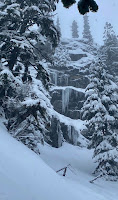
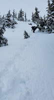
 We saddled into snowshoes right from the parking lot. The first 5 minutes were flat-ish. Soon, the grade picks up and we had to stop to take layers off. I kept on my rain jacket. Light fluffy snow. Soon, no more tracks. Going up treed slope, very steep. At one point, one by one, we started to slide down. D slipped down to W, and W slipped after the impact, and stopped by my arm. H slid farther down, was caught by a tree. There, K decide to turn around. Her husband M went down to her, on the way, slipped to a tree. Seeing all this, A decided to bail. But she came with C, so C had to downclimb to give her car key. But she didn't come back up. Only one hour in, we lost half of the group. The rest of us took off snowshoes, put on micro-spikes and ice-axes. D put on crampons. Too bad, I brought a helmet, but not crampons :(
 The trail goes east side of the creek. Many icicles, water was still running. We had to drop down to cross the creek. Then go straight up again. Once left the trees, the view was very good. We were above the clouds. The slope is relentlessly steep. But I didn't sweat much (my progress is slow - I was the slowest of the 4), nor drinking much (my water bottle was inside my backpack, hard to reach). Many times, without proper foodhold, I had to punch the ice axe down, and pull myself up. My arms got very sore.
 The upper ridge was quite windy. When the gust was blowing, the snow was kicked up and hit my face like bullets. At one point, D sat down and not wanting to move, saying that he couldn't see anything (his sunglasses were fogged up). It was cold. I put on a fleece inside my rain jacket. The fingers of my ski gloves were frozen hard, so was the strap of my hiking pole. My pole was frozen, so difficult to shorten or lengthen (one tip: do not use ski brasket on steep hills, use smaller brasket on your pole. Ski brasket makes your pole slip). I had to take off my knee strap, because it couldn't stick any more. There, we met a couple coming up in crampons.
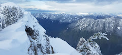
 12:30pm when I got to the top. 5 hours to do less than 2 miles! H was heading down. W went down earlier. The view at the top is, of course, fabulous. It's a twin top. The farther one is slightly higher. Be careful to stay off the edge. D and I went to the true summit.

 Took a few photos and headed down shortly before 1pm. No place to hide from the wind.


