 Drove to Staircase ranger station (~2 hrs), was told that the trail to the loop was closed due to fire. Rerouted to Dosewallips trail head. The road was in good shape, but stops ~5.5 miles (~2 hrs) to the trail head. A big landslide, probably 10 years ago, cuts the road short.
  A very pleasant walk, next the roaring West Fork Dosewallips River. Took too many water photos. The camp grounds at Elkhorn and Dosewallips are completely abandoned and overgrown with vegetation.
This trail is full of bridges, big and small. All nicely done. Passed a fork to Grey Wolf @1.5 mile (~1 hr), Big Timber camp (~1:15 hr), Diamond Meadows (~1:15 hr), arrived at Honeymoon Meadow (3527 ft) in another 1 hr @7pm, finally more or less out of the trees. All camp sites are to the left of the creek, without a good view of the meadow. Total ~14 miles.
9.4. Saturday.
 Blue sky with increasing clouds. 1.5 mile (~1 hr) reached Anderson Pass @4464 ft. A 0.9 mile side trail to the north and up a huckleberry hill leads to a blue tarn in front of Anderson Glacier. Beautiful. One tent was pitched at a smaller pond. Encountered 3 groups, 9 people.
 1 hr later, reached the junction to Enchanted Valley trail (~3010 ft). From here is a 3.2 mile, ~1000 ft drop to the valley floor. Many waterfalls along the way. The valley is large and flat, grassy, many elder trees. Idyllic. The chalet is locked, except one room. Saw 2 couples. Back to the junction, headed south for ~35 minutes, camped above the White Creek meadow, good view to the northwest.
9.5. Sunday. Blue sky, with increasing clouds.

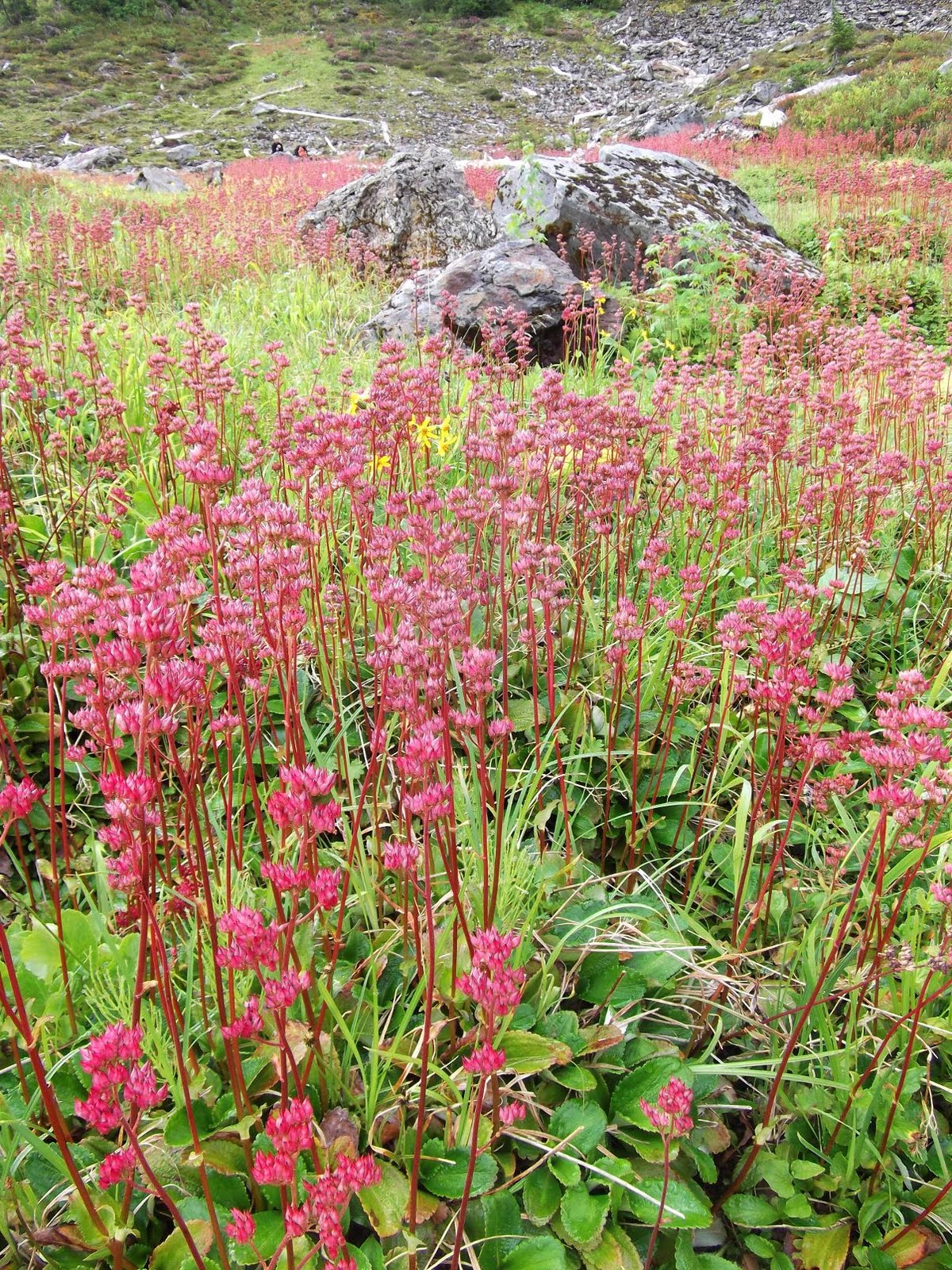 My favorite day. Above tree line most of the time. Flowers covering the slopes. Saw 5 bears, one of these was a little guy scared and ran up a tree in a second. Headed over to O'Neil Pass @4950 ft, ~4 hrs. Saw a father and son below the pass.
Marmot Lake is ~1 mile east, a few camp sites with bear wire, not close enough to water.
 The lake itself is a bit disappointing. The area is nice: lush meadows dotted with the last summer flowers.
  Headed north ~0.5 mile, up ~500 ft, to the junction of Hart Lake / LaCrosse Lake. Found a very nice camp site in the lovely heather meadow close to the junction, above a tiny pond (not close enough). Good view over Mt Duckabush. Hart Lake is 0.4 miles west. Big, deep blue, very nice, good camp sites close to water. LaCrosse Lake is 0.8 miles north, not as great as Ira Spring claimed, camping available (no bear wire). By now, the clouds were rolling in in mass.
9.6. Monday. Clear sky and stars before midnight, then rained all night and all day, lightly.
 Every leaf turns into a picture, coated with water beads. ~3.5 miles and close to 2000 ft drop, a bad water crossing, to the junction with Skokomish river (to Staircase trail head, ~2 hrs). A difficult water ford immediately after the junction. Then it's an easy walk of 1.7 miles to the junction with Duckabush river @2600 ft (~1 hr). Now it's 3.3 miles up to LaCrosse Pass @5566 ft (~2.5 hrs).
  Ran closely into 2 bears just below the tree line, and another 2 north of the pass. The scenery around the pass is very nice, lots of flowers, but LaCrosse Mt is shrouded in cloud. 3.1 miles and 2000 ft later, reached junction with Dosewallips river (~2.5 hrs).
Ate dinner at Honeymoon Meadow under the rain. Not tired, but my waterproof shoes are completely wet. I was determined to end the misery today. So walked another 14 miles to the car (~5 hrs). Arrived ~11pm, completely stiff and sore. That made a Marathon: ~26 miles. The only human saw today is a couple at Diamond Meadow warming next to a fire.

 Practicality: Dosewallips trail head is almost 3 hours drive from Seattle. ~20 minutes left of Hwy 101. Ferry might be faster. (Staircase trail head is 45 mins closer if driving from Olympia.) Total distance without side trips: ~51 miles. Adding all side trips (without backpack): ~63 miles. Lowest elevation ~700 ft, highest ~5566 ft.


 First Thursday at Seattle Art Museum. Picked up my temporary membership card. A tall man made entirely of green bottles (beer?) stands by the staircase. The new exhibition of


