 A sunny Monday afternoon, on my way down from Canada. Parked at Yellow Aster Butte trail head (~5 cars), walked up the 2.5 miles of the remaining gravel road to Twin Lakes. Good view all along, and never stops. 1 hour later reached the first lake. A couple of camp sites next to the lake.
Continued around the first lake, Winchester Mt trail starts in between the two lakes. Another ~5 cars here. Just 2 miles to the lookout, but took me 1:20 hr up and almost an hour down. Easy grade, but after the first mile, walked on snow, and then on ice. A bit tricky at some points without hiking poles.
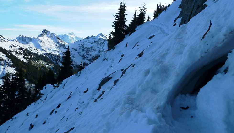 Close to the top, it's possible to see Canadian peaks. A couple and a dog occupied the lookout equipped with a table and benches. Their bulky camera was sitting on a tripod waiting for the sunset. Excellent 360° view.
Some huckleberry trees. The color cannot match Yellow Aster Butte. No berries. Caught a ride back down from four chatty local girls, who told me that the road condition has greatly improved due to the reopenning of gold mining further up the road.
Direction: Mt Baker Hwy 12.6 miles east of Glacier ranger station. Left on Twin Lakes Rd next to the DOT garage. 4.5 miles to Yellow Aster Butte @3600', another 2.5 miles to the lakes @5200'.
Border crossing at Sumas 11:35-11:58. Estimate on the LED board: 10 minutes (vs. 80 minutes at Peace Arch). ~1:10 hour from the border, or 30 minutes from the ranger station (closed M-Th).