
Friday.
 Traffic. Arrived at the trail head close to 8pm. Saw at least 6 dark figures emerged from 2 cars with head lamps. Hiking at night on an unfamiliar trail is not a good idea. Missed the turn and arrived at Lake Stuart after ~2 hours. Saw at least two other tents. Realized the mistake, set alarm to 7:30am.
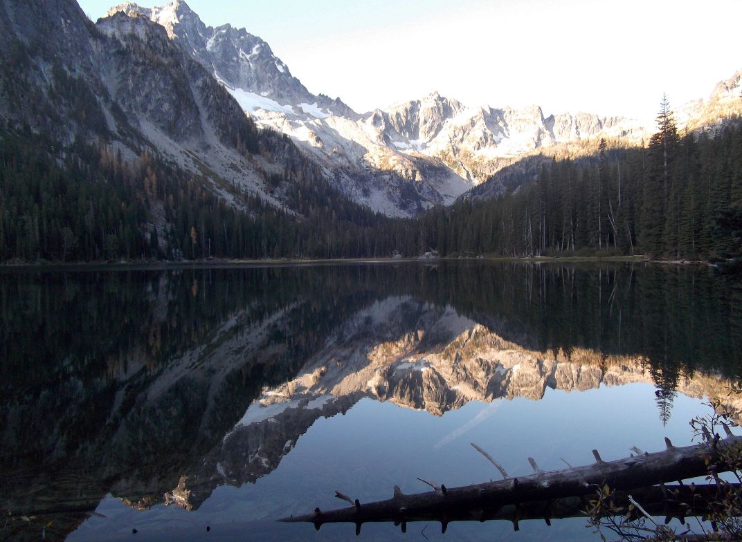
Saturday. On departing, the morning sun just was moving across the lake. Set against steep (green) hills, hanging ice fields on Mt Stuart, Lake Stuart is quite lovely!
Back track ~1 hr (passed a few camp sites, a bushy meadow). Turned right (left, if coming from the trail head, maybe 20 minutes past the double log bridge) on to a small side trail (a small sign was fixed on a tree) towards Colchuck Lake (~5600').
 A (shorter) bridge soon after, then sharp turn over a small boulder field. Then, the slope picks up. 1.5 hrs and many zigzags later, reached Colchuck. Walked along the boulders next to the shore to the right for ~0.5 hrs. Refueled at a small sandy beach (a good camp site). Now the real climb starts. 2200 ft gain in one mile. Loose gravel at times (very slippery, especially the upper half). Had to cross a running creek to the left, where rocks were coated with ice. Adding on the treachery is the number of hikers closer by. Maybe 30 at the same time. Anyone can set a rock loose and hit someone behind. Not easy: took my street shoes, both hands (and by now somewhat shaky legs) over 2 hrs to reach Aasgard Pass (~7800', @~1:20pm). Exellent view to the north, including Mt. Baker.
Enchantment basin starts soon. Icy Tranquil Lake, green Isolation Lake. Larches and red and yellow low lying plants came to view ~30 min later. Set up camp in the middle of the middle basin, surrounded by a dozen larch trees (almost bare branched, but carpeted the ground golden), only steps away from a pond with running water. Cooked some noodles, while watching the hiker traffic going both directions.
 ~3pm, took off with just water and a jacket to the lower basin and more larches. Walked along the cold Inspiration Lake to the large inviting Perfection Lake. At its north end, branched cross the yellow meadow (slightly swampy) to the left, up a knoll towards Prusik Peak. Soaking in the view on the top of the knoll: two deap blue lakes (Shield Lake?) to the north and more mountains beyong, Vivian and Leprechaun Lakes to the east close by, a distant snowy mountain (St. Helens?) looming over the hazy valley to the south, Pusnik Peak is up close and vertical (looks unattainable without proper rock climbing gears). Turned back ~4:30pm. Saw a group of 4 coming back from the climb.
Sun went down quickly. By 6pm, only the top cliffs were casted pink. Still a few hikers were looking for camp spots, a group with 3 tents set up next to ours. Over the main trail, at least 5 more tents. I knew it would be busy, but not this crowded.
Sunday, bright sunshine.
 Warm if you sit in the sun. 2 goats (mother and child) with heavy coat walked by each tent site. With a background of golden ground and blue sky, they looked adorable. Depart ~10:30am, took almost 2 hours going down Aasgard pass. Reached the car ~4:30pm. Stopped by Leavenworth for some sausages and OB beer. At home shortly after 8pm. Fairly relaxed schedule. Saw this shocking news: A hiker was killed by a mountain goat in Olympic national park on Saturday!
 Practicality: Hwy US2, 1 miles west of Leavenworth. South on Icicle Creek Rd. @mile 4, it's the Snow Lake trail head. Pavement ends. @mile 8.5, turn left on #7601. 4 miles to the end of the gravel road (in good condition), or 1 mile after the bridge. This is the Lake Stuart trail head. Very large parking area. ~50 cars Sunday afternoon each, here and at the Snow Lake trail head.