
Canyon de Chelly National Monument (2hrs SE of Monument Valley) is a living monument, one of the longest continuously inhabited landscapes of North America. You can gaze down from the rim at 12th century Puebloan cliff dwellings and white sheeps grazing at the same time. The park consists of two major canyons - Canyon de Chelly (pronounced as duh shay) in the south and Canyon del Muerto in the north.
The South Rim Drive climbs slowly. It first stops at the Tunnel Overlook, where a short narrow canyon feeds into Chinle Wash. The 2nd stop overlooks the junction of Canyon del Muerto and Canyon de Chelly, as well as two small Pueblo ruins.
 The 3rd is your only chance to descend to the canyon floor without a guide. White House Ruin trail (600 feet drop and 2.5 mile/rt) winds along the canyon cliffs, passes by some Navajo homes, acrosses Chinle Wash, and ends in front of the 80-room White House Ruins (1040 - 1275). Try to spot a couple of ancient drawings made with the desert varnish (formed by seeping water reacted with iron in the sandstone). The next stop overlooks the aptly named Sliding House ruin. The last, at mile 17, and the most impressive overlook is named after two freestanding 800 ft pinnacles called Spider Rock.
The North Rim drive is about 15 miles. Antelope House Overlook is named after the paintings of antelopes next to a cliff ruin, made by a Navajo around 1830. The last two stops are next to each other: Mummy Cave (two mummies were found in burial urns below the ruins) which was occupied from 300 to 1300, and Massacre Cave (Spanish military killed 115 Navajo here in 1805).
It took us close to 5 hours to go through all these sights.
 After a brief stop at Hubbell Trading Post (36 miles south on US 191), we drove another hour to the Petrified Forest National Park off I-40. The north part of the Park is an area of badlands called Painted Desert: expansive red barren hills. Dinosaurs fossils have been discovered in the vicinity.
 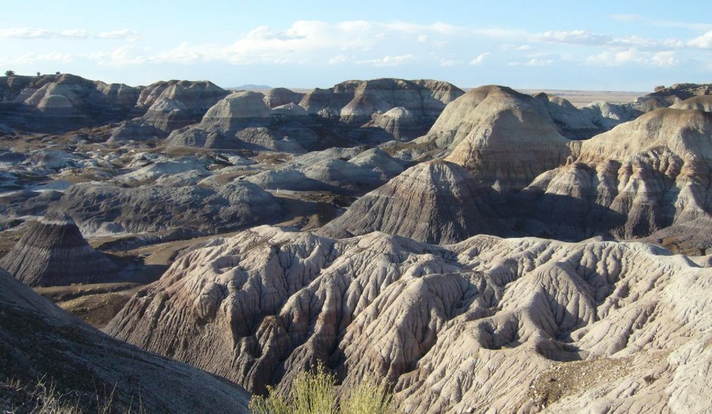 Driving along the park's 27 mile road across to the south of I-40, you came across blue and dark barren hills, a bit sinister. Aptly named The Teepees, and Blue Mesa. These are erosions colored by manganese, iron and other minerals.
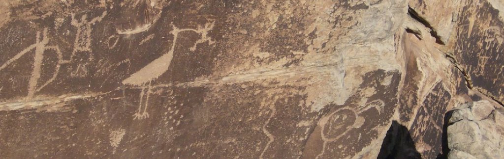 The park's largest archaeological site, Puerco Pueblo, contains the remains of homes (complete ruin) and lots of petroglyphs on the stones. Next to this stop is Newspaper Rock, a rock covered with ancient logs.
 At Agate Bridge stop, you'll see an unbroken petrified log laid across like a bridge. At Jasper Forest and Crystal Forest and further south, the land is littered with large crystallized tree trunks, remains of a lush Triassic period. Rainbow Forest Museum close to the south entrance of the park is also the start of several short trails dotted with petrified woods.
Two hours later, we managed to arrive at Josephine's at Flagstaff in time for a wonderful dinner in this cozy little house. A practical note on hotels: do NOT stay along the east route 66, as it's parallel to a train track. Very noisy.