3/26, Friday, I ate a very early meal, and headed out ~5:15pm. Met V at a lightrail station an hour later. Drove to Marble Mount Sno-park. Traffic at Tacoma and JBMC. Couldn't even reach the trailhead parking. Cars were already parked along the road, when we arrived ~10pm. 40°F. Warm. Cars were still driving in and out, and people walking in headlights. We tried to settle down for some rest. But it was very busy. Some talking loudly when they walked by. I really don't understand why they were walking around. A few tents popped up on the road, but most slept in their cars. I took the front seat, V folded down backseat, and slept in the trunk bed. I don't think I got much sleep, noise and light throughout the night. I had to put on earbud and played podcasts to block some noise. Eventually I did pass out, until 1:10am, when V got up to pee. Well, we might as well get up, even though our alarm was set to 1:40am.
3/27, Saturday, V cooked water for breakfast and more for his thermos. I ate cereal in cold almond milk (I didn't bring a stove, was taking only a day pack). While waiting for V, I ate a bar. ==> This, it turned out, was not enough, because I didn't eat since 5pm yesterday. V's pack was heavy, so we went through it and dumped a couple of items.

Walked 0.3 miles to TH, filled out climbing permit, signed the registry. Put on microspikes, and off we went at 2:20am. The forest was dark, but the trail is straightforward. No wind in the forest, not cold. I had to make stops to take off layers, twice. I was down to just my thick base layer. V had to remove his gaiters to cool off. His glasses were fogged up so badly, that he had to pack it away. We were, in fact, walking in clouds. When we finally left the forest, a little bit of wind, so put on a shell. Soon, we broke out of the clouds. It was beautiful: the near-full moon was shining brightly. I felt like walking in Ansel Adams' black-white photo. This photo is from V's new iPhone. We could see everything clearly, I even switched off my headlamp.

As soon as the elevation picked up, I was feeling lethargic. After 2nd re-fuel, I was back to normal, and we were making good time. However, I lost my water bottle at some point. I had a thermos inside the pack, but only ~0.5L. V gave me some water, and I also ate snow (very hard).

The horizon started to light up slowly after 6am. Sun rose beside Mt. Adams. Wind kicked in, from time to time. Forecast was 25mph, more or less accurate. The slope wasn't icy, just hard snow. The spikes worked well. Saw a couple of people on snowshoes, many on crampons. I made to the rim ~7:02, maybe 5 minutes after sunrise. The view of Helens' crater and to the north is always amazing. Right now, the rising sun made everything glow, even more beautiful.

After a long break in our puffies, we continued towards the real summit. There was a traverse on a ~45° slope. No one had ventured over in recent days. I was afraid of avalanche. V was convinced that the snow was stable. He's determined to get to the true summit, as he climbed Helens this Jan already, but didn't go to the summit that time. We stopped to put on crampons, helmet, ice-axe. He went ahead first. Here, you can see our footprints.

Before the true summit, this small section has delicate snow patterns. After that, old footprints looked like sculptures, raised from the snow surface, instead of depression in the snow. Very odd.

We had the summit to ourselves. The red arrow shows where most hikers ended at. Took another break here, wind was on and off. On our way down, we met one hiker coming our way. Saw a couple of others contemplating the true summit. We went down directly to join the main trail. There, I packed away crampons, helmet, put back on microspikes. So many people on the slope, it looks like ant hill. On the lower slopes, we were able to glissade a little bit. In the afternoon, the butt tracks would be more established and smoother. Right now, the bumpy ride made my butt hurt. Sun was shining, getting warmer, postholed a bit to let uphill traffic go. At some point, we realized that V lost one trekking pole. Also a conincident that I saw Avinash on the trail going up, among a thousand others.
Still chilly in the forest. I had to put my fleece back on. Back at the parking lot ~12:20. Repacked, and drove back to the TH, hoping to see if anyone found V's trekking pole. We saw a pair of shoes: how is it possible to lose your shoes? I didn't count how many cars today, but the last car was 1.8 miles out! Thankfully, no one was ticketed.
Some traffic again on I-5 in the same places. Got to my train station ~4pm, very sleepy. After cleaned up and eaten, I slept for 10 hour straight.
 I have never made it to Camp Muir. So wanted to try it. It's a good workout. A lot of folks had the same idea. A line of people were marching to Camp Muir on this sunny day. More than half of these are skiers.
  View up to Rainier and down to Tatoosh Range (with Mt. Adams behind) is excellent. Only from higher up, we saw St. Helens. The temperature significantly dropped around 9000'.
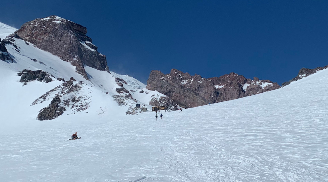 At 2:45pm, I opted to have a lunch break instead of pushing to Camp Muir, which needs another 15 minter or so. Reason: the gate at Longmire closes at 5pm. Still winter season. Coming back was fast and easy, a little bit of post-holing. Made to the gate at 5:01.
  On the way out, saw a Cascade Red Fox sitting by the tree above the road watching the cars leave.


