10/18, Friday. I went to "Cappy Thompson in conversation with Margery Aronson" at Convention Center, ARCH building, the event space between the administrative office and room 205. I emailed the event organizer weeks ahead.
It was really just a talk by Cappy Thompson on her experience in the early days of Seattle glass art scene, the founding time of Pilchuck school, and her works.
I did enjoyed her talk.
Followed by a brief talk by Margery Aronson. She is a curator of various exhibitions, and was involved in glass art scene in PNW for over 40 years.
Then, Margery gave us a tour of the glass arts in exhibit on the 2nd floor right outside of the event space.
She could remember who made each piece. One of these (the black vase) is by Cappy Thompson.
SAM open house 6-9pm.
Even though guests had gathered in front of SAM's door, they didn't open the door until 6:05pm. That's very disappointing.
The advertised "delicious cocktail and snacks" are pretty pricy.
The "relaxing music" is very loud, so loud that our tour guide made repeated futile attempts to escape from the sounds.
I really enjoyed this tour of Calder in motion exhibition by Jose Carlos Diaz, the deputy director for arts at the museum.
The new exhibition of Joyce Scott's beads work is colorful, but looked all ugly, if not scary, to me.
I did join the tour which softened my dislike.
This is a large exhibition with many articles.
There're 3 tables set up in the main lobby if you want to thread some beads yourself.
Only when I got home Friday night, did I realize that there is also a bus tour of the studios this weekend.
Too late to buy tickets. Yes, it's now $20+fee, instead of free last year's.
10/19, Saturday.
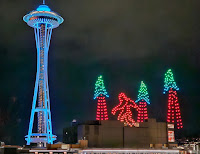
I went to Space Needle to wait for the tour bus, hoping for last minute cancellation.
With a paid ticket, everyone showed up.
The organizer also brought 3 unpaying "friends".
Surprisingly, there is a last seat. The driver called his boss, opened a ticket online, which I purchased there and then.
Total 25 passengers, including the 2 tour guides.
Saturday's tour is north of downtown, all new to me. Tomorrow's is south of downtown (which I went last year, so many repeated studios).
First is Morgan Madison's studio, which he built behind his house.
A very nice building. He cuts sheet glasses, and arrange them in a rectangle flat, augmented by powders, and then fire in the kiln.
Geometric, precise patterns. He talked about the processes, very nice.
Next, Carol Milne studio.
She makes knit glasses. She talked about her process: "knit" wax curls, plaster, and then pour melt glass.
Interesting.
3rd, Bazaz Studios.
She paints, silkscreens, acid etching on to flat glass, then fired in kiln.
We were given some extra time to go to Top Pot Donut across the street for a bite and use the restroom.
4th, Karen Seymour's home.
First we went down her studio in the basement to see her fancy kiln with precise temperature control, which she talked about the annealing, and the natural thickness of glass is 6mm (not sure why).
Back up in her house (note of the good view of Lake Union from her window), she has many items for sale, as well as other artists who brought their products to sell.
Last on today's tour is Milo Snyder.
He uses 3D printer to make his design, then plaster, then fire in the kiln.
He makes lamp covers, pendant lights.
A woodwork artisan was selling his bowls of different tree species in the yard.
Overall, I enjoyed the artists talking about their craft, and seeing their working space.
However, this year's tour guides are more of chaperoons.
They are enthusiastic, but didn't tell us anything regarding to glass during the tour.
One of them worked at Chihuly's Museum of Glass for number of years.
Oh, yes, when the bus drove by Chihuly's staging workshop, they did talk about it.
I very much prefer last year's tour guides.
Another difference is that quite a few passengers are out-of-town tourists. I guess Refract this year did much better advertisement.
10/20 Sunday. Went to the closing party.
Not much of a party. Cedric Mitchell and his friends were making a large vase. More people to watch them. But no lecture or explaination.
Some crackers, chips, cheese, grape.
I like these glass pumpkins.
Sunday, October 20, 2024
Saturday, October 19, 2024
2024.10.19-20. SLU's Fall for pumpkins
10/19, Saturday, before my Refrac bus tour, I stopped by Amazon for its Fall For SLU event and pumpkin patch (11-2, repeats on Sunday).
Spread over 2 plazas. Music on both. Attracted quite some people, half are Indians.
A few vendors (carving on glasses, coffee, bakery, knitting, olive oil, scented candles ...).
Fare Start provided fresh (squeezed right there) apple juice, and produce (apples, pears, chard, carrots, beets, different varieties of winter squash). None of the folks taking these free produces are people-in-need. I didn't see any homeless or visibly poor.
This year, there's a maze, and many clay (blue) pumpkins, a table for you to paint your pumpkins.
Saturday, October 12, 2024
2024.10.12. Stiletto Lookout
10/12, Saturday, 11 of us met at Northgate at 6:30am. 1 person overslept, didn't show up.
My driver drives a Tesla, and it was 80% charged. In order to make our way back with certainty, we stopped in a supercharge in Burlington for half an hour to top off her battery.
Driving through Rainy Pass on Hwy-20 is surreal. So many cars parked along the highway half mile out both directions, at least, many of them couldn't fit out of the white edge line. Thankfully, the Bridge Creek TH parking area wasn't overflowing. It was full when we pulled in. But our hike to Stiletto Lookout starts on the south side of the highway. We parked in the pullout by the highway.
Last time, when O.K. and I came here in on July 24th, 2022, the creek crossing was too swifty, and we gave up. Now, it was such an easy crossing. Some hikers in my group brought watershoes. Going south on PCT for 10 minutes, and take the left fork, crossing State Creek. Shortly after, take the right fork (Stiletto Spur trail), crossing Copper Creek. This is also an easy crossing now. It's all slightly going downhill. Again, shortly after, take the left fork. Started gaining elevation, and then zigzag up. Fall color, mostly brown grass, larch across the East Fork McAlester Creek valley, not on our side. Once we were above the tree level (~6000'), started seeing red huckleberry color, no berries.
Finally, at about 6800', we are in larches. Good view towards, yes, hwy-20. Finally, I reached the lookout site. ~4 people in my group were already there. Long broad ridge, easy to spread out. I was starving, past 1pm already. Yes, I ate 2 bars on the way here. Considering my breakfast was at 5:30am, this is late lunch.
After chowing down my sandwich, I scrambled down to follow the ridge to the next bump. Great view looking back. Stiletto Peak looks too daunting to try. A few in my group also came over. I went back to wait. Chatted with an Indian girl and a Polish guy. We stayed here for about an hour. Met a few backpackers. I think I'll come here in the future to camp at Stiletto Lake, and maybe loop back from Copper Pass.
Headed back as we came. Maybe ~3300' gain, a little less than 10 miles RT. Fairly easy and straightforward. My driver dropped me off at my building, since she also lives in downtown.
Friday, October 11, 2024
2024.10.11. The Making of Jubilee
10/11 Friday. 7pm. Opera Talk: The Making of Jubilee.
The creator and librettist Tazewell Thompson discussed origin of his play and then this opera on Fisk Jubilee Singers.
Thompson is such a great story teller, I really enjoyed this talk, even thought I arrived a bit late.
2024.10.11. Belltown Art Walk
10/12, Friday. Belltown Art Walk happens on 2nd Friday of the month.
Seems less galleries now.
I visited Basecamp and Slip Gallery today, very taken by Rooted in Joy exhibit by Jessie Lipscomb.
Beautiful sunset when I walked home. It was 6:38pm. It's getting dark early now.
Monday, October 07, 2024
2024.10.7. Enchantment Peak via Aasgard Pass
I did Enchantment thru-hike in 2018 on a Saturday. The crowd was so bad, that I vowed to never return -- well, not in weeekends.
Since then, I visited Enchantments on a Friday via Aasgard Pass (still busy), and via Crystal Lake drainage (not a soul).
Monday is better. No crowd.
10/7. Monday. We tried to checkout at ~6:10am, but the front desk was closed. The parking lot at Colchuck TH was only half full, but plenty cars were parked illegally along the road. Filled the registration. Started hiking ~6:50am, light enough not needing head lamp.
We were passed by a few runners. Not crowded. Reached Colchuck Lake before 9:30am. It's in the shade, so no color. We are both a bit out of shape, also I have knee problem, and my partner had stomach issue that day. We were not fast, but making good progress. Took a break overlooking the lake. A few campers here and there.
Getting to the end of the lake, and then hop the boulders to get on to the base of the gully for Aasgard Pass. This took at least half an hour -- would be headache in the dark when I returned. This is the west slope, so in the shade before noon, even though the lake was illuminated more and more as we gained elevation. Took a few breaks. Especially under a small waterfall with icicles. Broke some ice into our water bottles. Note, need to go *right* below this waterfall. Here, we were already above a grove of shining golden larches. Reached Aasgard Pass ~12:40. 7800'. More mountains to the west, blue water blow.
Crossing the pass, a lot of rocks. Now we were officially in the core zone of the Enchantments. First tarn, more of less frozen. My favorite lake is next: Isolation Lake, because there'a path that you can walk between two lakes, and also the permanent ice hanging on the rocks. We took a break and filtered water here. Only a few small larches here. A little too high for them ~7500'.
Walking across the upper basin, passing 2 more ponds, slowly loosing elevation. As we go down along the main trail eastwards, more and more larches, and larger trees. Perfection Lake is in such a splendor, true to its name. I love the larch needles that still have a green tint. Took a food break at its shore. Here, the two of us part our ways. My partner continued the through hike down to Snow Lake TH, 10.5 miles away, 6000' down. I was to go back via Aarsgard Pass, 7.5 miles away, 1000' gain, 4600' down. My goal was 9pm. It's already 3pm.
I still wanted to climb Enchantment Peak (which I visited 3 years ago), which adds another 1000' gain. I'm running short of time. I figured that going down from Aasgard Pass at 6pm should be okay. I thought sunset was at 7pm. The color going up to Prusik Pass is fabulous. Not just the golden larches, a lot of red huckleberry bushes (no berries). Here's the view of Perfection Lake below, and the area west of the pass.
Instead of going to Prusik Pass first to catch the trail, I short cut it, and heading west earlier. I more of less found the trail fairly soon. May have stayed a bit too high (climbed a small false summit unnecessarily, but snapped this photo). Was debating turning around at 4pm. But the summmit was right there. The top rock requires some careful movement. I left my backpack and hiking poles below. Reached the summit at 4:30pm. View is 360° excellent.
Heading down at 4:35pm, saw footprints in the sandy ground going down to a gully. I decided to follow that, which goes above Inspiration Lake, saves me some elevation loss and gain. It was steep, but not too dangerous. Then it's easy cross country (no more visible track), to Lake Olrun area. Good view of Inspiration and Perfection lakes below. Finally I hit the main trail, and started seeing people again since 3pm.
Reached Aarsgard Pass at 6:10pm. 5.5 miles and 4600' loss till TH. I thought I was only a little behind, 3 hours might still be possible. But I was so wrong. Totally under-estimated the time hiking in the dark, especially going through camping areas. Sunset today was actually 6:35pm. I made a repeated (did this last time coming down Aasgard Pass) mistake following a track to the right of a flat meadow. Scrambled down the icy waterfall which we filled water on the way up. It was dangerous, I slipped on the slippery rock, thankfully only a few feet. Filled my water bottle again with icicles here. Going down to Colchuck Lake was not too bad, even though I had to turn on headlamp half way down, and not entirely on trail.
Reached the boulder hopping area ~7:30pm, slower than I expected. However, at night, hopping rocks took longer. Then, many side tracks going to camping areas and day use areas led me stray. The main trail wasn't all that obvious even during daylight. I wasted precious time correcting my track. By the time I was leaving Colchuck Lake, it was almost 9pm. Got to the TH just before 10:50. Hopped into the car without changing my boots, and drove out like a mad person.
Shortly before reaching Snow Lake TH, I saw my partner walking my way. Not sure why. It was already 11:10pm. 2 hours wait would made everyone angry and wary. Changed my boots with sand and small rocks falling out. Ate my sandwich, I was starving. I didn't stop for food hiking out.
Still 2+ hour drive back to town. Thus ended my saga of day climb to Enchantment Peak. Will I do this again, yes, but need to hike faster. Need to turn around at 3:30pm, go down Aasgard Pass by 5pm, so to assure going though the camping area around Colchuck in daylight.
Sunday, October 06, 2024
2024.10.6. Sculpture Rock + Leavenworth OctoberFest
10/6, Sunday. I got picked up at 9:30am. Not early, but I only slept for ~4 hours. Same last few days. Totally lack of sleep.
We were heading to Leavenworth. I have reserved a 2bd condo for Sunday night for an early morning hike on Monday.
We took I-90. Checked out Sculpture Rock on the way, off Hwy-97. Swauk Campground is already closed for the season. Unable to drive in. I'm worried of potential break-in, so we took turns. I walked ~1 mile to the end of the campground, got the trail to the rock. Instead of the loop, I took the same way out (shorter), so I could explorer a possible closer access. Found a highway pull-out closer to the TH. Walked back to the car on Hwy-97, drove to this pull-out, and waited for my partner visiting the rock.
The short trail is half flat, half going up a treed hill. Then suddenly, you see this large eroded sandstone jutting out of the ridge. Quite interesting.
Continued towards Leavenworth. Stopped at a farm stand, bought a box of apples+pears, $23.
Checked into Worldmark Leavenworth. Large ground. Older style. Not only 2 bedrooms, there's another wall bed in the living room. Walked to town via Waterfront Park along Wenatchee River. Shared a litre October Fest beer and a Schweinshaxe at Ludwig's. The skin is a bit tough to chew. Meat is cooked right. Quite a lot for 2 people.
October Fest here seems only for Friday and Saturday. The beer garden was deserted on this Sunday. Plenty tourists walking on the street. Pretty warm this afternoon. Checked out the art vendors before return. Drove to Dan's market for some meat, cheese and bread, to make sandwiches for tomorrow. Went to sleep early, set alarm for 5:30am.
Friday, October 04, 2024
2024.10.4. Overlook Walk opens today
10/4, Friday. Went to Pier 62 vie the newly openned
Overlook Walk for sunset.
A lot of people today.
A few entertainer on stilts or animal clothes posing photos with you.
A band playing.
The walkway has many benches, plants. What I like the most is the pattern on the pavement, and of course the view of Puget Sound.
Pier 62 itself doesn't offset anything special. Two food trucks were making good business now.
Wednesday, October 02, 2024
2024.8.29. Glacier Basin at Mt Rainier NP
8/29 Sunday. Temperature has cooled significantly (compared to yesterday). Supposed to be high 41°F today at Bourough Mt, our intended destination in Mt. Rainier National Park.
9am pick up. The entrance to Sunrise had a line, but not too long. We were informed that there'd be an hour delay to Sunrise due to an accident. At the turn to the White Rock campground, the road is barricaded ahead. We didn't even see the accident. No one was able to go to Sunrise. Parked at the far-end of the campground (this half of the campground is closed for the season, so are the bathrooms). Headed to Glacier Basin instead. We were here only once before, had a fond memory of the trip. In fact, we camped at Glacier Basin. It was earlier in the season, the campsites were all covered by snow, so had to camp outside. Walked up to Camp Schurman in crampons and a glissade back.
The trail starts in the trees, passing the turn to the morain, and then the turn to Sunrise Camp. A woman was posing for Instagram shots at one of the openings between trees. Some pearly-everlasting, thistles, the last of asters and fireweed. Not many. Not much of fall color here. Passed and being passed by some hikers, including one Becky-like gentleman with a giant backpack. Once we continued after "end of maintained trail" sign at Glacier Basin camp, we were the only people. The view is very getting better and better, however, Mount Rainier was blocked mostly.
The trail for Camp Schuman is clearly visible. We followed it into a grassy meadow (very pretty), and then into pile of rocks. There, multiple tracks, all leading to the glacier. I decided to climb up to the ridge, and the slope was getting quite steep. I stick to areas that have plants here and there. At some point, I decided to turn around. Here, I saw quite some gentium and yarrow still blooming. My partner turned around earlier to check out a track we could see earlier. Later, I was told that it leads to some mining structure, and then the track disappeared. Coming down from there is dangerous, more loose ground and steep. An adventure in this rocky amphitheater.
Hikign out, started to see people again. Back on the road, it was cleared, so cars were driving up to Sunrise.
Some traffic on the drive back. Got back to Seattle ~7pm.
Saturday, September 28, 2024
2024.9.28. Alta Mountain from Rampart Ridge Backdoor
9/28, Saturday. 3 of us met ~6:30am, heading to Rampart Ridge backdoor.
Reached the TH ~8am. The last few miles are brushy, some potholes.
There were already some color at the TH. Thick fog hanging in the valley. Quite pretty. The trail is rugged. Half an hour later we reached the junction to Lake Laura. I took the short spur to snap this photo. It's very small.
Continue on, reached Lake Lillian in 20 minutes. Found a couple of tents here. Circling the lake has some problem. These's a faint trail going up into the trees to get around a large boulder. We actually scrambled over on its surface. Needs care. On the way back, we took the long detour in the trees to avoid this sketchy boulder.
At the north end of Lake Lillian, zigzag up a steep hill. Good trail, so no problem. As we got higher, great view of the lake below and Mount Rainier in the distance. Once reached the ridge, need to head left. Somewhat faint trail, but it'll become obvious later. Saw a grouse here. S.W. went over and down the ridge. Me and Aiden followed the main trail. Took us sometime to regroup. S.W. claimed that he found a great campsites. While waiting for S.W. to scramble back up, Aiden coached his g.f. on some of her homework on the phone! Here, huckleberry galore.
Continued on, we met a group of 4 people at a creek crossing. Didn't even notice the trail fork, took the left track into another small lake basin with nice fall color. Would be a nice camp spot. Getting over and steeply down to Rampart Lakes basin. Started seeing many backpackers. Plenty lakes to choose for the night. So many side trails: need a GPS map here.
Passing all these lakes, continue into the trees. A major trail junction (no signs) to Rachel Lake. We stayed straight gaining elevation. Soon can see Rachel Lake below. At the next junction, didn't even see the junction, almost went down to more lakes. Back tracked, going up aggressively for a short while.
From now on, it's on a ridge with lovely fall color, view to both sides. The peak looming head is not Alta Mountain. After this peak, it is a fun, easy scramble. Maybe 0.5 miles. Saw quite a few people both ways.
The summit has plenty space to spread out. Great view, so many peaks, and yes, I-90! Interesting to see where I hiked last weekend. You can see PCT cutting into the slopes to our west. S.W. stretched his Swaraj flag. It took some time. He completely ignored his earlier demand of turning around at 12:30. We left at 1pm.
On our way back, we took the eastern route south of Rampart Lakes. It is quite different, more open, better track. More cloudy though. One section, the color was especially good.
Back to TH ~4:30pm. They decided to stop at North Bend for ice cream. Some traffic on I-90. Back to Belltown ~6:30pm.
This is a keeper. Fabulous color. Not too many people. Plenty tarns and huckleberries. Maybe I'll come backpacking here next fall!
Bright rainbow when I was walking home.
Subscribe to:
Posts (Atom)