Saturday 6/7, high mid 20s-C (70s-F), low in single digit (low 40s-F), early start. At 5am, I was already waiting for my ride, B, who arrived ~5:25. ~6am, picked up M near Gateway. After a stop for bathroom and coffee, we arrived at Independent Mine trailhead at ~10:10, at the end of a one-mile bad road off FR 42 (nicely paved Canyon Creek Rd - off Hwy 26, signed to Walton Lake / Big Summit Prairie), some 200 miles east of home.

We hiked up to
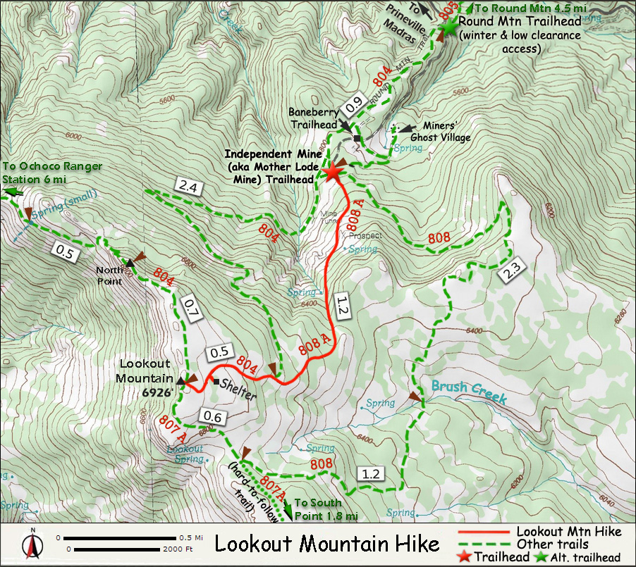
Lookout Mountain via 808 (leftmost trail). 4.1 easy miles to the summit, where a vague foundation of former lookout can be seen. The high plateau is mostly flat, 360° view, large expense of green trees.


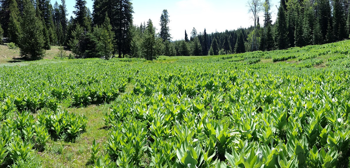
Very rocky, hard to find flat and soft space for 3 tents. We dumped our backpacks close to the summit under a tree with more grass than rocks. Mixed habitat. On the way, we passed many large fields of lushly green corn lily and mossy evergreen, and dry fields of low sage bush and wild peony (lots), juniper trees, lots of balsamroot, larkspur, bluebell, desert parsley, ~16 bikers, ~6 hikers. Views at times. Very little snow left.
Continued to the North Point (0.7 mile), along the edge of the plateau (lots of geum). We then backtraced to South Point (no trail to follow, but easy to figure out). Other than the rocks (wear supportive boots!), this is a lovely place to stroll around (if you don't mind the sun): continuous views all along, and endless flowers at your feet. ~6pm, we ate dinner at the edge of the bluff (windy), finished the beers (we carried the M's cooler and ice up). A long wait for sun to set (8:45pm). The clouds during the day somehow all evaporated. More hazy. It was getting quite chilly, and M abandoned the wait and went to his tent. I only packed a thin sleeping bag, and woke up cold ~2am. Quite windy until early morning.

Sunday 6/8, we packed up ~7am. Clear sky. Down via 804.

0.3 miles down from the summit is the Snow Shelter in the woods, with a wood stove. Graffitis on the wall (log). Outside, plenty logs to sit. A good snowshoe destination.

Almost at the trailhead, up from a creek, is the abandoned ore processing building (
cinnabar?), with a rusted boiler, big pipes. A collapsed mine shaft a short distance down.

We decided to check out
Big Summit Prairie, which we could see from the top of Lookout Mountain. Continuing on FR42 for ~10 miles, seeing the immense grass land mostly on the left (north). Very nice, all private land (fenced), other than the small stretch by the road. At its beginning (western end), at the junction of the gravel FR300 is a nice flat patch of mule's ear in their peak, where we stopped for snacks. Saw some cream colored mule's ear.


Before turning back, we visited
Painted Hills further east. It's rather small. Interesting, hot (85°F/27°C), some flowers. Did two very short hikes. Arrived back home before 7pm, early enough to clean up my gears. Thus concludes this easy and enjoyable road trip.
 A rainy Saturday. 11 of us (all who have signed up) hiked to Silver Star Mountain via Bluff Mountain, skirting Little Baldy. About 13 miles, mostly flat rocky trail with water running on it. Wed and cold. No view to speak of due to the weather. Can only imagine what it could be like when all is clear, as part of the trail are on the ridge. About a mile first on a logging road. Flowers along the trail for the first few miles. Lots of bear grass, but only about 10 in bloom. According to Wikipedia, they have a 4-6 year cycle. So I should come here again in 2017-19. It was such a disappointment after what I saw last year.