Sunday, September 28, 2014

2014.9.27-28 Indian Heaven wilderness

9/27 Saturday, sunny with clouds. 7am. Steve picked up me, Duncan and Charlene at Parkrose P&R and drove to Cultus Creek campground, where we started our relaxing yet adventurous weekend in Indian Heaven.

The first hour is steady uphill (south), not too steep, but enough to get you warm up. In 30 minutes, there's viewpoint for Adams and Rainier. We stopped at Cultus Lake for snack. Starting here, it's meadow land: mostly flat, full of yummy huckleberries and brilliant autumn color. We turned east (left) onto Lemei trail to its highest point for an overview of the eastern landscape: Rainier (barely), Adams, Hood, and Lake Wapiki below. On the way back, we decided to scramble up Lemei Rock. Duncan and I got to the top, so we could see Mt St Helen. Coming down is a slow process. 
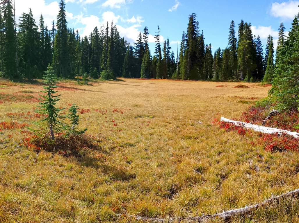
More lush meadows and ponds until Junction Lake. At the SE end, we turn on PCT. It's now all in the woods. More up and downs. Not very interesting, until Blue Lake. It's the bluest of all the lakes here. Restricted camping here. Tombstone Lake is a short steep hike down, not pretty. We found a spot high on its northern slope, but just below that is a lake shore day-use spot, which became our kitchen and hangout. The easily reachable sites are all taken.

9/28 Sunday. The lake is calm in the morning, made a perfect reflection. I took off 7:30-8:30 by myself along Thomas Lake trail. Saw a few more ponds, small meadows without many berries. The mist rising above the ponds and grass dew in the sun is lovely. We backtracked on PCT ~9:30, and the water was no longer still. At the highest point on trail, we bushwhacked to the east (right - the blue line on my map) towards East Crater. I took to the ridge line, while Steve followed the contour. I soon lost sight of everyone as well as where I was supposed to go. As it got quite bushy, I decided to turn back. Soon Duncan showed up. Armed with Garmin, Steve and Charlene got to the top of the crater and saw a small lake. I waited reading my Kindle. Back at Junction Lake, we continued on PCT, which is more boring, and no berries. Checked out Bear Lake and Elk Lake. Bear Lake is quite pretty. I saw at least 2 nice campsites on its southern shore. Detoured to Clear Lake for lunch. Another pretty lake, Steve swam a bit. I saw one good campsite where we ate. No berries though :( The last 2 miles (the northern piece) is very steep, going down. We explored one bluff briefly for view of Adams. ~4pm, arrived at the Campground at a different location. Steve, who lives in WA, kindly dropped all of us at Hollywood TC, more convenient for us.

Sunday, September 21, 2014

2014.9.20-21 Goat Lake in Goat Rocks Wilderness

2nd time here in a month, better weather this time :) A truly remarkable area. My route is highlighted in orange on the map.

9/19 Friday. Left work early.  Met Julie and Tom at Gateway.  Took off at 4pm. Traffic in the city was bad at first. Julie drove pretty steadily and blasted through the washboard FR 21. We made to Chambers Lake at 7, able to set up tents in daylight. Lots of sites to choose from. This is a horse camp, without horse tonight. The outhouse has toilet paper. Quite clean. About 50F. I put on a sweater and fleece, and that was enough to sit around. I ate my leftover, hot tea from my little thermo. Tom cooked canned veggie and hot dogs in his Jetboil. I didn't see Julie eat. I shared my tomatoes with her. They are both climbers and expert backpackers. I learnt many nice areas that I have to explore in the future. Before retiring, we walked to the lake for a starry sky reflected in the water. Absolutely beautiful. 9pm.

9/20 Saturday. This plan for this weekend was Goat Lake Loop. I rose at 7. Read a bit. We didn't start hiking from Berry Patch TH until 9. There's a small lake along the trail. 0.4 miles it converge with the Snowgrass trail. One hour in, Julie's stomach cramped up, again, according to her, for the past month. She was visibly weak, sweat streaming down and she needed bio breaks often. So our progress was slow, and our route was revised. Snowgrass Flat trail junction is 5 miles in. Nice meadow turning red. 2 campsites, but I didn't see water. We took Lily Basin trail on the left, soon saw Adams. Lost some elevation in a mile, reached a nice creek, and pitched our tents closeby in front of a talus slope behind some trees, with a nice fire ring and plenty seating rocks nicely surrounding it. Not much view though.

At 3pm, we continued further north along the eastern slope of Goat Basin. Very pretty. A small waterfall, one more creek, and a nice camp just NE. Taken :( Further north along the slope, one more creek, but no camp, until almost at Goat Lake, where everyone was. We counted 20+ tents. Certainly lovely, if not crowded and exposed. The cool air off the lake can easily chill: it still has ice floating on it. ~20 goats above the lake on the other side. I was pleasantly surprised to see lots of yellow daisy-like flowers and asters.

I continued on and up, now by myself, circled the north end of Goat Basin. At the junction of Goat Ridge trail, you can see Gordon Basin (or Goat Ridge Meadow), smaller, a nice stream, quite idyllic, good campsites. I turned right/north following Lily Basin trail, all up slope. Pretty soon, Mt hood can been seen behind Adams. There's a small plateau, flat enough to put many tents. Exposed, and no water (except snow further up). As you crest the ridge, Lily Basin is now in full view, as well as Mt Rainier. Along this stretch, lots of now dead monkey flowers. I'll have to come again to see the pink slope. Here, I turned east (right), walked up to a hilltop, then dropped down an icy slope, up again to Hawkeye Pt. All the way you can see both Lily Basin below Mt Rainier, and Goat Basin below Mt Adams. Absolutely gorgeous, the best view of this weekend. At the very end, Hawkeye Pt, is a remnant of some lookout. Lots of rusty nails and some serious iron poles. You can see Goat Lake below. Instead of backtracking, I edged straight down. Suffice to say that it is a bad idea, one of my poles was broken in my slow and dangerous process. However, I did see the goats again closer as they moved west from Goat Lake, and a marmot. By the time I got back down to the trail, my legs were a bit shaken. It was almost 7, and I enjoyed the sunset on my way back to camp, not as good as on the Flat. Tom had a fire going. I tried to cook some water at the fire edge, didn't quite work. Tried my $5 wingstove, not working either, the flame was blown sideways. Another beautiful starry sky. I was the last to bed. Saw 2 shooting stars!

9/21 Sunday. A warm night. I sweated in my 0° bag. I got up at 7. Julie was already up since sunrise. I picked huckleberries before the sun got high on me. Julie was much better today. About 9, we decided to walk to Snowgrass Flat, where I went with my nephew 4 weeks ago. Almost no flowers left, still very beautiful. Now the fall color has graced the meadows. Under clear blue sky, the grass and leaves shone brilliantly. We were back to TH ~1:30. Stopped at IGA at Randle for some cool drinks. Driving back was uneventful. Hot.

Sunday, September 14, 2014

2014.9.14. In Search of the Perfect Loaf - a book talk

Sept 14, Sunday 7:30. Journalist Samuel Fromartz, author of the book, shared his experience of home baked bread with Tim Healea, owner and head baker of Little T American Baker, at Powell's City of Books. In 2009, Fromartz was offered the assignment of a lifetime: to travel to France to work in a boulangerie. So began his quest, which later won him the "Best Baguette of D.C." For the next four years, Fromartz traveled across the United States and Europe, meeting historians, millers, farmers, wheat geneticists, sourdough biochemists — learning about the history and science of bread making. Tonight, Tim brought some Pain de Campagne and Baguette, as well as his starter to share with the audience. I like his baguette. His starter doesn't taste sour at all, and has a sweet smell. Fromartz rated (not ordered) Portland/Seattle, New England, Bay Area, Charlotte North Carolina, New York as the 5 top city/region for artisan bakery.

Saturday, September 13, 2014

2014.9.13. Lookout Mountain and Flag Point Looout via Fret Creek

September 13. Saturday. Sunny and warm. Badger Creek Wilderness, ~2 hours drive from Portland. Total 11 people, 3 cars. ~12 miles, 2600' gain.

First, we hiked Fret Creek trail to Palisade Point. Starting at the opposite of the parking area. At mile ~2, reach Oval Lake (nothing special, good water source, no more water after that). Continue up a little bit to the junction of Divide Trail. Gain 1000', with a few steep sections and flat sections. Found one big larch tree of ~5' wide.

Turn left for a few zigzag to the ridge, and quickly reached the rock outcrops of Palisade Point. Nice view to the north: Mt Jefferson, and Hood to the west while the moon is falling behind it. Now we descent through dusty trails towards Flag Point Lookout. That's about 2 miles and ~500' drop, ~300' up from the junction. Boogi, the current fire watcher, kindly gave us a tour (in two batches) and demo of how the reading is done. The other batch had a leisure lunch on the rocks in front of the tower. Delightful 360° views. of Mt. Rainier, Adams, Hood, Jefferson, and all the way to the desert eastern Oregon. Too foggy to see the Sisters. A better time to come here will be in October, as there're quite a number of larch trees.

Back at the trail juntion, now we continued on Divide Trail to Lookout Mountain, another 2 miles and 800' gain. At 6525', it's the highest after Hood in Mt. Hood National Forest. Again, dusty trail, but great 360° view. Only a foundation of a former lookout here. Large flat area on the top to sit and enjoy the view and twisted limbs of whitebark pine. Can see Mt St. Helen as well as the aforementioned Volcanic peaks. Only on this section, we met other people, only ~8.

Stopped at Solera Brewery in Parkdale on the way home. I had Hedonist IPA - the only one on tap that's low in alcohol and made in house. It's okay. The setting is quite nice though. Its window faces Mt Hood, and it has a large open space that can accommodate a band and picnic tables.

Direction (copied from PortlandHikersFieldGuide): 45.349711, -121.472139, Elevation: 4610'.
  • Via Sandy: 31 miles south, passing Government Camp, exit right onto Highway 35 for Hood River. Drive 13.7 miles and turn right onto FR 44 for Lookout Mountain, Camp Baldwin, and Dufur.
  • Via Hood River: I-84 Exit 64 for White Salmon and Government Camp. Turn right, and then right again immediately for 0.4 miles to a four-way stop. Keep straight for Highway 35 South for Odell, Parkdale and Mt. Hood. Drive 26 miles and turn left onto FR 44 for Lookout Mountain, Camp Baldwin, and Dufur.
  • From RF 44: 5.3 miles on paved FR 44, turn right to stay on FR 44 for another 3.3 miles. Turn right onto FR 4420 for 0.9 miles. Bear right, keeping to the pavement for 1.2 miles. Keep straight on FR 2730 for 2.2 miles, pulling off to the left 0.2 miles past the Fifteenmile Forest Camp.

Friday, September 12, 2014

2014.9.12. Chasing Aurora Borealis in vain

Friday. News of potential Northern Light viewing in Oregon prompted me to contact someone I know who participates local astronomical events. It's said to be the best Friday night. So three of us drove up to Cloud Cap north of Mt Hood for high elevation and hopefully less light pollution. We arrived ~9pm. Beautiful night sky: Milky Way clearly visible, orange moon on the low horizon. Not as dark as I liked: the lights of Hood River valley is not negligible. However, the moon rose and it got brighter. Cars coming and going. A group was sitting in front of the fireplace of Cloud Cap Inn, at the end of a locked gate. It was quite cold, single digit in °C. Even though we brought lawn chairs to sit, I elected to walk around to keep myself warm. At least not too windy. We waited till ~11pm to ever brighter sky, and diminished hope.

Tuesday, September 09, 2014

2014.9.9 Intimate Apparel

Tuesday preview at Artists Rep. A play by Lynn Nottage about an illiterate 35 year-old "Negro" seamstress in 1905 New York, earning her living sewing fancy underwear.

I really like Mr. Marks (Chris Harder) and Mayme (Dedra D Woods, a wonderful piano player). Nice stage (no set change). Full house.

As soon as the show started, I had a sense of deja-vu. Yeah, I saw it at Seattle 9 years ago.

Sunday, September 07, 2014

2014.9.7. Indian Point

2014.9.7. Sunny Sunday. Herman Creek trailhead is only 2 miles north of Cascade Locks. Mary agreed to hike Indian Point loop with me, even though she's been here twice this year already, and it's dry and potentially hot. 8:30 am - 1:30 pm. Only ~7.5 miles, 2800' gain. Yes, slow: Mary is slow going up, and I am going down. 1.2 miles to Herman Camp (a power line strip in the middle), turned left onto Gordon Creek trail for 2.6 miles. Continued for a few steps past Cutoff trail for a steep downhill to Indian Point. Long lunch, saw at least 5 small planes going west. Now, took Cutoff trail for ~0.6 mile, turn right on Nick Eaton trail for ~1.4 miles, turn right on to Herman Creek trail to the car. Most of this trail is smooth, and relatively easy, except for the short spur to the Indian Point. Great view at the point: all along the gorge, Mt Adams was a bit faint. The rock was loose and I abandoned climbing it.

Most of this loop is shade by trees, some are quite big. So not as hot as I dreaded. I saw neither Herman Creek nor Gordon Creek. Highway noise on a better part of this loop. Mary found a good sized young chanterelle, a nice prize for this weekend. As always, I learnt some plants from her: funny seeding of Queen Anne's Lace, nice pattern on the leaves of Rattlesnake Orchid. The flower in the photo to the right is still unknown.

Saturday, September 06, 2014

2014.9.6. PCT Day @ Cascade Locks

Sept 5-7, ~31°C. Sunny if not hazy. Cascade Locks hosts the 8th annual PCT Days on Thunder Island, at the shadow of Bridge of the Gods - the lowest point of PCT.

Since most events are on Saturday, I only went for one day. The two ends of the skinny island are camping areas. Grassy, with some big trees. Plenty empty space to pitch a tent. Bathroom is in the Marine Park on the mainland over a short walk bridge. Even though the highway (I-84) is close by, its noise is not really noticeable. The trains going by are loud and clear, and from both sides of the Columbia River. I didn't want to put up my ultralight tent without me watching over it, so I put some of my stuff in Mary's "car camping tent". A bit windy, not too warm. I ate my sandwich on my new lawn chair bought this morning for $2. Had some beers I brought in my small cooler. I left the chair and a hardcover book by Bill Bryson (just picked up at the library the previous day) on it out in the open, so the chair doesn't get blown over (well it did, when I came back). Then we walked around all the vendors and talked to most of them. Checked out some nice gears. You are allowed to try them on, lie on the mattress, or crawl into the tents. Other than the raffle tickets, I bought a tiny stove, and two savory bars, donated to the pedestrian walkway (on Bridge of the God) study fund. There's a lot of place you can easily spend your money here. The new gears are very expensive. There're 3 scheduled talks. I did attend the 3rd one about gears. They guy said the best thing for hot spots (to prevent blisters) is duct tape!

Lots of trinket tossing, and shouting (or cheering). I received a plastic water bottle by Steripen, or rather someone got too many gave one to me. (Mary used it, and showed me that it leaks!) Gregory and Berghaus had their own drawing - drew large crowds and produced a LOT of noise. Backpacks, rain jackets. Lori, another lady I know won a Gregory day pack. Quite nice. Some people put their trail names instead of real names. These are often funny: Psycho, Clutch, ... Many through hikers here. One guy just completed on Wednesday! Mary told me that when she asked 3 hikers at her table in the beer garden "what's next". The answer was unanimously "no more walking". I thought they would have enjoyed the long hike, and would be inspired to walk more.

5pm is raffle drawing. Of course, nothing was on time here. The announcer is very funny. From socks and coffee mugs to down jackets and mattress pad, bear vaults, gift certificate. The worst is road atlas of far off states: Georgia, Mississippi, ... (see photo: no one wants them) A big hairy guy won a ladies hiking shorts. This dog got excited when his owner won a canister of dried food. Bill Bryson won a microspike and something else. I won a Soto WindMaster stove - canister not included. Some people won many times. A guy said he bought 95 tickets ($100). Each volunteer received 20 tickets. Yes, a lot of tickets. The money is raised for PCTA, of course all the prizes are donated. At time dragged on, they had to speed things up, so awarding multiple items to each winner. It took over 2 hours to get rid of most of the prizes. Last, they tossed water bottles and lip balms out.

Evening program didn't start until 9pm (1 hour late). A short clip emphasizing volunteering in the wilderness areas using hand tools: this is the 50th anniversary of the Wilderness Act. A documentary movie Meaning of Wild, which I thought was underwhelming, filming 6 wilderness areas in Alaska Aleutian Islands and Coasts, generally aided by float planes and motor boats, then he and his guide hiked a bit. The scenery is nice, but not drop-down gorgeous. I like the bear place. The way he organize the film is quite good. I did enjoy the slide show of Jason Waicunas.

An easy and entertaining day. I had spare time to read 1 page of my book.

Sunday. I rose early. Only 8°. Walked across Bridge of the Gods, and walked back (~7-7:30am). Nice view of Thunder Island. Not many cars. On my way back, saw an old gentleman walking over. Couldn't find where PCT is supposed to go (left? right?) when I reached WA land. No sign. The Oregon side collects a toll. Pedestrian is 50c. On Saturday between 9 and 9:30, a few hundred people walked across free of charge - part of the PCT day event.